Barger Lake Dam Dam

Barger Lake Dam
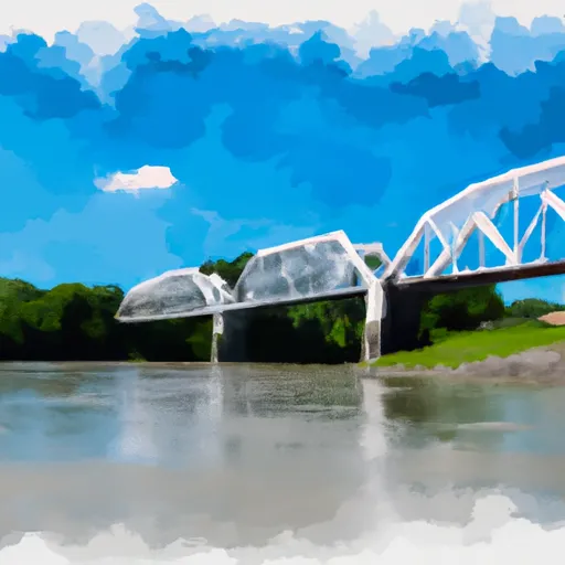
Barger Lake Dam, located in Pope County, Illinois, was completed in 1958 and serves as a recreational spot for water enthusiasts. The dam, standing at a height of 39 feet and spanning 525 feet in length, holds a normal storage capacity of 90 acre-feet with a maximum storage of 106 acre-feet. The dam overlooks the TRIB LUST CREEK and is under the regulatory jurisdiction of the Illinois Department of Natural Resources (IDNR), ensuring regular inspections and enforcement for safety compliance.
With a low hazard potential and a moderate risk assessment rating, Barger Lake Dam provides a safe and enjoyable environment for visitors engaging in water-related activities. The dam features an uncontrolled spillway and outlet gates, offering a means for managing water levels during peak flow periods. Despite limited information on condition assessment and emergency preparedness measures, the dam continues to be a popular destination for locals and tourists seeking recreational opportunities in the beautiful surroundings of WATTERSBURG, Illinois.
While the dam's structural details and associated structures are well-documented, further information on risk management measures and emergency action plans could enhance the overall safety and resilience of Barger Lake Dam. As water resource and climate enthusiasts continue to enjoy the amenities offered by the dam, ongoing efforts to ensure proper maintenance and adherence to regulatory standards will be essential in preserving the dam's recreational value and safeguarding against potential risks.
Plan around the weather
Same NOAA / yr.no feed Snoflo's iOS app uses. Watch the precipitation column on the meteogram -- rain on the basin upstream typically lifts inflow 24-72 hours later.
Next 5 days, hour by hour
Temperature line with weather symbols on top, snow + rain accumulation as columns, humidity as a dotted line.
5-day forecast table
Every 3 hours, broken out across temperature, snow, rain, humidity, and wind. Each cell is colour-coded relative to the column min/max.
| Time | Condition | Temp (°F) | Snow (in) | Rain (in) | Humidity (%) | Wind (mps) | Wind dir |
|---|---|---|---|---|---|---|---|
| Loading detailed forecast… | |||||||
15-day temperature & precipitation
Daily temperatures, snow, and rain projected over the next two weeks.
Nearby streamflow gauges
USGS streamgauges around Barger Lake Dam -- inflows here typically show up in storage 24-72 hours later.
| Streamgauge | Discharge | View |
|---|---|---|
| Lusk Creek Near Eddyville | 8 cfs | → |
| South Fork Saline River Nr Carrier Mills | 158 cfs | → |
| Crab Orchard Creek Near Marion | 3 cfs | → |
| Cache River At Forman | 1,560 cfs | → |
| Ohio River At Old Shawneetown | 152,000 cfs | → |
| Ohio River At Metropolis | 444,000 cfs | → |
Make a day of it
Boat launches, lakeside camping, fishing access, and other reservoirs near Barger Lake Dam.
Boat launches
See all →


Campgrounds
See all →


Fishing spots
See all →


River runs
See all →


About Barger Lake Dam
Where does the data for Barger Lake Dam come from?
Structural and regulatory data come from the U.S. Army Corps of Engineers' National Inventory of Dams (NID). Weather forecast comes from NOAA / yr.no -- the same feed Snoflo's iOS app uses.
How often is the report updated?
NID structural data refreshes annually as the Corps publishes updated assessments. The weather forecast refreshes throughout the day.
What does the Low hazard rating mean?
The Corps of Engineers' hazard potential classification grades probable consequences if the dam fails: High = probable loss of human life; Significant = no probable loss of human life but possible economic loss / environmental damage; Low = no probable loss of human life, only minor economic / environmental losses. See the Dam Data Reference card below for the full definitions.
What's "% of normal"?
The current storage value compared to the historical average storage on this calendar day. 100% = right on average; values above 100% mean above-normal storage (wet year); values below mean below-normal (dry year or drought).
Can I get alerts when storage crosses a threshold?
Yes -- alerts are managed in the Snoflo iOS app. Favorite this dam, set a threshold, and you'll get a push the moment conditions cross.
Dam data reference
Condition Assessment
- Satisfactory
- No existing or potential dam safety deficiencies are recognized. Acceptable performance is expected under all loading conditions (static, hydrologic, seismic) in accordance with the minimum applicable state or federal regulatory criteria or tolerable risk guidelines.
- Fair
- No existing dam safety deficiencies are recognized for normal operating conditions. Rare or extreme hydrologic and/or seismic events may result in a dam safety deficiency. Risk may be in the range to take further action.
- Poor
- A dam safety deficiency is recognized for normal operating conditions which may realistically occur. Remedial action is necessary. POOR may also be used when uncertainties exist as to critical analysis parameters which identify a potential dam safety deficiency.
- Unsatisfactory
- A dam safety deficiency is recognized that requires immediate or emergency remedial action for problem resolution.
- Not Rated
- The dam has not been inspected, is not under state or federal jurisdiction, or has been inspected but, for whatever reason, has not been rated.
Hazard Potential Classification
- High
- Dams assigned the high hazard potential classification are those where failure or mis-operation will probably cause loss of human life.
- Significant
- Dams assigned the significant hazard potential classification are those dams where failure or mis-operation results in no probable loss of human life but can cause economic loss, environmental damage, disruption of lifeline facilities, or impact other concerns. Significant hazard potential classification dams are often located in predominantly rural or agricultural areas but could be in areas with population and significant infrastructure.
- Low
- Dams assigned the low hazard potential classification are those where failure or mis-operation results in no probable loss of human life and low economic and/or environmental losses. Losses are principally limited to the owner's property.
- Undetermined
- Dams for which a downstream hazard potential has not been designated or is not provided.