Carbondale Park District Golf Course Dam Dam

Carbondale Park District Golf Course Dam
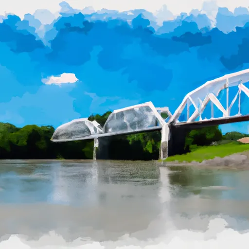
The Carbondale Park District Golf Course Dam is a vital structure located in Pomona, Illinois, along the TRIB BIG MUDDY RIVER. Built in 1992 by E. M. Webb & Associates, this earth dam stands at a height of 15 feet and spans a length of 360 feet, providing essential recreational opportunities for the local community. With a storage capacity of 68 acre-feet and a maximum discharge of 340 cubic feet per second, this dam plays a crucial role in managing water resources in the area.
Managed by the Illinois Department of Natural Resources (IDNR), the Carbondale Park District Golf Course Dam has a low hazard potential and a moderate risk assessment level. While the dam is primarily used for recreational purposes, it is also subject to regular state inspections and enforcement to ensure its structural integrity and safety. With an uncontrolled spillway and outlet gates, this dam serves as a key component of the local water management infrastructure, contributing to the overall resilience of the region's hydrological systems.
Despite its low hazard potential, the Carbondale Park District Golf Course Dam remains a significant asset for the community, providing not only recreational benefits but also contributing to water resource management efforts along the TRIB BIG MUDDY RIVER. With a history of effective operation and maintenance, this dam exemplifies the importance of proactive risk management and regulatory oversight in ensuring the safety and sustainability of critical water infrastructure in Illinois.
Plan around the weather
Same NOAA / yr.no feed Snoflo's iOS app uses. Watch the precipitation column on the meteogram -- rain on the basin upstream typically lifts inflow 24-72 hours later.
Next 5 days, hour by hour
Temperature line with weather symbols on top, snow + rain accumulation as columns, humidity as a dotted line.
5-day forecast table
Every 3 hours, broken out across temperature, snow, rain, humidity, and wind. Each cell is colour-coded relative to the column min/max.
| Time | Condition | Temp (°F) | Snow (in) | Rain (in) | Humidity (%) | Wind (mps) | Wind dir |
|---|---|---|---|---|---|---|---|
| Loading detailed forecast… | |||||||
15-day temperature & precipitation
Daily temperatures, snow, and rain projected over the next two weeks.
Nearby streamflow gauges
USGS streamgauges around Carbondale Park District Golf Course Dam -- inflows here typically show up in storage 24-72 hours later.
| Streamgauge | Discharge | View |
|---|---|---|
| Big Muddy River At Rte 127 At Murphysboro | 1,520 cfs | → |
| Big Muddy River At Plumfield | 131 cfs | → |
| Crab Orchard Creek Near Marion | 3 cfs | → |
| South Fork Saline River Nr Carrier Mills | 71 cfs | → |
| Mississippi River At Chester | 244,000 cfs | → |
| Cache River At Forman | 826 cfs | → |
Make a day of it
Boat launches, lakeside camping, fishing access, and other reservoirs near Carbondale Park District Golf Course Dam.
Boat launches
See all →


Campgrounds
See all →


Fishing spots
See all →


River runs
See all →


About Carbondale Park District Golf Course Dam
Where does the data for Carbondale Park District Golf Course Dam come from?
Structural and regulatory data come from the U.S. Army Corps of Engineers' National Inventory of Dams (NID). Weather forecast comes from NOAA / yr.no -- the same feed Snoflo's iOS app uses.
How often is the report updated?
NID structural data refreshes annually as the Corps publishes updated assessments. The weather forecast refreshes throughout the day.
What does the Low hazard rating mean?
The Corps of Engineers' hazard potential classification grades probable consequences if the dam fails: High = probable loss of human life; Significant = no probable loss of human life but possible economic loss / environmental damage; Low = no probable loss of human life, only minor economic / environmental losses. See the Dam Data Reference card below for the full definitions.
What's "% of normal"?
The current storage value compared to the historical average storage on this calendar day. 100% = right on average; values above 100% mean above-normal storage (wet year); values below mean below-normal (dry year or drought).
Can I get alerts when storage crosses a threshold?
Yes -- alerts are managed in the Snoflo iOS app. Favorite this dam, set a threshold, and you'll get a push the moment conditions cross.
Dam data reference
Condition Assessment
- Satisfactory
- No existing or potential dam safety deficiencies are recognized. Acceptable performance is expected under all loading conditions (static, hydrologic, seismic) in accordance with the minimum applicable state or federal regulatory criteria or tolerable risk guidelines.
- Fair
- No existing dam safety deficiencies are recognized for normal operating conditions. Rare or extreme hydrologic and/or seismic events may result in a dam safety deficiency. Risk may be in the range to take further action.
- Poor
- A dam safety deficiency is recognized for normal operating conditions which may realistically occur. Remedial action is necessary. POOR may also be used when uncertainties exist as to critical analysis parameters which identify a potential dam safety deficiency.
- Unsatisfactory
- A dam safety deficiency is recognized that requires immediate or emergency remedial action for problem resolution.
- Not Rated
- The dam has not been inspected, is not under state or federal jurisdiction, or has been inspected but, for whatever reason, has not been rated.
Hazard Potential Classification
- High
- Dams assigned the high hazard potential classification are those where failure or mis-operation will probably cause loss of human life.
- Significant
- Dams assigned the significant hazard potential classification are those dams where failure or mis-operation results in no probable loss of human life but can cause economic loss, environmental damage, disruption of lifeline facilities, or impact other concerns. Significant hazard potential classification dams are often located in predominantly rural or agricultural areas but could be in areas with population and significant infrastructure.
- Low
- Dams assigned the low hazard potential classification are those where failure or mis-operation results in no probable loss of human life and low economic and/or environmental losses. Losses are principally limited to the owner's property.
- Undetermined
- Dams for which a downstream hazard potential has not been designated or is not provided.