


Saxon Reservoir Report
Last Updated: May 3, 2026
Nearby: Saxon Falls Superior Falls
°F
°F
mph
Wind
%
Humidity
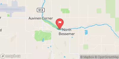
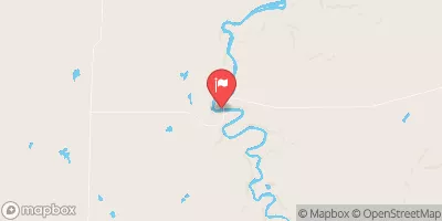
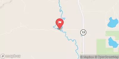
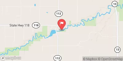
Saxon, also known as Saxon Falls, is a private hydroelectric dam located in Wisconsin along the Montreal River.
Summary
Built in 1911, this gravity dam stands at 37 feet high and has a hydraulic height of 133 feet, providing a surface area of 63 acres and a maximum storage capacity of 700 acre-feet. The dam serves multiple purposes including hydroelectric power generation and recreation, with a normal storage capacity of 250 acre-feet and a drainage area of 270 square miles.
Despite being privately owned, Saxon Falls is regulated by the state of Wisconsin and permitted for operation, but not subject to regular inspections. The dam has a controlled spillway and a low hazard potential, with a very high risk rating due to its age and condition assessment not being rated. Limited risk management measures are in place, but emergency action plans have been prepared and updated as recently as January 2020. With its historical significance and potential for both energy production and outdoor activities, Saxon Falls remains an important water resource for the region.
Regional Streamflow Levels
 Black River Near Bessemer
|
419cfs |
 Bad River Near Odanah
|
1130cfs |
 Bad River Near Mellen
|
101cfs |
 White River Near Ashland
|
342cfs |
 Whittlesey Creek Near Ashland
|
18cfs |
 Presque Isle River Near Tula
|
66cfs |
15-Day Long Term Forecast
Years Modified |
1940 - Other |
Year Completed |
1911 |
Dam Length |
230 |
Dam Height |
37 |
River Or Stream |
MONTREAL |
Primary Dam Type |
Gravity |
Surface Area |
63 |
Hydraulic Height |
133 |
Drainage Area |
270 |
Nid Storage |
700 |
Structural Height |
37 |
Hazard Potential |
Low |
Nid Height |
133 |
Seasonal Comparison
5-Day Hourly Forecast Detail
Dam Data Reference
Condition Assessment
SatisfactoryNo existing or potential dam safety deficiencies are recognized. Acceptable performance is expected under all loading conditions (static, hydrologic, seismic) in accordance with the minimum applicable state or federal regulatory criteria or tolerable risk guidelines.
Fair
No existing dam safety deficiencies are recognized for normal operating conditions. Rare or extreme hydrologic and/or seismic events may result in a dam safety deficiency. Risk may be in the range to take further action. Note: Rare or extreme event is defined by the regulatory agency based on their minimum
Poor A dam safety deficiency is recognized for normal operating conditions which may realistically occur. Remedial action is necessary. POOR may also be used when uncertainties exist as to critical analysis parameters which identify a potential dam safety deficiency. Investigations and studies are necessary.
Unsatisfactory
A dam safety deficiency is recognized that requires immediate or emergency remedial action for problem resolution.
Not Rated
The dam has not been inspected, is not under state or federal jurisdiction, or has been inspected but, for whatever reason, has not been rated.
Not Available
Dams for which the condition assessment is restricted to approved government users.
Hazard Potential Classification
HighDams assigned the high hazard potential classification are those where failure or mis-operation will probably cause loss of human life.
Significant
Dams assigned the significant hazard potential classification are those dams where failure or mis-operation results in no probable loss of human life but can cause economic loss, environment damage, disruption of lifeline facilities, or impact other concerns. Significant hazard potential classification dams are often located in predominantly rural or agricultural areas but could be in areas with population and significant infrastructure.
Low
Dams assigned the low hazard potential classification are those where failure or mis-operation results in no probable loss of human life and low economic and/or environmental losses. Losses are principally limited to the owner's property.
Undetermined
Dams for which a downstream hazard potential has not been designated or is not provided.
Not Available
Dams for which the downstream hazard potential is restricted to approved government users.
Area Campgrounds
| Location | Reservations | Toilets |
|---|---|---|
 Little Girls Point Campground
|
||
 Potato River Falls
|
||
 Potato River Falls County Forest
|
||
 Gold Mine West
|
||
 Wren Falls
|
||
 Sandy Ledges Campsite
|
 Lake Gogebic Near Bergland
 Cisco Lake Near Watersmeet
 Saxon Falls Flowage -- Access
 Minnewawa Falls To Lake Superior
 Forest Road 149 To West Forest Boundary
 East Forest Boundary To Forest Road 162 Crossing
 West Branch, Mi State Highway 28 To Cascade Falls
 Forest Road 148 To Forest Road 149
 Footbridge To Forest Road 144
 Sunday Lake
 Henry Lake
 Heron Lake
 Lake of the Clouds
 Lake Owen Recreation Area