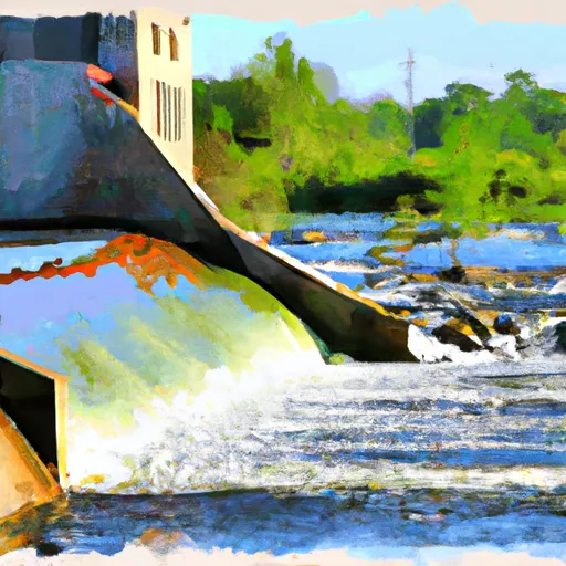
Spruce Creek dam

Spruce Creek
Spruce Creek, also known as Spruce Center Dam, is a state-owned water resource located in Douglas County, Minnesota. Managed by the Minnesota Department of Natural Resources, this dam holds a primary purpose of recreation, offering a serene environment for outdoor enthusiasts to enjoy. With a structural height of 27 feet and a length of 500 feet, Spruce Creek provides a storage capacity of 600 acre-feet and covers a surface area of 40 acres.
Despite its satisfactory condition assessment as of October 2017, Spruce Creek poses a significant hazard potential, prompting regular inspections every four years. The dam's uncontrolled spillway type and moderate risk assessment level indicate the need for ongoing risk management measures to ensure the safety and stability of the structure. Situated in a scenic location near Spruce Center, this dam serves as a vital water resource within the region, supporting both recreational activities and environmental conservation efforts.
As one of the key water infrastructure projects in the area, Spruce Creek's significance lies in its contribution to local water management and conservation efforts. With its proximity to the Omaha District and the oversight of state regulatory agencies, this dam plays a crucial role in maintaining water quality, supporting wildlife habitats, and providing recreational opportunities for residents and visitors alike. As climate change continues to impact water resources, the preservation and management of structures like Spruce Creek are essential for ensuring sustainable water usage and resilience in the face of evolving environmental challenges.
Plan around the weather
Same NOAA / yr.no feed Snoflo's iOS app uses. Watch the precipitation column on the meteogram -- rain on the basin upstream typically lifts inflow 24-72 hours later.
Next 5 days, hour by hour
Temperature line with weather symbols on top, snow + rain accumulation as columns, humidity as a dotted line.
5-day forecast table
Every 3 hours, broken out across temperature, snow, rain, humidity, and wind. Each cell is colour-coded relative to the column min/max.
| Time | Condition | Temp (°F) | Snow (in) | Rain (in) | Humidity (%) | Wind (mps) | Wind dir |
|---|---|---|---|---|---|---|---|
| Loading detailed forecast… | |||||||
15-day temperature & precipitation
Daily temperatures, snow, and rain projected over the next two weeks.
Nearby streamflow gauges
USGS streamgauges around Spruce Creek -- inflows here typically show up in storage 24-72 hours later.
| Streamgauge | Discharge | View |
|---|---|---|
| Long Prairie River At Long Prairie | 271 cfs | → |
| Crow Wing River At Nimrod | 284 cfs | → |
| Otter Tail River Near Elizabeth | 358 cfs | → |
| Crow Wing River Near Pillager | 1,300 cfs | → |
| Mississippi River Near Royalton | 4,800 cfs | → |
| Otter Tail River Bl Orwell D Nr Fergus Falls | 416 cfs | → |


About Spruce Creek
Where does the data for Spruce Creek come from?
Structural and regulatory data come from the U.S. Army Corps of Engineers' National Inventory of Dams (NID). Weather forecast comes from NOAA / yr.no -- the same feed Snoflo's iOS app uses.
How often is the report updated?
NID structural data refreshes annually as the Corps publishes updated assessments. The weather forecast refreshes throughout the day.
What does the Significant hazard rating mean?
The Corps of Engineers' hazard potential classification grades probable consequences if the dam fails: High = probable loss of human life; Significant = no probable loss of human life but possible economic loss / environmental damage; Low = no probable loss of human life, only minor economic / environmental losses. See the Dam Data Reference card below for the full definitions.
What's "% of normal"?
The current storage value compared to the historical average storage on this calendar day. 100% = right on average; values above 100% mean above-normal storage (wet year); values below mean below-normal (dry year or drought).
Can I get alerts when storage crosses a threshold?
Yes -- alerts are managed in the Snoflo iOS app. Favorite this dam, set a threshold, and you'll get a push the moment conditions cross.
Dam data reference
Condition Assessment
- Satisfactory
- No existing or potential dam safety deficiencies are recognized. Acceptable performance is expected under all loading conditions (static, hydrologic, seismic) in accordance with the minimum applicable state or federal regulatory criteria or tolerable risk guidelines.
- Fair
- No existing dam safety deficiencies are recognized for normal operating conditions. Rare or extreme hydrologic and/or seismic events may result in a dam safety deficiency. Risk may be in the range to take further action.
- Poor
- A dam safety deficiency is recognized for normal operating conditions which may realistically occur. Remedial action is necessary. POOR may also be used when uncertainties exist as to critical analysis parameters which identify a potential dam safety deficiency.
- Unsatisfactory
- A dam safety deficiency is recognized that requires immediate or emergency remedial action for problem resolution.
- Not Rated
- The dam has not been inspected, is not under state or federal jurisdiction, or has been inspected but, for whatever reason, has not been rated.
Hazard Potential Classification
- High
- Dams assigned the high hazard potential classification are those where failure or mis-operation will probably cause loss of human life.
- Significant
- Dams assigned the significant hazard potential classification are those dams where failure or mis-operation results in no probable loss of human life but can cause economic loss, environmental damage, disruption of lifeline facilities, or impact other concerns. Significant hazard potential classification dams are often located in predominantly rural or agricultural areas but could be in areas with population and significant infrastructure.
- Low
- Dams assigned the low hazard potential classification are those where failure or mis-operation results in no probable loss of human life and low economic and/or environmental losses. Losses are principally limited to the owner's property.
- Undetermined
- Dams for which a downstream hazard potential has not been designated or is not provided.