Mononame 772 Dam

Mononame 772
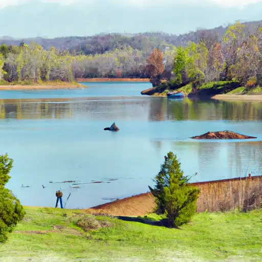
Mononame 772 is a private earth dam located in Howell, Missouri, near the city of West Plains. Completed in 1970, this dam has a primary purpose of recreation and stands at a height of 17 feet, with a storage capacity of 73 acre-feet. Situated on TR Spring Creek, the dam offers a serene escape for water resource and climate enthusiasts, covering an area of 8 acres and draining a watershed of 120 square miles.
Despite being unregulated by the state and having a low hazard potential, Mononame 772 provides a valuable recreational space for the local community. With its buttress core type and unknown foundation, this dam has not been rated for its condition assessment. While it may not be a prominent feature in terms of size or capacity, this dam serves as a reminder of the diverse ways in which water resources can be utilized and appreciated in different regions.
As a site that has not undergone recent inspections or assessments, Mononame 772 presents an opportunity for further study and evaluation in the realm of water resource management. Its location in the Memphis District underlines its significance within the broader context of dam infrastructure in the region. For water resource and climate enthusiasts, this dam offers a glimpse into the intersection of human engineering and natural landscapes, showcasing the potential for sustainable recreation and conservation efforts in Missouri.
Plan around the weather
Same NOAA / yr.no feed Snoflo's iOS app uses. Watch the precipitation column on the meteogram -- rain on the basin upstream typically lifts inflow 24-72 hours later.
Next 5 days, hour by hour
Temperature line with weather symbols on top, snow + rain accumulation as columns, humidity as a dotted line.
5-day forecast table
Every 3 hours, broken out across temperature, snow, rain, humidity, and wind. Each cell is colour-coded relative to the column min/max.
| Time | Condition | Temp (°F) | Snow (in) | Rain (in) | Humidity (%) | Wind (mps) | Wind dir |
|---|---|---|---|---|---|---|---|
| Loading detailed forecast… | |||||||
15-day temperature & precipitation
Daily temperatures, snow, and rain projected over the next two weeks.
Nearby streamflow gauges
USGS streamgauges around Mononame 772 -- inflows here typically show up in storage 24-72 hours later.
| Streamgauge | Discharge | View |
|---|---|---|
| North Fork River Near Tecumseh | 667 cfs | → |
| Mammoth Spring At Mammoth Spring | 290 cfs | → |
| Bryant Creek Near Tecumseh | 428 cfs | → |
| Jacks Fork Near Mountain View | 81 cfs | → |
| Spring River At Town Branch Bridge At Hardy | 435 cfs | → |
| Eleven Point River Near Bardley | 458 cfs | → |
Make a day of it
Boat launches, lakeside camping, fishing access, and other reservoirs near Mononame 772.
Boat launches
See all →


Campgrounds
See all →


Fishing spots
See all →


River runs
See all →


About Mononame 772
Where does the data for Mononame 772 come from?
Structural and regulatory data come from the U.S. Army Corps of Engineers' National Inventory of Dams (NID). Weather forecast comes from NOAA / yr.no -- the same feed Snoflo's iOS app uses.
How often is the report updated?
NID structural data refreshes annually as the Corps publishes updated assessments. The weather forecast refreshes throughout the day.
What does the Low hazard rating mean?
The Corps of Engineers' hazard potential classification grades probable consequences if the dam fails: High = probable loss of human life; Significant = no probable loss of human life but possible economic loss / environmental damage; Low = no probable loss of human life, only minor economic / environmental losses. See the Dam Data Reference card below for the full definitions.
What's "% of normal"?
The current storage value compared to the historical average storage on this calendar day. 100% = right on average; values above 100% mean above-normal storage (wet year); values below mean below-normal (dry year or drought).
Can I get alerts when storage crosses a threshold?
Yes -- alerts are managed in the Snoflo iOS app. Favorite this dam, set a threshold, and you'll get a push the moment conditions cross.
Dam data reference
Condition Assessment
- Satisfactory
- No existing or potential dam safety deficiencies are recognized. Acceptable performance is expected under all loading conditions (static, hydrologic, seismic) in accordance with the minimum applicable state or federal regulatory criteria or tolerable risk guidelines.
- Fair
- No existing dam safety deficiencies are recognized for normal operating conditions. Rare or extreme hydrologic and/or seismic events may result in a dam safety deficiency. Risk may be in the range to take further action.
- Poor
- A dam safety deficiency is recognized for normal operating conditions which may realistically occur. Remedial action is necessary. POOR may also be used when uncertainties exist as to critical analysis parameters which identify a potential dam safety deficiency.
- Unsatisfactory
- A dam safety deficiency is recognized that requires immediate or emergency remedial action for problem resolution.
- Not Rated
- The dam has not been inspected, is not under state or federal jurisdiction, or has been inspected but, for whatever reason, has not been rated.
Hazard Potential Classification
- High
- Dams assigned the high hazard potential classification are those where failure or mis-operation will probably cause loss of human life.
- Significant
- Dams assigned the significant hazard potential classification are those dams where failure or mis-operation results in no probable loss of human life but can cause economic loss, environmental damage, disruption of lifeline facilities, or impact other concerns. Significant hazard potential classification dams are often located in predominantly rural or agricultural areas but could be in areas with population and significant infrastructure.
- Low
- Dams assigned the low hazard potential classification are those where failure or mis-operation results in no probable loss of human life and low economic and/or environmental losses. Losses are principally limited to the owner's property.
- Undetermined
- Dams for which a downstream hazard potential has not been designated or is not provided.