Lake Ellsworth Near Elgin Reservoir Report
Nearby: Oknoname 031016 Oknoname 031008
Last Updated: February 26, 2026
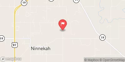
Lake Ellsworth is a man-made reservoir located near Elgin, Oklahoma.
Summary
It was constructed in 1962 by the U.S. Army Corps of Engineers as part of the Cache Creek Flood Control Project. The lake provides flood control, irrigation, and recreational opportunities for the area. It has a surface area of 5,200 acres and a maximum depth of 87 feet. The main source of water for the lake is Cache Creek, which flows into the lake from the north. Snowmelt and rainfall also contribute to the lake's water supply. The lake is used for fishing, boating, and swimming, and there are several campgrounds and picnic areas located along its shores. Agriculture is an important industry in the area, and the lake is used for irrigation purposes.
°F
°F
mph
Wind
%
Humidity
15-Day Weather Outlook
Reservoir Details
| Gage Height, Ft 24hr Change | 0.0% |
| Percent of Normal | 100% |
| Minimum |
1,223.22 ft
2012-02-29 |
| Maximum |
1,236.46 ft
2015-05-25 |
| Average | 1,230 ft |
| Dam_Height | 96 |
| Hydraulic_Height | 96 |
| Drainage_Area | 249 |
| Year_Completed | 1961 |
| Nid_Storage | 189200 |
| Structural_Height | 96 |
| Foundations | Rock |
| Surface_Area | 5220 |
| Outlet_Gates | Valve - 1, Vertical Lift - 15 |
| River_Or_Stream | EAST CACHE CREEK |
| Dam_Length | 3900 |
| Hazard_Potential | High |
| Primary_Dam_Type | Earth |
| Nid_Height | 96 |
Seasonal Comparison
Reservoir Storage, Acre-Ft Levels
Gage Height, Ft Levels
5-Day Hourly Forecast Detail
Nearby Streamflow Levels
Dam Data Reference
Condition Assessment
SatisfactoryNo existing or potential dam safety deficiencies are recognized. Acceptable performance is expected under all loading conditions (static, hydrologic, seismic) in accordance with the minimum applicable state or federal regulatory criteria or tolerable risk guidelines.
Fair
No existing dam safety deficiencies are recognized for normal operating conditions. Rare or extreme hydrologic and/or seismic events may result in a dam safety deficiency. Risk may be in the range to take further action. Note: Rare or extreme event is defined by the regulatory agency based on their minimum
Poor A dam safety deficiency is recognized for normal operating conditions which may realistically occur. Remedial action is necessary. POOR may also be used when uncertainties exist as to critical analysis parameters which identify a potential dam safety deficiency. Investigations and studies are necessary.
Unsatisfactory
A dam safety deficiency is recognized that requires immediate or emergency remedial action for problem resolution.
Not Rated
The dam has not been inspected, is not under state or federal jurisdiction, or has been inspected but, for whatever reason, has not been rated.
Not Available
Dams for which the condition assessment is restricted to approved government users.
Hazard Potential Classification
HighDams assigned the high hazard potential classification are those where failure or mis-operation will probably cause loss of human life.
Significant
Dams assigned the significant hazard potential classification are those dams where failure or mis-operation results in no probable loss of human life but can cause economic loss, environment damage, disruption of lifeline facilities, or impact other concerns. Significant hazard potential classification dams are often located in predominantly rural or agricultural areas but could be in areas with population and significant infrastructure.
Low
Dams assigned the low hazard potential classification are those where failure or mis-operation results in no probable loss of human life and low economic and/or environmental losses. Losses are principally limited to the owner's property.
Undetermined
Dams for which a downstream hazard potential has not been designated or is not provided.
Not Available
Dams for which the downstream hazard potential is restricted to approved government users.


 Edgewater Park - Lawton
 Collier Landing City
 East Side - Lake Lawtonka
 Medicine Creek RV Military - Fort Sill
 Robinsons Landing - Lake Lawtonka
 Lake Elmer Thomas Military - Fort Sill
 Ellsworth
 Lake Ellsworth Near Elgin
 Lake Lawtonka Near Lawton
 Scs Pond No. 26 Near Cyril