Big Cliff Dam Dam

Big Cliff Dam
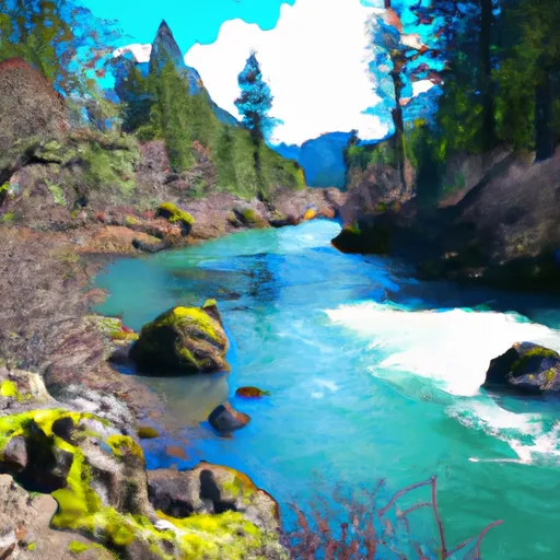
Big Cliff Dam, located on the North Santiam River in Oregon, was completed in 1954 and serves as a key hydroelectric facility managed by the US Army Corps of Engineers. Standing at 172 feet tall with a gravity design, the dam provides essential water storage for the region, with a maximum storage capacity of 5,930 acre-feet. Despite being labeled as a high hazard potential structure, a recent risk assessment conducted by USACE in 2012 categorized the dam's risk level as low.
The risk assessment highlighted potential challenges posed by extreme earthquake events that could damage the spillway gates, leading to uncontrolled releases and downstream flooding. However, USACE has implemented various risk management measures, including routine inspections, instrumentation for monitoring dam performance, and an Emergency Action Plan (EAP) to guide response in emergency situations. The agency also collaborates with local authorities and community members to increase awareness of flood risks and ensure preparedness for any potential events.
While the Willamette Valley dams, including Big Cliff Dam, play a crucial role in reducing flood risks in the region, they cannot completely eliminate the possibility of flooding during extreme weather events. USACE continues to prioritize dam safety and invest in infrastructure maintenance to mitigate risks and safeguard downstream communities from potential flooding impacts.
Plan around the weather
Same NOAA / yr.no feed Snoflo's iOS app uses. Watch the precipitation column on the meteogram -- rain on the basin upstream typically lifts inflow 24-72 hours later.
Next 5 days, hour by hour
Temperature line with weather symbols on top, snow + rain accumulation as columns, humidity as a dotted line.
5-day forecast table
Every 3 hours, broken out across temperature, snow, rain, humidity, and wind. Each cell is colour-coded relative to the column min/max.
| Time | Condition | Temp (°F) | Snow (in) | Rain (in) | Humidity (%) | Wind (mps) | Wind dir |
|---|---|---|---|---|---|---|---|
| Loading detailed forecast… | |||||||
15-day temperature & precipitation
Daily temperatures, snow, and rain projected over the next two weeks.
Nearby streamflow gauges
USGS streamgauges around Big Cliff Dam -- inflows here typically show up in storage 24-72 hours later.
| Streamgauge | Discharge | View |
|---|---|---|
| North Santiam River At Niagara | 1,060 cfs | → |
| Breitenbush R Abv French Cr Nr Detroit | 130 cfs | → |
| No Santiam R Blw Boulder Crk | 405 cfs | → |
| Blowout Creek Near Detroit | 7 cfs | → |
| Schafer Creek Near Lacomb | 0 cfs | → |
| Little North Santiam River Near Mehama | 87 cfs | → |


About Big Cliff Dam
Where does the data for Big Cliff Dam come from?
Structural and regulatory data come from the U.S. Army Corps of Engineers' National Inventory of Dams (NID). Weather forecast comes from NOAA / yr.no -- the same feed Snoflo's iOS app uses.
How often is the report updated?
NID structural data refreshes annually as the Corps publishes updated assessments. The weather forecast refreshes throughout the day.
What does the High hazard rating mean?
The Corps of Engineers' hazard potential classification grades probable consequences if the dam fails: High = probable loss of human life; Significant = no probable loss of human life but possible economic loss / environmental damage; Low = no probable loss of human life, only minor economic / environmental losses. See the Dam Data Reference card below for the full definitions.
What's "% of normal"?
The current storage value compared to the historical average storage on this calendar day. 100% = right on average; values above 100% mean above-normal storage (wet year); values below mean below-normal (dry year or drought).
Can I get alerts when storage crosses a threshold?
Yes -- alerts are managed in the Snoflo iOS app. Favorite this dam, set a threshold, and you'll get a push the moment conditions cross.
Dam data reference
Condition Assessment
- Satisfactory
- No existing or potential dam safety deficiencies are recognized. Acceptable performance is expected under all loading conditions (static, hydrologic, seismic) in accordance with the minimum applicable state or federal regulatory criteria or tolerable risk guidelines.
- Fair
- No existing dam safety deficiencies are recognized for normal operating conditions. Rare or extreme hydrologic and/or seismic events may result in a dam safety deficiency. Risk may be in the range to take further action.
- Poor
- A dam safety deficiency is recognized for normal operating conditions which may realistically occur. Remedial action is necessary. POOR may also be used when uncertainties exist as to critical analysis parameters which identify a potential dam safety deficiency.
- Unsatisfactory
- A dam safety deficiency is recognized that requires immediate or emergency remedial action for problem resolution.
- Not Rated
- The dam has not been inspected, is not under state or federal jurisdiction, or has been inspected but, for whatever reason, has not been rated.
Hazard Potential Classification
- High
- Dams assigned the high hazard potential classification are those where failure or mis-operation will probably cause loss of human life.
- Significant
- Dams assigned the significant hazard potential classification are those dams where failure or mis-operation results in no probable loss of human life but can cause economic loss, environmental damage, disruption of lifeline facilities, or impact other concerns. Significant hazard potential classification dams are often located in predominantly rural or agricultural areas but could be in areas with population and significant infrastructure.
- Low
- Dams assigned the low hazard potential classification are those where failure or mis-operation results in no probable loss of human life and low economic and/or environmental losses. Losses are principally limited to the owner's property.
- Undetermined
- Dams for which a downstream hazard potential has not been designated or is not provided.