Clear Creek Reservoir-West Fork Dam

Clear Creek Reservoir-West Fork
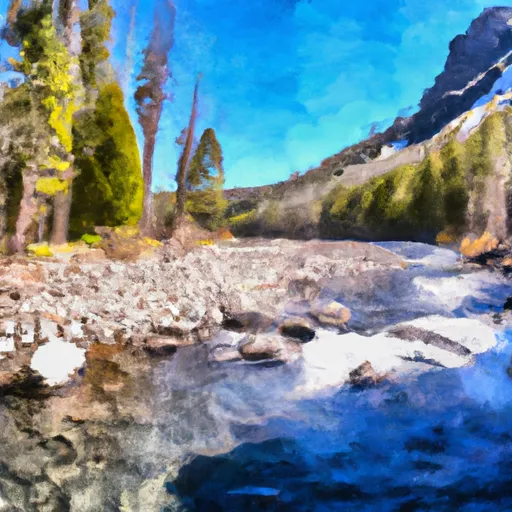
Clear Creek Reservoir-West Fork, located in Baker, Oregon, is a privately owned earth dam structure completed in 1924 for irrigation purposes. The reservoir, situated on the West Fork of Clear Creek, has a maximum storage capacity of 257 acre-feet and covers an area of 34.3 acres. With a significant hazard potential and a hydraulic height of 19 feet, the dam is inspected every three years to ensure safety and compliance with state regulations enforced by OWRD.
The dam stands at a height of 16 feet and a structural height of 24 feet, with a length of 255 feet. Its primary purpose is to support irrigation activities in the area, utilizing a slide (sluice gate) outlet for water release. Despite its age, Clear Creek Reservoir-West Fork remains a crucial water resource for the region, serving the agricultural community and providing essential water storage during dry periods. The dam is located within the jurisdiction of the state and is subject to regular inspections and enforcement measures to uphold its structural integrity and safety standards.
As part of the Walla Walla District, the dam is not operated by the US Army Corps of Engineers but is under the oversight of the Oregon state regulatory agency. Given its location and purpose, Clear Creek Reservoir-West Fork plays a vital role in water management and climate resilience efforts in the region. Its historical significance, coupled with its practical utility for irrigation, highlights the importance of maintaining and monitoring such essential water infrastructure in the face of changing environmental conditions and water resource demands.
Plan around the weather
Same NOAA / yr.no feed Snoflo's iOS app uses. Watch the precipitation column on the meteogram -- rain on the basin upstream typically lifts inflow 24-72 hours later.
Next 5 days, hour by hour
Temperature line with weather symbols on top, snow + rain accumulation as columns, humidity as a dotted line.
5-day forecast table
Every 3 hours, broken out across temperature, snow, rain, humidity, and wind. Each cell is colour-coded relative to the column min/max.
| Time | Condition | Temp (°F) | Snow (in) | Rain (in) | Humidity (%) | Wind (mps) | Wind dir |
|---|---|---|---|---|---|---|---|
| Loading detailed forecast… | |||||||
15-day temperature & precipitation
Daily temperatures, snow, and rain projected over the next two weeks.
Nearby streamflow gauges
USGS streamgauges around Clear Creek Reservoir-West Fork -- inflows here typically show up in storage 24-72 hours later.
| Streamgauge | Discharge | View |
|---|---|---|
| Snake River At Hells Canyon Dam Id-Or State Line | 19,200 cfs | → |
| Imnaha River At Imnaha | 150 cfs | → |
| Weiser River Nr Cambridge Id | 91 cfs | → |
| Little Salmon River At Riggins Id | 279 cfs | → |
| Minam River Near Minam | 148 cfs | → |
| Nf Payette River At Mccall Id | 58 cfs | → |


About Clear Creek Reservoir-West Fork
Where does the data for Clear Creek Reservoir-West Fork come from?
Structural and regulatory data come from the U.S. Army Corps of Engineers' National Inventory of Dams (NID). Weather forecast comes from NOAA / yr.no -- the same feed Snoflo's iOS app uses.
How often is the report updated?
NID structural data refreshes annually as the Corps publishes updated assessments. The weather forecast refreshes throughout the day.
What does the Significant hazard rating mean?
The Corps of Engineers' hazard potential classification grades probable consequences if the dam fails: High = probable loss of human life; Significant = no probable loss of human life but possible economic loss / environmental damage; Low = no probable loss of human life, only minor economic / environmental losses. See the Dam Data Reference card below for the full definitions.
What's "% of normal"?
The current storage value compared to the historical average storage on this calendar day. 100% = right on average; values above 100% mean above-normal storage (wet year); values below mean below-normal (dry year or drought).
Can I get alerts when storage crosses a threshold?
Yes -- alerts are managed in the Snoflo iOS app. Favorite this dam, set a threshold, and you'll get a push the moment conditions cross.
Dam data reference
Condition Assessment
- Satisfactory
- No existing or potential dam safety deficiencies are recognized. Acceptable performance is expected under all loading conditions (static, hydrologic, seismic) in accordance with the minimum applicable state or federal regulatory criteria or tolerable risk guidelines.
- Fair
- No existing dam safety deficiencies are recognized for normal operating conditions. Rare or extreme hydrologic and/or seismic events may result in a dam safety deficiency. Risk may be in the range to take further action.
- Poor
- A dam safety deficiency is recognized for normal operating conditions which may realistically occur. Remedial action is necessary. POOR may also be used when uncertainties exist as to critical analysis parameters which identify a potential dam safety deficiency.
- Unsatisfactory
- A dam safety deficiency is recognized that requires immediate or emergency remedial action for problem resolution.
- Not Rated
- The dam has not been inspected, is not under state or federal jurisdiction, or has been inspected but, for whatever reason, has not been rated.
Hazard Potential Classification
- High
- Dams assigned the high hazard potential classification are those where failure or mis-operation will probably cause loss of human life.
- Significant
- Dams assigned the significant hazard potential classification are those dams where failure or mis-operation results in no probable loss of human life but can cause economic loss, environmental damage, disruption of lifeline facilities, or impact other concerns. Significant hazard potential classification dams are often located in predominantly rural or agricultural areas but could be in areas with population and significant infrastructure.
- Low
- Dams assigned the low hazard potential classification are those where failure or mis-operation results in no probable loss of human life and low economic and/or environmental losses. Losses are principally limited to the owner's property.
- Undetermined
- Dams for which a downstream hazard potential has not been designated or is not provided.