Hard Creek River Run
Community Reviews
Been here? Share the conditions.
Reviews, ratings & photos are added in the free Snoflo iOS app — rate a spot, tag the conditions, and your visit is verified by location. Add or manage your reviews from the app.
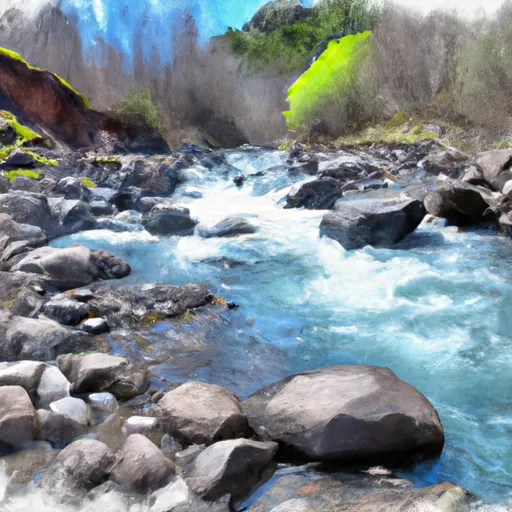
Hard Creek
The Hard Creek section of the Whitewater River spans approximately 6 miles, starting at the Hard Creek trailhead and ending at the Whitewater River campground. The rapids on this section include several technical drops, including "S-Turn" and "Boulder Drop," as well as a few larger waves and holes.
The Oregon State Marine Board requires all boaters to carry a personal flotation device, and helmets are strongly recommended. Additionally, a permit is required to launch a watercraft on this section of the Whitewater River. The permit can be obtained online or at several locations throughout the area.
Overall, the Hard Creek section of the Whitewater River offers a challenging and exciting run for experienced boaters, with stunning scenery and unique rapids. It is important to always check current streamflow conditions and follow all regulations to ensure a safe and enjoyable experience.
Plan your run down to the hour
Same weather feed Snoflo's iOS app uses -- updated continuously from NOAA / yr.no. Watch the precipitation column on the meteogram; rain ahead of a run typically lifts flows 12-48 hours later depending on the basin.
Next 5 days, hour by hour
Temperature line with weather symbols on top, snow + rain accumulation as columns, humidity as a dotted line.
5-day forecast table
Every 3 hours, broken out across temperature, snow, rain, humidity, and wind. Each cell is colour-coded relative to the column min/max.
| Time | Condition | Temp (°F) | Snow (in) | Rain (in) | Humidity (%) | Wind (mps) | Wind dir |
|---|---|---|---|---|---|---|---|
| Loading detailed forecast… | |||||||
15-day temperature & precipitation
Daily temperatures, snow, and rain projected over the next two weeks -- the upstream story that drives next week's flows.
Regional streamflow levels
USGS streamgauges around Hard Creek -- useful for spotting upstream pulses and gauging which tributary is contributing what.
| Streamgauge | Discharge | View |
|---|---|---|
| Little Salmon River At Riggins Id | 220 cfs | → |
| Snake River At Hells Canyon Dam Id-Or State Line | 19,200 cfs | → |
| Nf Payette River At Mccall Id | 57 cfs | → |
| Lake Fork Payette River Ab Jumbo Cr Nr Mccall Id | 35 cfs | → |
| Sf Salmon River Nr Krassel Ranger Station Id | 171 cfs | → |
| Imnaha River At Imnaha | 150 cfs | → |
Plan a longer trip
The closest boat launches, other paddle runs, and campgrounds so a day on the water can grow into a full weekend.
Boat launches
- Grouse Creek Campground Road Adams County
- Granite Lake Dam Road Valley County
- Fisher Creek Road Adams County
- National Forest Development Road 1614 Idaho County
- Warren Wagon Road Mccall
Other river runs
- Hazard Creek
- Headwaters To Confluence With Vance Creek At Payette Nf Boundary
- Headwaters At Hard Creek Lake To Payette Nf Boundary
- French Creek
- Hells Canyon (Hells Canyon Dam To Pittsburg Landing)
Whitewater safety
- Check the flow before you run
- Use the linked-gauge card and Regional Flow panel above. Class ratings change with flow -- a Class III at low water can become Class IV+ at high water.
- Know your skill ceiling
- Pick runs comfortably below your ceiling. Cold-water and big-water runs raise the consequences of any mistake.
- Wear the right gear
- Helmet, PFD, drysuit / wetsuit when water is below 60°F. Throw bag, knife, and whistle on your person, not in the boat.
- Scout, set safety, and run with a team
- Scout new rapids on foot, set safety with throw bags above the consequence pool, and run with at least one other competent paddler.
- Respect the river
- Strainers, undercuts, low-head dams, and wood can kill at any class rating. When in doubt, portage.
Set push alerts in the Snoflo app
Save Hard Creek as a favorite, set a discharge threshold (e.g. "alert me when flow hits 600 cfs"), and the iOS app pushes the moment the linked gauge crosses.
About Hard Creek
What's the optimal flow for Hard Creek?
The optimal flow depends on the section and the craft. Check the Run Details panel for the linked gauge and current status.
How fresh is the cfs reading on this page?
The linked USGS streamgauge reports continuously (every 15 minutes); Snoflo refreshes throughout the day. Hover the streamflow sparkline to read individual datapoints.
What's the whitewater class?
See the Run Details panel for the class rating Snoflo tracks for this run. Class ratings change with flow -- a Class III at low water can become Class IV in high water.
Where do I put in / take out?
Tap Directions in the hero above to open driving directions to the put-in. For shuttle planning, check the Nearby Boat Launches panel and the river run operator's site.
Can I get alerts when flows hit the optimal range?
Yes -- alerts are managed in the Snoflo iOS app. Favorite this run, set a discharge threshold, and you'll get a push the moment the gauge crosses.
Other runs near here
Snoflo-tracked paddle runs within driving distance of Hard Creek.