Wade Reservoir Report
Nearby: Gardener Reservoir Star Lake
Last Updated: February 21, 2026
Wade is a privately owned irrigation dam located in Jackson County, Oregon, specifically in the city of Brownsboro.
Summary
Built in 1963 on Maple Creek, this Earth-type dam stands at 85 feet tall and has a storage capacity of 1100 acre-feet. With a surface area of 21.85 acres, Wade serves as a crucial water resource for the surrounding area, primarily used for irrigation purposes.
Despite its age, Wade is regularly inspected and maintained by the Oregon Water Resources Department to ensure its structural integrity and functionality. The dam has a high hazard potential but is currently assessed to be in fair condition as of the last inspection in October 2020. Although no emergency action plan (EAP) has been prepared for Wade, the dam meets regulatory guidelines and is subject to regular monitoring to mitigate any potential risks associated with its operation.
Located within the Portland District of the US Army Corps of Engineers, Wade plays a vital role in water management in the region. With its significant storage capacity and strategic position on Maple Creek, this dam is a key asset for irrigation and agricultural activities in Jackson County, highlighting the importance of sustainable water resource management in the face of changing climate conditions.
°F
°F
mph
Wind
%
Humidity
15-Day Weather Outlook
Year Completed |
1963 |
Dam Length |
2070 |
Dam Height |
82 |
River Or Stream |
MAPLE CREEK |
Primary Dam Type |
Earth |
Surface Area |
21.85 |
Hydraulic Height |
80 |
Nid Storage |
1100 |
Structural Height |
85 |
Hazard Potential |
High |
Nid Height |
85 |
Seasonal Comparison
5-Day Hourly Forecast Detail
Nearby Streamflow Levels
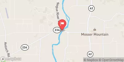
 Rogue River At Dodge Bridge
|
1490cfs |
 Big Butte Creek Near Mcleod
|
123cfs |
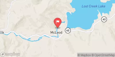
 Rogue River Near Mcleod
|
1320cfs |
 Rogue R At Cole M Rivers F Hatchery Nr Mcleod
|
949cfs |
 Bear Creek At Medford
|
76cfs |
 Elk Creek Near Trail
|
97cfs |
Dam Data Reference
Condition Assessment
SatisfactoryNo existing or potential dam safety deficiencies are recognized. Acceptable performance is expected under all loading conditions (static, hydrologic, seismic) in accordance with the minimum applicable state or federal regulatory criteria or tolerable risk guidelines.
Fair
No existing dam safety deficiencies are recognized for normal operating conditions. Rare or extreme hydrologic and/or seismic events may result in a dam safety deficiency. Risk may be in the range to take further action. Note: Rare or extreme event is defined by the regulatory agency based on their minimum
Poor A dam safety deficiency is recognized for normal operating conditions which may realistically occur. Remedial action is necessary. POOR may also be used when uncertainties exist as to critical analysis parameters which identify a potential dam safety deficiency. Investigations and studies are necessary.
Unsatisfactory
A dam safety deficiency is recognized that requires immediate or emergency remedial action for problem resolution.
Not Rated
The dam has not been inspected, is not under state or federal jurisdiction, or has been inspected but, for whatever reason, has not been rated.
Not Available
Dams for which the condition assessment is restricted to approved government users.
Hazard Potential Classification
HighDams assigned the high hazard potential classification are those where failure or mis-operation will probably cause loss of human life.
Significant
Dams assigned the significant hazard potential classification are those dams where failure or mis-operation results in no probable loss of human life but can cause economic loss, environment damage, disruption of lifeline facilities, or impact other concerns. Significant hazard potential classification dams are often located in predominantly rural or agricultural areas but could be in areas with population and significant infrastructure.
Low
Dams assigned the low hazard potential classification are those where failure or mis-operation results in no probable loss of human life and low economic and/or environmental losses. Losses are principally limited to the owner's property.
Undetermined
Dams for which a downstream hazard potential has not been designated or is not provided.
Not Available
Dams for which the downstream hazard potential is restricted to approved government users.
Area Campgrounds
| Location | Reservations | Toilets |
|---|---|---|
 Whiskey Springs Campground
|
||
 Whiskey Springs
|
||
 Fourbit Ford Campground
|
||
 Fourbit Ford
|
||
 Willow Prairie Cabin
|
||
 Willow-Witt Ranch
|

 Wade
Wade
 Big Butte Creek (Incl South Fork Big Butte Creek)
 Antelope Creek