


Richland Creek Reservoir Dam Reservoir Report
Last Updated: May 7, 2026
°F
°F
mph
Wind
%
Humidity
Richland Creek Reservoir Dam, located in Paulding County, Georgia, is a vital infrastructure owned by the local government and regulated by the GA-SAFE DAMS PROGRAM.
Summary
Designed by Jeffery Powers, P.E., this earth dam stands at a height of 125 feet and spans 4000 feet along Richland Creek. Its primary purpose is to serve as a water supply, with a storage capacity of 13,927 acre-feet and a surface area of 292 acres.
With a high hazard potential but a satisfactory condition assessment as of October 2019, Richland Creek Reservoir Dam plays a crucial role in water resource management in the region. The dam, with uncontrolled spillways and outlet gates, poses a moderate risk that is actively monitored through regular inspections. The dam's hydraulic height matches its structural height at 125 feet, ensuring proper functionality in managing water flow and storage within the reservoir.
As a key component of the local water supply infrastructure, Richland Creek Reservoir Dam showcases the importance of efficient dam management and safety regulations in ensuring the sustainability of water resources. With its strategic location along Richland Creek and impressive storage capacity, this earth dam remains a critical asset for the community, highlighting the intersection of water resource management and climate resilience in the face of changing environmental conditions.
Regional Streamflow Levels


15-Day Long Term Forecast
Dam Length |
4000 |
Dam Height |
125 |
River Or Stream |
Richland Creek |
Primary Dam Type |
Earth |
Surface Area |
292 |
Hydraulic Height |
125 |
Drainage Area |
1518 |
Nid Storage |
13927 |
Outlet Gates |
Uncontrolled |
Hazard Potential |
High |
Foundations |
Unlisted/Unknown |
Nid Height |
125 |
Seasonal Comparison
5-Day Hourly Forecast Detail
Dam Data Reference
Condition Assessment
SatisfactoryNo existing or potential dam safety deficiencies are recognized. Acceptable performance is expected under all loading conditions (static, hydrologic, seismic) in accordance with the minimum applicable state or federal regulatory criteria or tolerable risk guidelines.
Fair
No existing dam safety deficiencies are recognized for normal operating conditions. Rare or extreme hydrologic and/or seismic events may result in a dam safety deficiency. Risk may be in the range to take further action. Note: Rare or extreme event is defined by the regulatory agency based on their minimum
Poor A dam safety deficiency is recognized for normal operating conditions which may realistically occur. Remedial action is necessary. POOR may also be used when uncertainties exist as to critical analysis parameters which identify a potential dam safety deficiency. Investigations and studies are necessary.
Unsatisfactory
A dam safety deficiency is recognized that requires immediate or emergency remedial action for problem resolution.
Not Rated
The dam has not been inspected, is not under state or federal jurisdiction, or has been inspected but, for whatever reason, has not been rated.
Not Available
Dams for which the condition assessment is restricted to approved government users.
Hazard Potential Classification
HighDams assigned the high hazard potential classification are those where failure or mis-operation will probably cause loss of human life.
Significant
Dams assigned the significant hazard potential classification are those dams where failure or mis-operation results in no probable loss of human life but can cause economic loss, environment damage, disruption of lifeline facilities, or impact other concerns. Significant hazard potential classification dams are often located in predominantly rural or agricultural areas but could be in areas with population and significant infrastructure.
Low
Dams assigned the low hazard potential classification are those where failure or mis-operation results in no probable loss of human life and low economic and/or environmental losses. Losses are principally limited to the owner's property.
Undetermined
Dams for which a downstream hazard potential has not been designated or is not provided.
Not Available
Dams for which the downstream hazard potential is restricted to approved government users.
Area Campgrounds
 World Famous Lake Military - Atlanta NAS
 Lake Allatoona Military - Fort McPherson
 Old Hwy 41 - Allatoona Lake
 Red Top Mountain State Park
 McKinney - Allatoona Lake
 Clark Creek South - Allatoona Lake
Nearby Reservoirs
-
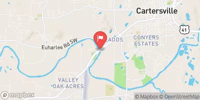
Richland Creek Reservoir Dam
-
Raccoon Creek W/S Str # 7
-
Taylor Lake Dam No. 2
-
Taylor Lake Dam No. 1
-
Dellinger Lake Dam
-
Raccoon Creek Watershed Structure No. 8
-
 Allatoona Lake Near Cartersville
-
 Chattahoochee River At Morgan Falls Dam
-
 Carters Re-Regulation Lake Near Carters
-
 Lake Sidney Lanier Near Buford
 Gayle Drive Southeast Bartow County
River Runs
-
 River Miles 8 Near Ga Sate Line To Confluence With Little River
-
 Confluence With East And West Branches To Al 37 Bridge
-
 Al 35 Bridge To Ends One Mile Upstream From Al 273 Bridge
-
 Begins One Mile Upstream From Al 273 Bridge To Lake Weiss
-
 Desoto Falls In Desoto State Park To Confluence With Little River
 Fort Yargo Lake
 McNeels Lake
 GB's Lake
 Etowah River
 Butternut Creek