Dorton Reservoir Report
Nearby: Wilbanks Lake Hiawatha
Last Updated: February 14, 2026
Dorton, located in Cumberland, Tennessee, is a privately owned Earth dam built in 1952, with a primary purpose that is unspecified.
Summary
The dam is situated on Byrd Creek and falls under the jurisdiction of the Nashville District of the US Army Corps of Engineers. With a hydraulic height of 13 feet and a structural height of 15 feet, Dorton has a storage capacity of 60 acre-feet and a surface area of 10 acres, serving a drainage area of 0.54 square miles.
Despite being categorized with a significant hazard potential and moderate risk assessment, Dorton's condition has not been rated as of yet. The dam has not undergone any modifications since its completion and lacks features such as outlet gates and controlled spillways. With the last inspection conducted in February 2017 and an inspection frequency of 5 years, it is essential for water resource and climate enthusiasts to monitor Dorton closely to ensure its structural integrity and safety in the face of potential emergencies.
°F
°F
mph
Wind
%
Humidity
15-Day Weather Outlook
Year Completed |
1952 |
Dam Length |
506.5 |
River Or Stream |
BYRD CREEK |
Primary Dam Type |
Earth |
Surface Area |
10 |
Hydraulic Height |
13 |
Drainage Area |
0.54 |
Nid Storage |
60 |
Structural Height |
15 |
Outlet Gates |
None |
Hazard Potential |
Significant |
Nid Height |
15 |
Seasonal Comparison
5-Day Hourly Forecast Detail
Nearby Streamflow Levels
 Daddys Creek Near Hebbertsburg
|
144cfs |
 Calfkiller River At Hwy 111 Below Sparta
|
282cfs |
 Clear Creek At Lilly Bridge Near Lancing
|
159cfs |
 Obed River Near Lancing
|
511cfs |
 Sewee Creek Near Decatur
|
32cfs |
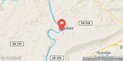 Emory River At Oakdale
|
736cfs |
Dam Data Reference
Condition Assessment
SatisfactoryNo existing or potential dam safety deficiencies are recognized. Acceptable performance is expected under all loading conditions (static, hydrologic, seismic) in accordance with the minimum applicable state or federal regulatory criteria or tolerable risk guidelines.
Fair
No existing dam safety deficiencies are recognized for normal operating conditions. Rare or extreme hydrologic and/or seismic events may result in a dam safety deficiency. Risk may be in the range to take further action. Note: Rare or extreme event is defined by the regulatory agency based on their minimum
Poor A dam safety deficiency is recognized for normal operating conditions which may realistically occur. Remedial action is necessary. POOR may also be used when uncertainties exist as to critical analysis parameters which identify a potential dam safety deficiency. Investigations and studies are necessary.
Unsatisfactory
A dam safety deficiency is recognized that requires immediate or emergency remedial action for problem resolution.
Not Rated
The dam has not been inspected, is not under state or federal jurisdiction, or has been inspected but, for whatever reason, has not been rated.
Not Available
Dams for which the condition assessment is restricted to approved government users.
Hazard Potential Classification
HighDams assigned the high hazard potential classification are those where failure or mis-operation will probably cause loss of human life.
Significant
Dams assigned the significant hazard potential classification are those dams where failure or mis-operation results in no probable loss of human life but can cause economic loss, environment damage, disruption of lifeline facilities, or impact other concerns. Significant hazard potential classification dams are often located in predominantly rural or agricultural areas but could be in areas with population and significant infrastructure.
Low
Dams assigned the low hazard potential classification are those where failure or mis-operation results in no probable loss of human life and low economic and/or environmental losses. Losses are principally limited to the owner's property.
Undetermined
Dams for which a downstream hazard potential has not been designated or is not provided.
Not Available
Dams for which the downstream hazard potential is restricted to approved government users.

 Dorton
 Mill Site To Center Bridge
 I-40 Bridge To Western Boundary Of Catoosa Wildlife Management Area, At Adams Bridge
 Center Bridge To Cumberland-Morgan County Line