Greenville Club Lake Dam Dam

Greenville Club Lake Dam
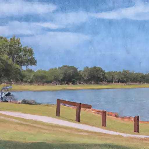
Greenville Club Lake Dam in Hunt, Texas, stands as a testament to engineering excellence, with a rich history dating back to its completion in 1922. Managed by a private owner, this earth dam on Cedar Creek serves primarily for recreational purposes, offering a tranquil oasis for water enthusiasts in the region. With a height of 29 feet and a length of 1786 feet, the dam provides a storage capacity of 4286 acre-feet and covers a surface area of 290 acres.
Over the years, Greenville Club Lake Dam has undergone modifications in 1946, 2006 for hydraulic and structural improvements, ensuring its continued safety and functionality. The dam's condition is assessed as fair, with a moderate hazard potential. The Texas Commission on Environmental Quality (TCEQ) regulates and inspects the dam regularly, affirming its adherence to state standards. With a spillway width of 250 feet and four uncontrolled outlet gates, the dam is equipped to manage water flow effectively in case of emergencies.
Water resource and climate enthusiasts will appreciate the strategic design and maintenance of Greenville Club Lake Dam, highlighting its significant role in providing recreational opportunities while safeguarding the surrounding area from potential risks. As a key feature on Cedar Creek, this dam reflects a harmonious blend of nature and infrastructure, showcasing the importance of responsible water management practices in ensuring sustainable development for future generations.
Plan around the weather
Same NOAA / yr.no feed Snoflo's iOS app uses. Watch the precipitation column on the meteogram -- rain on the basin upstream typically lifts inflow 24-72 hours later.
Next 5 days, hour by hour
Temperature line with weather symbols on top, snow + rain accumulation as columns, humidity as a dotted line.
5-day forecast table
Every 3 hours, broken out across temperature, snow, rain, humidity, and wind. Each cell is colour-coded relative to the column min/max.
| Time | Condition | Temp (°F) | Snow (in) | Rain (in) | Humidity (%) | Wind (mps) | Wind dir |
|---|---|---|---|---|---|---|---|
| Loading detailed forecast… | |||||||
15-day temperature & precipitation
Daily temperatures, snow, and rain projected over the next two weeks.
Nearby streamflow gauges
USGS streamgauges around Greenville Club Lake Dam -- inflows here typically show up in storage 24-72 hours later.
| Streamgauge | Discharge | View |
|---|---|---|
| Cowleech Fk Sabine Rv At Greenville | 0 cfs | → |
| S Sulphur At Commerce | 0 cfs | → |
| S Fk Sabine Rv Nr Quinlan | 6 cfs | → |
| Sabine Rv Nr Wills Point | 8 cfs | → |
| Middle Sulphur Rv At Commerce | · | → |
| Indian Ck At Sh 78 Nr Farmersville | 1 cfs | → |


About Greenville Club Lake Dam
Where does the data for Greenville Club Lake Dam come from?
Structural and regulatory data come from the U.S. Army Corps of Engineers' National Inventory of Dams (NID). Weather forecast comes from NOAA / yr.no -- the same feed Snoflo's iOS app uses.
How often is the report updated?
NID structural data refreshes annually as the Corps publishes updated assessments. The weather forecast refreshes throughout the day.
What does the Not Available hazard rating mean?
The Corps of Engineers' hazard potential classification grades probable consequences if the dam fails: High = probable loss of human life; Significant = no probable loss of human life but possible economic loss / environmental damage; Low = no probable loss of human life, only minor economic / environmental losses. See the Dam Data Reference card below for the full definitions.
What's "% of normal"?
The current storage value compared to the historical average storage on this calendar day. 100% = right on average; values above 100% mean above-normal storage (wet year); values below mean below-normal (dry year or drought).
Can I get alerts when storage crosses a threshold?
Yes -- alerts are managed in the Snoflo iOS app. Favorite this dam, set a threshold, and you'll get a push the moment conditions cross.
Dam data reference
Condition Assessment
- Satisfactory
- No existing or potential dam safety deficiencies are recognized. Acceptable performance is expected under all loading conditions (static, hydrologic, seismic) in accordance with the minimum applicable state or federal regulatory criteria or tolerable risk guidelines.
- Fair
- No existing dam safety deficiencies are recognized for normal operating conditions. Rare or extreme hydrologic and/or seismic events may result in a dam safety deficiency. Risk may be in the range to take further action.
- Poor
- A dam safety deficiency is recognized for normal operating conditions which may realistically occur. Remedial action is necessary. POOR may also be used when uncertainties exist as to critical analysis parameters which identify a potential dam safety deficiency.
- Unsatisfactory
- A dam safety deficiency is recognized that requires immediate or emergency remedial action for problem resolution.
- Not Rated
- The dam has not been inspected, is not under state or federal jurisdiction, or has been inspected but, for whatever reason, has not been rated.
Hazard Potential Classification
- High
- Dams assigned the high hazard potential classification are those where failure or mis-operation will probably cause loss of human life.
- Significant
- Dams assigned the significant hazard potential classification are those dams where failure or mis-operation results in no probable loss of human life but can cause economic loss, environmental damage, disruption of lifeline facilities, or impact other concerns. Significant hazard potential classification dams are often located in predominantly rural or agricultural areas but could be in areas with population and significant infrastructure.
- Low
- Dams assigned the low hazard potential classification are those where failure or mis-operation results in no probable loss of human life and low economic and/or environmental losses. Losses are principally limited to the owner's property.
- Undetermined
- Dams for which a downstream hazard potential has not been designated or is not provided.