Teasdale Dam B Reservoir Report
Nearby: Teasdale Dam A Coleman
Last Updated: February 11, 2026
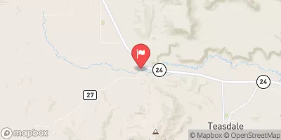
Teasdale Dam B, located in Wayne County, Utah, was completed in 1984 for the primary purpose of irrigation.
Summary
This private dam is regulated by the Utah Division of Water Rights and is subject to state inspection, permitting, and enforcement. With a structural height of 25 feet and a storage capacity of 100 acre-feet, Teasdale Dam B plays a crucial role in managing water resources in the region.
Even though the condition of Teasdale Dam B is currently marked as "Not Rated," its hazard potential is considered significant. The dam has a regular inspection frequency of every two years, with the last inspection conducted in June 2019. Despite the absence of a formal Emergency Action Plan (EAP) and risk assessment, the dam remains a key infrastructure for water management in the Birch Creek watershed.
Given its location and purpose, Teasdale Dam B serves as a vital component in the local irrigation system, ensuring a reliable water supply for agricultural activities in the area. Climate enthusiasts and water resource managers can appreciate the importance of maintaining and monitoring this earth-type dam to safeguard against potential hazards and ensure its continued functionality for the community.
°F
°F
mph
Wind
%
Humidity
15-Day Weather Outlook
Year Completed |
1984 |
River Or Stream |
BIRCH CREEK - OFFSTREAM |
Primary Dam Type |
Earth |
Drainage Area |
12.5 |
Nid Storage |
100 |
Structural Height |
25 |
Hazard Potential |
Significant |
Nid Height |
25 |
Seasonal Comparison
5-Day Hourly Forecast Detail
Nearby Streamflow Levels
Dam Data Reference
Condition Assessment
SatisfactoryNo existing or potential dam safety deficiencies are recognized. Acceptable performance is expected under all loading conditions (static, hydrologic, seismic) in accordance with the minimum applicable state or federal regulatory criteria or tolerable risk guidelines.
Fair
No existing dam safety deficiencies are recognized for normal operating conditions. Rare or extreme hydrologic and/or seismic events may result in a dam safety deficiency. Risk may be in the range to take further action. Note: Rare or extreme event is defined by the regulatory agency based on their minimum
Poor A dam safety deficiency is recognized for normal operating conditions which may realistically occur. Remedial action is necessary. POOR may also be used when uncertainties exist as to critical analysis parameters which identify a potential dam safety deficiency. Investigations and studies are necessary.
Unsatisfactory
A dam safety deficiency is recognized that requires immediate or emergency remedial action for problem resolution.
Not Rated
The dam has not been inspected, is not under state or federal jurisdiction, or has been inspected but, for whatever reason, has not been rated.
Not Available
Dams for which the condition assessment is restricted to approved government users.
Hazard Potential Classification
HighDams assigned the high hazard potential classification are those where failure or mis-operation will probably cause loss of human life.
Significant
Dams assigned the significant hazard potential classification are those dams where failure or mis-operation results in no probable loss of human life but can cause economic loss, environment damage, disruption of lifeline facilities, or impact other concerns. Significant hazard potential classification dams are often located in predominantly rural or agricultural areas but could be in areas with population and significant infrastructure.
Low
Dams assigned the low hazard potential classification are those where failure or mis-operation results in no probable loss of human life and low economic and/or environmental losses. Losses are principally limited to the owner's property.
Undetermined
Dams for which a downstream hazard potential has not been designated or is not provided.
Not Available
Dams for which the downstream hazard potential is restricted to approved government users.
Area Campgrounds
| Location | Reservations | Toilets |
|---|---|---|
 SUNGLOW CAMPGROUND
|
||
 Sunglow
|
||
 Singletree
|
||
 SINGLETREE CAMPGROUND
|
||
 Fruita - Capitol Reef National Park
|
||
 Fruita Campground
|


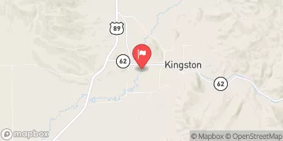
 Teasdale Dam B
 Fremont River 2 (Fremont Gorge)
 Fremont Canyon (Torrey to Capitol Reef)
 Fish Creek