
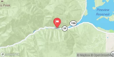
Box Elder County- Cook Canyon D.B. Reservoir Report
Last Updated: January 3, 2026
Located in Cook Canyon, Box Elder County, Utah, the Cook Canyon Dam serves as a vital flood risk reduction structure for the area.
°F
°F
mph
Wind
%
Humidity
Summary
Completed in 1985, this earth dam stands at a structural height of 24 feet with a hydraulic height of 21 feet, offering a maximum storage capacity of 3 acre-feet. The dam plays a crucial role in protecting the surrounding Willard City from potential flooding events, as it is regulated, inspected, and enforced by the Utah Division of Water Rights.
Despite its significant hazard potential, the Cook Canyon Dam has not been conditionally rated and lacks emergency action plans or risk assessment measures. The last inspection was conducted in May 2004, highlighting the need for updated assessments and emergency preparedness protocols. With a drainage area of 0.3 square miles, the dam plays a crucial role in managing water resources in the region, making it essential for local government officials and water enthusiasts to monitor its condition and regulatory compliance closely.
Hydraulic Height |
21 |
Drainage Area |
0.3 |
Year Completed |
1985 |
Structural Height |
24 |
Nid Storage |
3 |
River Or Stream |
COOK CANYON |
Dam Length |
255 |
Hazard Potential |
Significant |
Primary Dam Type |
Earth |
Nid Height |
24 |
Seasonal Comparison
Weather Forecast
Nearby Streamflow Levels
 Weber River Near Plain City
|
264cfs |
 Ogden River Nr Gibson Avenue At Ogden
|
23cfs |
 Weber River At Ogden
|
161cfs |
 Bear River Near Corinne
|
1280cfs |
 Ogden River Bl Pineview Res Near Huntsville
|
15cfs |
 Little Bear River At Paradise
|
50cfs |
Dam Data Reference
Condition Assessment
SatisfactoryNo existing or potential dam safety deficiencies are recognized. Acceptable performance is expected under all loading conditions (static, hydrologic, seismic) in accordance with the minimum applicable state or federal regulatory criteria or tolerable risk guidelines.
Fair
No existing dam safety deficiencies are recognized for normal operating conditions. Rare or extreme hydrologic and/or seismic events may result in a dam safety deficiency. Risk may be in the range to take further action. Note: Rare or extreme event is defined by the regulatory agency based on their minimum
Poor A dam safety deficiency is recognized for normal operating conditions which may realistically occur. Remedial action is necessary. POOR may also be used when uncertainties exist as to critical analysis parameters which identify a potential dam safety deficiency. Investigations and studies are necessary.
Unsatisfactory
A dam safety deficiency is recognized that requires immediate or emergency remedial action for problem resolution.
Not Rated
The dam has not been inspected, is not under state or federal jurisdiction, or has been inspected but, for whatever reason, has not been rated.
Not Available
Dams for which the condition assessment is restricted to approved government users.
Hazard Potential Classification
HighDams assigned the high hazard potential classification are those where failure or mis-operation will probably cause loss of human life.
Significant
Dams assigned the significant hazard potential classification are those dams where failure or mis-operation results in no probable loss of human life but can cause economic loss, environment damage, disruption of lifeline facilities, or impact other concerns. Significant hazard potential classification dams are often located in predominantly rural or agricultural areas but could be in areas with population and significant infrastructure.
Low
Dams assigned the low hazard potential classification are those where failure or mis-operation results in no probable loss of human life and low economic and/or environmental losses. Losses are principally limited to the owner's property.
Undetermined
Dams for which a downstream hazard potential has not been designated or is not provided.
Not Available
Dams for which the downstream hazard potential is restricted to approved government users.
 Box Elder County- Cook Canyon D.B.
 Willard Bay Reservoir
 Source To Nf Boundary
 Below Ogden Play Park
 Lower Ogden
 Ogden Play Park
 Rainbow Gardens