Source To Nf Boundary River Run
Community Reviews
Been here? Share the conditions.
Reviews, ratings & photos are added in the free Snoflo iOS app — rate a spot, tag the conditions, and your visit is verified by location. Add or manage your reviews from the app.
Source To Nf Boundary
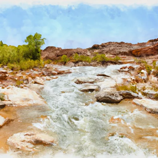
The Whitewater River Run features several challenging rapids and obstacles, including The Gates of Lodore, Hells Half Mile, and Disaster Falls. The Gates of Lodore is a Class IV rapid that requires expert navigation skills, and Hells Half Mile is a steep and technical drop that demands precise maneuvering. Disaster Falls is a Class V rapid that poses a serious risk to even the most experienced whitewater adventurers.
It is important to note that the Whitewater River Run Source to Nf Boundary is located in a protected wilderness area, and specific regulations apply to the area. Visitors are required to obtain a permit from the National Park Service before embarking on their river run. Additionally, certain areas of the river may be closed during breeding season to protect local wildlife.
Plan your run down to the hour
Same weather feed Snoflo's iOS app uses -- updated continuously from NOAA / yr.no. Watch the precipitation column on the meteogram; rain ahead of a run typically lifts flows 12-48 hours later depending on the basin.
Next 5 days, hour by hour
Temperature line with weather symbols on top, snow + rain accumulation as columns, humidity as a dotted line.
5-day forecast table
Every 3 hours, broken out across temperature, snow, rain, humidity, and wind. Each cell is colour-coded relative to the column min/max.
| Time | Condition | Temp (°F) | Snow (in) | Rain (in) | Humidity (%) | Wind (mps) | Wind dir |
|---|---|---|---|---|---|---|---|
| Loading detailed forecast… | |||||||
15-day temperature & precipitation
Daily temperatures, snow, and rain projected over the next two weeks -- the upstream story that drives next week's flows.
Regional streamflow levels
USGS streamgauges around Source To Nf Boundary -- useful for spotting upstream pulses and gauging which tributary is contributing what.
| Streamgauge | Discharge | View |
|---|---|---|
| Weber River Near Plain City | 32 cfs | → |
| Bear River Near Corinne | 145 cfs | → |
| Ogden River Nr Gibson Avenue At Ogden | 359 cfs | → |
| Weber River At Ogden | 59 cfs | → |
| Ogden River Bl Pineview Res Near Huntsville | 246 cfs | → |
| Little Bear River At Paradise | 19 cfs | → |
Plan a longer trip
The closest boat launches, other paddle runs, and campgrounds so a day on the water can grow into a full weekend.
Boat launches
- Willard Bay North
- Willard Bay South Marina
- Mantua Reservoir
- Promontory Road Corinne
- Road Tour Box Elder County
- Pineview Reservoir - North Arm
Other river runs
Campgrounds
- Brigham City / Perry South Koa
- Box Elder Campground
- Little Valley Country Store & Campground
- Maples Campground
- Old Maple Campground
- Middle Fork Dispersed Camping
Whitewater safety
- Check the flow before you run
- Use the linked-gauge card and Regional Flow panel above. Class ratings change with flow -- a Class III at low water can become Class IV+ at high water.
- Know your skill ceiling
- Pick runs comfortably below your ceiling. Cold-water and big-water runs raise the consequences of any mistake.
- Wear the right gear
- Helmet, PFD, drysuit / wetsuit when water is below 60°F. Throw bag, knife, and whistle on your person, not in the boat.
- Scout, set safety, and run with a team
- Scout new rapids on foot, set safety with throw bags above the consequence pool, and run with at least one other competent paddler.
- Respect the river
- Strainers, undercuts, low-head dams, and wood can kill at any class rating. When in doubt, portage.
Set push alerts in the Snoflo app
Save Source To Nf Boundary as a favorite, set a discharge threshold (e.g. "alert me when flow hits 600 cfs"), and the iOS app pushes the moment the linked gauge crosses.
About Source To Nf Boundary
What's the optimal flow for Source To Nf Boundary?
The optimal flow depends on the section and the craft. Check the Run Details panel for the linked gauge and current status.
How fresh is the cfs reading on this page?
The linked USGS streamgauge reports continuously (every 15 minutes); Snoflo refreshes throughout the day. Hover the streamflow sparkline to read individual datapoints.
What's the whitewater class?
See the Run Details panel for the class rating Snoflo tracks for this run. Class ratings change with flow -- a Class III at low water can become Class IV in high water.
Where do I put in / take out?
Tap Directions in the hero above to open driving directions to the put-in. For shuttle planning, check the Nearby Boat Launches panel and the river run operator's site.
Can I get alerts when flows hit the optimal range?
Yes -- alerts are managed in the Snoflo iOS app. Favorite this run, set a discharge threshold, and you'll get a push the moment the gauge crosses.
Other runs near here
Snoflo-tracked paddle runs within driving distance of Source To Nf Boundary.