Ladd's Mill Reservoir Report
Nearby: Curtis Pond Elmslie
Last Updated: February 22, 2026
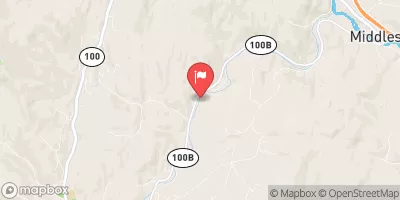
Ladd's Mill, also known as Worcester Hydro Dam, is a private hydroelectric facility located in Worcester, Vermont along the North Branch Winooski River.
Summary
The dam, constructed in 1928, stands at a height of 21 feet and has a length of 80 feet, providing a normal storage capacity of 68 acre-feet. With a maximum discharge of 800 cubic feet per second, the dam serves as a crucial source of renewable energy in the region.
Managed by the Federal Energy Regulatory Commission, Ladd's Mill has a low hazard potential and a moderate risk assessment rating. While state regulatory agencies oversee its operations, the dam has not been subject to recent inspections or condition assessments. Despite its age, this concrete gravity dam continues to contribute to the local energy grid, showcasing the sustainable potential of small-scale hydroelectric projects in enhancing water resource management and climate resilience efforts in Vermont.
As a historic structure with a rich legacy in Vermont's hydroelectric landscape, Ladd's Mill represents a fusion of traditional engineering and modern energy production technologies. While its role in the state's renewable energy portfolio is significant, ongoing risk management measures and periodic inspections are essential to ensure the dam's continued safety and efficiency. With its picturesque location and environmental impact, Ladd's Mill serves as a reminder of the interconnectedness between water resources, climate action, and sustainable energy development.
°F
°F
mph
Wind
%
Humidity
15-Day Weather Outlook
Year Completed |
1928 |
Dam Length |
80 |
Dam Height |
21 |
River Or Stream |
North Branch Winooski River |
Primary Dam Type |
Concrete |
Surface Area |
9 |
Drainage Area |
47 |
Nid Storage |
68 |
Hazard Potential |
Low |
Nid Height |
21 |
Seasonal Comparison
5-Day Hourly Forecast Detail
Nearby Streamflow Levels
Dam Data Reference
Condition Assessment
SatisfactoryNo existing or potential dam safety deficiencies are recognized. Acceptable performance is expected under all loading conditions (static, hydrologic, seismic) in accordance with the minimum applicable state or federal regulatory criteria or tolerable risk guidelines.
Fair
No existing dam safety deficiencies are recognized for normal operating conditions. Rare or extreme hydrologic and/or seismic events may result in a dam safety deficiency. Risk may be in the range to take further action. Note: Rare or extreme event is defined by the regulatory agency based on their minimum
Poor A dam safety deficiency is recognized for normal operating conditions which may realistically occur. Remedial action is necessary. POOR may also be used when uncertainties exist as to critical analysis parameters which identify a potential dam safety deficiency. Investigations and studies are necessary.
Unsatisfactory
A dam safety deficiency is recognized that requires immediate or emergency remedial action for problem resolution.
Not Rated
The dam has not been inspected, is not under state or federal jurisdiction, or has been inspected but, for whatever reason, has not been rated.
Not Available
Dams for which the condition assessment is restricted to approved government users.
Hazard Potential Classification
HighDams assigned the high hazard potential classification are those where failure or mis-operation will probably cause loss of human life.
Significant
Dams assigned the significant hazard potential classification are those dams where failure or mis-operation results in no probable loss of human life but can cause economic loss, environment damage, disruption of lifeline facilities, or impact other concerns. Significant hazard potential classification dams are often located in predominantly rural or agricultural areas but could be in areas with population and significant infrastructure.
Low
Dams assigned the low hazard potential classification are those where failure or mis-operation results in no probable loss of human life and low economic and/or environmental losses. Losses are principally limited to the owner's property.
Undetermined
Dams for which a downstream hazard potential has not been designated or is not provided.
Not Available
Dams for which the downstream hazard potential is restricted to approved government users.
Area Campgrounds
| Location | Reservations | Toilets |
|---|---|---|
 A Area
|
||
 B Area
|
||
 Primitive Campsite #21
|
||
 Primitive Campsite #22
|
||
 Little River State Park
|
||
 Elmore State Park
|


 Ladd's Mill
 Wrightsville Detention Reservoir @ Wrightsville Vt
 Waterbury Reservoir Near Waterbury
 Justa Road Calais