


Long Hope Club Dam Reservoir Report
Last Updated: May 4, 2026
Nearby: Headwaters Dam Indian Lake Dam
°F
°F
mph
Wind
%
Humidity
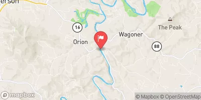
Located in Ashe, North Carolina, the Long Hope Club Dam spans the Long Hope Creek and serves as a recreational site for water resource and climate enthusiasts.
Summary
Managed by a private owner, this earth-type dam stands at a structural height of 24 feet with a hydraulic height of 19.8 feet, providing a storage capacity of 67 acre-feet. The dam covers a surface area of 6.4 acres and is equipped to handle a maximum discharge of 1830 cubic feet per second.
With a high hazard potential and fair condition assessment, the Long Hope Club Dam undergoes regular inspections by the North Carolina Dam Safety Program to ensure its safety and integrity. The dam's emergency action plan was last revised in 2012, and it is important for stakeholders and local authorities to stay updated on its risk management measures. The dam's location in Creston, Ashe County, makes it a key infrastructure for water management in the region, highlighting the importance of maintaining and monitoring its operations for the surrounding community.
Regional Streamflow Levels
15-Day Long Term Forecast
Dam Length |
200 |
River Or Stream |
Long Hope Creek |
Primary Dam Type |
Earth |
Surface Area |
6.4 |
Hydraulic Height |
19.8 |
Drainage Area |
5 |
Nid Storage |
67 |
Structural Height |
24 |
Hazard Potential |
High |
Nid Height |
24 |
Seasonal Comparison
5-Day Hourly Forecast Detail
Dam Data Reference
Condition Assessment
SatisfactoryNo existing or potential dam safety deficiencies are recognized. Acceptable performance is expected under all loading conditions (static, hydrologic, seismic) in accordance with the minimum applicable state or federal regulatory criteria or tolerable risk guidelines.
Fair
No existing dam safety deficiencies are recognized for normal operating conditions. Rare or extreme hydrologic and/or seismic events may result in a dam safety deficiency. Risk may be in the range to take further action. Note: Rare or extreme event is defined by the regulatory agency based on their minimum
Poor A dam safety deficiency is recognized for normal operating conditions which may realistically occur. Remedial action is necessary. POOR may also be used when uncertainties exist as to critical analysis parameters which identify a potential dam safety deficiency. Investigations and studies are necessary.
Unsatisfactory
A dam safety deficiency is recognized that requires immediate or emergency remedial action for problem resolution.
Not Rated
The dam has not been inspected, is not under state or federal jurisdiction, or has been inspected but, for whatever reason, has not been rated.
Not Available
Dams for which the condition assessment is restricted to approved government users.
Hazard Potential Classification
HighDams assigned the high hazard potential classification are those where failure or mis-operation will probably cause loss of human life.
Significant
Dams assigned the significant hazard potential classification are those dams where failure or mis-operation results in no probable loss of human life but can cause economic loss, environment damage, disruption of lifeline facilities, or impact other concerns. Significant hazard potential classification dams are often located in predominantly rural or agricultural areas but could be in areas with population and significant infrastructure.
Low
Dams assigned the low hazard potential classification are those where failure or mis-operation results in no probable loss of human life and low economic and/or environmental losses. Losses are principally limited to the owner's property.
Undetermined
Dams for which a downstream hazard potential has not been designated or is not provided.
Not Available
Dams for which the downstream hazard potential is restricted to approved government users.
Area Campgrounds
| Location | Reservations | Toilets |
|---|---|---|
 Deep Gap Campsite
|
||
 Peaks 61
|
||
 Racoon Holler Campground
|
||
 Peaks Groupsite
|
||
 Honey Bear Campground
|
||
 Goshen Creek
|
 W. Kerr Scott Reservoir At Dam Nr Wilkesboro
 Big Hill Road Watauga County
River Runs
-
 Green Cove--Jefferson Nf Near Confluence Of Star Hill Branch To Confluence With Whitetop Laurel
-
 Whitetop Laurel--Jefferson Nf Boundary (Intersection Of Hwy 58 And Sr 859) To Jefferson Nf Boundary Above Damascus
-
 Headwaters To Tn/Va State Line
-
 Watauga Reservoir To Tn/Nc State Line
-
 Headwaters Above Linville Gap To Blue Ridge Parkway Boundary
-
 Blue Ridge Parkway Boundary To Linville Gorge Boundary
 Watauga River
 Basin Creek
 Bell Branch
 Blood Creek
 Benfield Creek