Bagley dam

Bagley
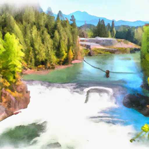
Bagley, also known as Lower Bagley Lake, is a federal-owned structure located in Whatcom County, Washington. Situated in the city of Glacier, this concrete dam on Bagley Creek was completed in 1927 and serves a primary purpose of recreation. With a hydraulic height of 12 feet and a structural height of 16 feet, the dam has a storage capacity of 90 acre-feet and a drainage area of 1.1 square miles.
Despite its high hazard potential, Bagley has not been rated for its condition assessment, and its last inspection took place in November 2019. The dam features uncontrolled spillways and outlet gates, and its risk assessment is classified as moderate. While it is not regulated by the state, the structure is under the ownership and management of the Forest Service. Given its age and the potential risks associated with its condition, there is a need for continued monitoring and possible risk management measures to ensure the safety of this water resource in the picturesque Pacific Northwest.
Water resource and climate enthusiasts in the region may find Bagley to be an intriguing structure to study, given its historical significance and the potential environmental impacts it poses. As a popular recreational spot, the dam plays a vital role in providing water storage and flood control for the surrounding area. With its unique design and operational characteristics, Bagley presents an opportunity for further research and assessment in the context of climate change and sustainable water resource management.
Plan around the weather
Same NOAA / yr.no feed Snoflo's iOS app uses. Watch the precipitation column on the meteogram -- rain on the basin upstream typically lifts inflow 24-72 hours later.
Next 5 days, hour by hour
Temperature line with weather symbols on top, snow + rain accumulation as columns, humidity as a dotted line.
5-day forecast table
Every 3 hours, broken out across temperature, snow, rain, humidity, and wind. Each cell is colour-coded relative to the column min/max.
| Time | Condition | Temp (°F) | Snow (in) | Rain (in) | Humidity (%) | Wind (mps) | Wind dir |
|---|---|---|---|---|---|---|---|
| Loading detailed forecast… | |||||||
15-day temperature & precipitation
Daily temperatures, snow, and rain projected over the next two weeks.
Nearby streamflow gauges
USGS streamgauges around Bagley -- inflows here typically show up in storage 24-72 hours later.
| Streamgauge | Discharge | View |
|---|---|---|
| Nf Nooksack River Bl Cascade Creek Nr Glacier | 626 cfs | → |
| Clearwater Creek Near Welcome | 39 cfs | → |
| Mf Nooksack River Near Deming | 247 cfs | → |
| Racehorse Creek At North Fork Road Nr Kendall | 23 cfs | → |
| Bacon Creek Below Oakes Creek Near Marblemount | 206 cfs | → |
| Skagit River Near Concrete | 13,200 cfs | → |
Make a day of it
Boat launches, lakeside camping, fishing access, and other reservoirs near Bagley.
Boat launches
See all →


Campgrounds
See all →


River runs
See all →


About Bagley
Where does the data for Bagley come from?
Structural and regulatory data come from the U.S. Army Corps of Engineers' National Inventory of Dams (NID). Weather forecast comes from NOAA / yr.no -- the same feed Snoflo's iOS app uses.
How often is the report updated?
NID structural data refreshes annually as the Corps publishes updated assessments. The weather forecast refreshes throughout the day.
What does the High hazard rating mean?
The Corps of Engineers' hazard potential classification grades probable consequences if the dam fails: High = probable loss of human life; Significant = no probable loss of human life but possible economic loss / environmental damage; Low = no probable loss of human life, only minor economic / environmental losses. See the Dam Data Reference card below for the full definitions.
What's "% of normal"?
The current storage value compared to the historical average storage on this calendar day. 100% = right on average; values above 100% mean above-normal storage (wet year); values below mean below-normal (dry year or drought).
Can I get alerts when storage crosses a threshold?
Yes -- alerts are managed in the Snoflo iOS app. Favorite this dam, set a threshold, and you'll get a push the moment conditions cross.
Dam data reference
Condition Assessment
- Satisfactory
- No existing or potential dam safety deficiencies are recognized. Acceptable performance is expected under all loading conditions (static, hydrologic, seismic) in accordance with the minimum applicable state or federal regulatory criteria or tolerable risk guidelines.
- Fair
- No existing dam safety deficiencies are recognized for normal operating conditions. Rare or extreme hydrologic and/or seismic events may result in a dam safety deficiency. Risk may be in the range to take further action.
- Poor
- A dam safety deficiency is recognized for normal operating conditions which may realistically occur. Remedial action is necessary. POOR may also be used when uncertainties exist as to critical analysis parameters which identify a potential dam safety deficiency.
- Unsatisfactory
- A dam safety deficiency is recognized that requires immediate or emergency remedial action for problem resolution.
- Not Rated
- The dam has not been inspected, is not under state or federal jurisdiction, or has been inspected but, for whatever reason, has not been rated.
Hazard Potential Classification
- High
- Dams assigned the high hazard potential classification are those where failure or mis-operation will probably cause loss of human life.
- Significant
- Dams assigned the significant hazard potential classification are those dams where failure or mis-operation results in no probable loss of human life but can cause economic loss, environmental damage, disruption of lifeline facilities, or impact other concerns. Significant hazard potential classification dams are often located in predominantly rural or agricultural areas but could be in areas with population and significant infrastructure.
- Low
- Dams assigned the low hazard potential classification are those where failure or mis-operation results in no probable loss of human life and low economic and/or environmental losses. Losses are principally limited to the owner's property.
- Undetermined
- Dams for which a downstream hazard potential has not been designated or is not provided.