


Bishop Dam Reservoir Report
Last Updated: May 3, 2026
°F
°F
mph
Wind
%
Humidity
Bishop Dam, located in Wesco, Missouri, is a privately owned structure primarily used for recreation.
Summary
Completed in 1972, this earth dam stands at a height of 25 feet and has a storage capacity of 201 acre-feet. Situated on the Stone Hill Branch river, the dam covers a surface area of 15 acres and serves a drainage area of 260 acres. With its high hazard potential, the condition of Bishop Dam is currently not rated.
Despite not being regulated by the state, Bishop Dam remains a popular spot for water resource and climate enthusiasts to enjoy outdoor activities such as fishing, boating, and wildlife observation. The dam's location in Dent County, Missouri, offers stunning views of the surrounding landscape and a tranquil environment for visitors to explore. While the dam does not have a spillway or outlet gates, its structural integrity and emergency preparedness measures are being monitored closely.
Although Bishop Dam has not been officially assessed for its risk management measures, its importance in providing recreational opportunities and contributing to the local ecosystem cannot be understated. As water resource and climate enthusiasts continue to appreciate the beauty and functionality of this earth dam, efforts to ensure its safety and maintenance will be crucial in preserving its value for future generations.
Regional Streamflow Levels
 Meramec River At Cook Station
|
110cfs |
 Current River Above Akers
|
562cfs |
 East Fork Black River Nr Lesterville
|
32cfs |
 Meramec River Near Steelville
|
816cfs |
 East Fork Black River At Lesterville
|
44cfs |
 Jacks Fork At Eminence
|
760cfs |
15-Day Long Term Forecast
Year Completed |
1972 |
Dam Height |
25 |
River Or Stream |
STONE HILL BRANCH |
Primary Dam Type |
Earth |
Surface Area |
15 |
Drainage Area |
260 |
Nid Storage |
201 |
Structural Height |
25 |
Hazard Potential |
High |
Foundations |
Unlisted/Unknown |
Nid Height |
25 |
Seasonal Comparison
5-Day Hourly Forecast Detail
Dam Data Reference
Condition Assessment
SatisfactoryNo existing or potential dam safety deficiencies are recognized. Acceptable performance is expected under all loading conditions (static, hydrologic, seismic) in accordance with the minimum applicable state or federal regulatory criteria or tolerable risk guidelines.
Fair
No existing dam safety deficiencies are recognized for normal operating conditions. Rare or extreme hydrologic and/or seismic events may result in a dam safety deficiency. Risk may be in the range to take further action. Note: Rare or extreme event is defined by the regulatory agency based on their minimum
Poor A dam safety deficiency is recognized for normal operating conditions which may realistically occur. Remedial action is necessary. POOR may also be used when uncertainties exist as to critical analysis parameters which identify a potential dam safety deficiency. Investigations and studies are necessary.
Unsatisfactory
A dam safety deficiency is recognized that requires immediate or emergency remedial action for problem resolution.
Not Rated
The dam has not been inspected, is not under state or federal jurisdiction, or has been inspected but, for whatever reason, has not been rated.
Not Available
Dams for which the condition assessment is restricted to approved government users.
Hazard Potential Classification
HighDams assigned the high hazard potential classification are those where failure or mis-operation will probably cause loss of human life.
Significant
Dams assigned the significant hazard potential classification are those dams where failure or mis-operation results in no probable loss of human life but can cause economic loss, environment damage, disruption of lifeline facilities, or impact other concerns. Significant hazard potential classification dams are often located in predominantly rural or agricultural areas but could be in areas with population and significant infrastructure.
Low
Dams assigned the low hazard potential classification are those where failure or mis-operation results in no probable loss of human life and low economic and/or environmental losses. Losses are principally limited to the owner's property.
Undetermined
Dams for which a downstream hazard potential has not been designated or is not provided.
Not Available
Dams for which the downstream hazard potential is restricted to approved government users.
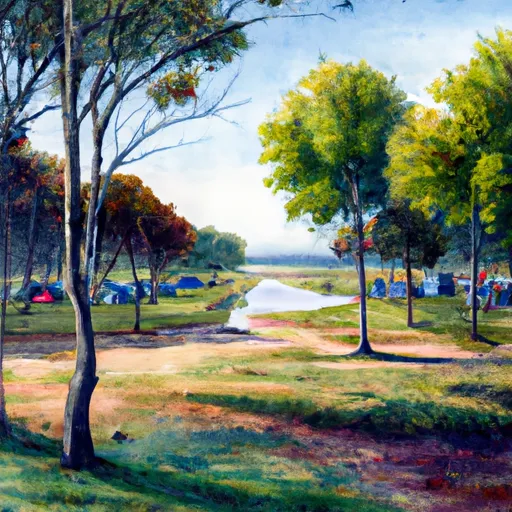
Area Campgrounds
| Location | Reservations | Toilets |
|---|---|---|
 Little Scotia Dispersed
|
||
 Ozark Trail Gunstock Hollow
|
||
 Loggers Lake
|
||
 Loggers Lake Recreation Area
|
||
 Red Bluff
|
||
 Jason's Place
|
 Clearwater Lake Near Piedmont
 State Highway B Shannon County
River Runs
-
 State Highway 49 Bridge Near Dillard, Missouri To Forest Boundary In Sections 13/24, T38N, R3W
-
 Confluence With Alley Spring (Branch) To Confluence With Current River (Does Not Include River Segment In Gap Between Parkland Units)
-
 Missouri State Highway 17 To Fort Leonard Wood (Army Base)
-
 Western Edge Of Ozark National Scenic Riverways To Confluence With Alley Spring (Branch)
-
 Northern Boundary Of Fort Leonard Wood To North Section Line Of Sec 31, T36N, R10W
-
 The Most Upstream Portion Of Ozark National Scenic Riverways To The Most Downstream Portion Of Ozark National Scenic Riverways
 Timberline Lake
 Parole Lake
 Howell Lake
 Crane Lake Recreation Area