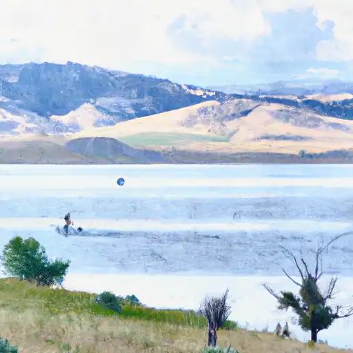
Brownlee Dam

Brownlee
Brownlee Dam, located in Carbon County, Wyoming, is a privately owned structure designed by John Brownlee for irrigation purposes. Completed in 1892, this earth dam stands at a height of 15 feet and has a storage capacity of 91 acre-feet with a normal storage level of 70 acre-feet. The dam spans 702 feet in length and is situated along the West Fork Cherokee and Cotton Creek, serving as a crucial water resource for the surrounding area.
Despite being classified as having a low hazard potential, Brownlee Dam's condition assessment is rated as poor, indicating a need for maintenance and potential upgrades to ensure its long-term stability. The dam's spillway, of uncontrolled type, has a width of 18 feet, and the structure features one other controlled outlet gate. With a moderate risk assessment score of 3, there is a call for effective risk management measures to be implemented to mitigate potential hazards and ensure the safety of the dam and the community it serves.
As a critical component of the local water infrastructure, Brownlee Dam warrants attention from water resource and climate enthusiasts due to its historical significance, ongoing maintenance concerns, and the vital role it plays in sustaining irrigation activities in the region. With its unique design and location, the dam serves as a valuable case study for understanding the intersection of water management, infrastructure development, and environmental conservation in the context of changing climate patterns.
Plan around the weather
Same NOAA / yr.no feed Snoflo's iOS app uses. Watch the precipitation column on the meteogram -- rain on the basin upstream typically lifts inflow 24-72 hours later.
Next 5 days, hour by hour
Temperature line with weather symbols on top, snow + rain accumulation as columns, humidity as a dotted line.
5-day forecast table
Every 3 hours, broken out across temperature, snow, rain, humidity, and wind. Each cell is colour-coded relative to the column min/max.
| Time | Condition | Temp (°F) | Snow (in) | Rain (in) | Humidity (%) | Wind (mps) | Wind dir |
|---|---|---|---|---|---|---|---|
| Loading detailed forecast… | |||||||
15-day temperature & precipitation
Daily temperatures, snow, and rain projected over the next two weeks.
Nearby streamflow gauges
USGS streamgauges around Brownlee -- inflows here typically show up in storage 24-72 hours later.
| Streamgauge | Discharge | View |
|---|---|---|
| Encampment River At Mouth | 28 cfs | → |
| Encampment River Ab Hog Park Cr | 44 cfs | → |
| South Brush Creek Near Saratoga | 18 cfs | → |
| North Brush Creek Near Saratoga | 11 cfs | → |
| Jack Creek Above Coyote Draw | 133 cfs | → |
| Little Snake River Near Slater | 31 cfs | → |


About Brownlee
Where does the data for Brownlee come from?
Structural and regulatory data come from the U.S. Army Corps of Engineers' National Inventory of Dams (NID). Weather forecast comes from NOAA / yr.no -- the same feed Snoflo's iOS app uses.
How often is the report updated?
NID structural data refreshes annually as the Corps publishes updated assessments. The weather forecast refreshes throughout the day.
What does the Low hazard rating mean?
The Corps of Engineers' hazard potential classification grades probable consequences if the dam fails: High = probable loss of human life; Significant = no probable loss of human life but possible economic loss / environmental damage; Low = no probable loss of human life, only minor economic / environmental losses. See the Dam Data Reference card below for the full definitions.
What's "% of normal"?
The current storage value compared to the historical average storage on this calendar day. 100% = right on average; values above 100% mean above-normal storage (wet year); values below mean below-normal (dry year or drought).
Can I get alerts when storage crosses a threshold?
Yes -- alerts are managed in the Snoflo iOS app. Favorite this dam, set a threshold, and you'll get a push the moment conditions cross.
Dam data reference
Condition Assessment
- Satisfactory
- No existing or potential dam safety deficiencies are recognized. Acceptable performance is expected under all loading conditions (static, hydrologic, seismic) in accordance with the minimum applicable state or federal regulatory criteria or tolerable risk guidelines.
- Fair
- No existing dam safety deficiencies are recognized for normal operating conditions. Rare or extreme hydrologic and/or seismic events may result in a dam safety deficiency. Risk may be in the range to take further action.
- Poor
- A dam safety deficiency is recognized for normal operating conditions which may realistically occur. Remedial action is necessary. POOR may also be used when uncertainties exist as to critical analysis parameters which identify a potential dam safety deficiency.
- Unsatisfactory
- A dam safety deficiency is recognized that requires immediate or emergency remedial action for problem resolution.
- Not Rated
- The dam has not been inspected, is not under state or federal jurisdiction, or has been inspected but, for whatever reason, has not been rated.
Hazard Potential Classification
- High
- Dams assigned the high hazard potential classification are those where failure or mis-operation will probably cause loss of human life.
- Significant
- Dams assigned the significant hazard potential classification are those dams where failure or mis-operation results in no probable loss of human life but can cause economic loss, environmental damage, disruption of lifeline facilities, or impact other concerns. Significant hazard potential classification dams are often located in predominantly rural or agricultural areas but could be in areas with population and significant infrastructure.
- Low
- Dams assigned the low hazard potential classification are those where failure or mis-operation results in no probable loss of human life and low economic and/or environmental losses. Losses are principally limited to the owner's property.
- Undetermined
- Dams for which a downstream hazard potential has not been designated or is not provided.