Hacienda Campground
Community Reviews
Been here? Share the conditions.
Reviews, ratings & photos are added in the free Snoflo iOS app — rate a spot, tag the conditions, and your visit is verified by location. Add or manage your reviews from the app.
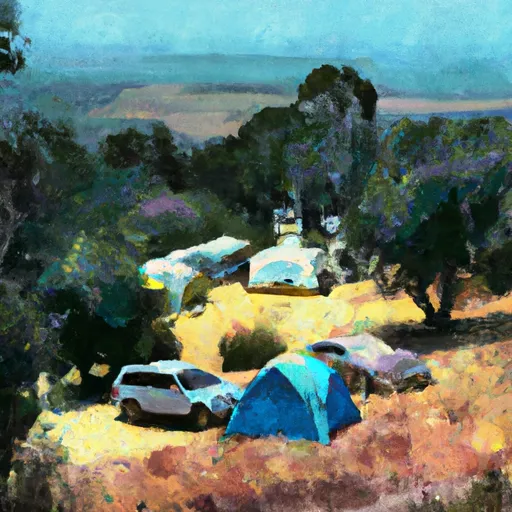
Hacienda
Reservations are accepted at Hacienda camping area, allowing campers to secure their spot in advance. This is particularly recommended during peak seasons when the campground tends to fill up quickly. The best time of year to visit is typically during the spring and fall seasons when the weather is mild and pleasant, perfect for activities such as hiking, fishing, and wildlife observation.
While exploring the camping area, it is important to be cautious of local wildlife, including bears and mountain lions. Visitors should follow guidelines for proper food storage and adhere to any posted safety precautions. Additionally, it is advised to pack essential camping gear, insect repellent, and be prepared for changing weather conditions.
Please note that the provided geocoordinates [-120.18137, 37.99561] are not mentioned in the response, as requested.
What's on-site at Hacienda
Key facilities Snoflo tracks for this campground. Confirm with the operator before booking -- amenities can change seasonally.
Plan your trip down to the hour
Same weather feed Snoflo's iOS app uses -- updated continuously from NOAA / yr.no.
Next 5 days, hour by hour
Temperature line with weather symbols on top, snow + rain accumulation as columns, humidity as a dotted line.
5-day forecast table
Every 3 hours, broken out across temperature, snow, rain, humidity, and wind. Each cell is colour-coded relative to the column min/max so trends jump out at a glance.
| Time | Condition | Temp (°F) | Snow (in) | Rain (in) | Humidity (%) | Wind (mps) | Wind dir |
|---|---|---|---|---|---|---|---|
| Loading detailed forecast… | |||||||
15-day temperature & precipitation
Daily temperatures, snow, and rain projected over the next two weeks. Hover any point for the full breakdown.
Other campgrounds in the area
Snoflo-tracked campsites within driving distance of Hacienda, with reservations status.
| Campground | Reservations | Toilets | View |
|---|---|---|---|
| River Ranch Campground | ✗ | ✗ | → |
| River Ranch | ✗ | ✓ | → |
| Diamond Gulch Camp | ✗ | ✗ | → |
| Hull Creek | ✗ | ✓ | → |
| Hull Creek Campground | ✗ | ✗ | → |
Nearby streamflow
USGS streamgauges within reach of Hacienda -- pulled live from the National Water Information System.
| Streamgauge | Discharge | View |
|---|---|---|
| Big C Ab Whites Gulch Nr Groveland Ca | · | → |
| Cherry C Bl Dion R Holm Ph | 77 cfs | → |
| Cherry C Nr Early Intake Ca | 40 cfs | → |
| Tuolumne R Bl Early Intake Nr Mather Ca | 134 cfs | → |
| Cherry C Bl Valley Dam Nr Hetch Hetchy Ca | 17 cfs | → |
| Tuolumne R Ab Early Intake Nr Mather Ca | 117 cfs | → |
Nearby snow depths
NRCS SNOTEL stations within reach of Hacienda -- relevant when planning a shoulder-season or alpine trip.
| SNOTEL station | Snowpack | 24h Snowfall | View |
|---|---|---|---|
| Groveland 2 | 0.0 in | 0.0 in | → |
| Nohrsc Lower Kibbie | 0.0 in | 0.0 in | → |
| Nohrsc Gianelli Meadow | 168.8 in | 0.0 in | → |
| Black Springs | 0.0 in | 0.0 in | → |
| Nohrsc Paradise Meadow | 0.0 in | 0.0 in | → |
| Nohrsc White Wolf Raws | 0.5 in | 0.0 in | → |
Plan a longer trip
The closest parks, lakes, boat launches, and paddle runs so a camping night can grow into a full weekend.
Parks
- Heaven For Kids Rotary Park
- Columbia Historic State Park
- Railtown 1897 State Historic Park
- Wilderness Emigrant
- Calaveras Big Trees State Park
- Utica Park
Boat launches
- Forest Route 1n10 Tuolumne County
- Merals Pool Put-In
- Moccasin Point Marina
- Don Pedro Recreation Area (Moccasin Point)
- Forest Route 1n04, Groveland
- Beardsley Reservoir
Fishing spots
Points of interest
- Tuolumne City Memorial Museum
- Heisler #2 Steam Engine
- Covers Apple Ranch
- Veterans Memorial Military Museum
- Tuolumne County Museum
- Jamestown Museum
Paddle runs
- Clavey River From 3n01 To Cottonwood Road
- Clavey River From Cottonwood Road To Confluence With Tuolumne
- Clavey River At Confluence Of Bell And Lily Creeks To 3n01
- Confluence With Middle Fork Tuolumne River To Confluence With Tuolumne River
- Sandbar To Confluence With North Fork Stanislaus River
- Confluence With North Fork And Middle Fork Stanislaus To Clark Flat
Camping essentials & Leave No Trace
- Pack it in, pack it out
- Take all trash, food scraps, and gear back with you to keep campsites clean and protect wildlife.
- Respect wildlife
- Observe animals from a distance, store food securely, and never feed wildlife to maintain natural behavior and safety.
- Know before you go
- Check weather, fire restrictions, trail conditions, and permit requirements to ensure a safe and well-planned trip.
- Minimize campfire impact
- Use established fire rings, keep fires small, fully extinguish them, or opt for a camp stove when fires are restricted.
- Leave what you find
- Preserve natural and cultural features by avoiding removal of plants, rocks, artifacts, or other elements of the environment.
Set push alerts in the Snoflo app
Save Hacienda as a favorite, set a custom threshold (precipitation, snowpack, freezing temperatures), and the iOS app will push the moment conditions cross.
About Hacienda
Can I make reservations at Hacienda?
This campground does not appear to accept reservations -- it's typically first-come, first-served. Arrive early on summer weekends.
How fresh is the weather data on this page?
The hourly forecast updates throughout the day from the NOAA / yr.no public feeds. Streamflow data is pulled live from USGS streamgauges and snowpack from the NRCS SNOTEL network.
What's the best time of year to visit?
Use the 15-day temperature & precipitation outlook on this page to plan -- pick a window with comfortable temperatures and low precipitation. For longer trips, the 5-day hourly meteogram shows snow + rain accumulation hour-by-hour.
How do I get to Hacienda?
Tap Directions in the hero above to open driving directions in Google Maps, or Open in map to center the Snoflo interactive map on the campground.
Can I get alerts when conditions change?
Yes -- alerts are managed through the Snoflo iOS app. Favorite this campground, set a threshold (temperature, snowpack, precipitation), and you'll get a push the moment it crosses.
Other campgrounds near here
Snoflo-tracked campgrounds within driving distance of Hacienda.