Shields Flat Campground
Community Reviews
Been here? Share the conditions.
Reviews, ratings & photos are added in the free Snoflo iOS app — rate a spot, tag the conditions, and your visit is verified by location. Add or manage your reviews from the app.
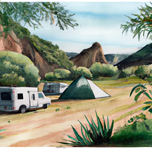
Shields Flat
Reservations are not accepted at Shields Flat camping area; campsites are available on a first-come, first-served basis. It is recommended to arrive early in the day, especially during weekends and peak seasons, to secure a spot. The camping area is open year-round, but the best time to visit is in the spring and fall when the weather is pleasant, and the wildflowers are in bloom.
While enjoying the natural beauty of Shields Flat, it is important to be cautious of potential hazards. The area is home to wildlife such as bears, so campers should properly store food and dispose of trash to avoid attracting them. Additionally, poison oak can be found in some parts of the campground, so it is advised to stay on designated paths and wear protective clothing. By following these guidelines, campers can fully enjoy the tranquility and natural wonders that Shields Flat camping area has to offer.
What's on-site at Shields Flat
Key facilities Snoflo tracks for this campground. Confirm with the operator before booking -- amenities can change seasonally.
Plan your trip down to the hour
Same weather feed Snoflo's iOS app uses -- updated continuously from NOAA / yr.no.
Next 5 days, hour by hour
Temperature line with weather symbols on top, snow + rain accumulation as columns, humidity as a dotted line.
5-day forecast table
Every 3 hours, broken out across temperature, snow, rain, humidity, and wind. Each cell is colour-coded relative to the column min/max so trends jump out at a glance.
| Time | Condition | Temp (°F) | Snow (in) | Rain (in) | Humidity (%) | Wind (mps) | Wind dir |
|---|---|---|---|---|---|---|---|
| Loading detailed forecast… | |||||||
15-day temperature & precipitation
Daily temperatures, snow, and rain projected over the next two weeks. Hover any point for the full breakdown.
Other campgrounds in the area
Snoflo-tracked campsites within driving distance of Shields Flat, with reservations status.
| Campground | Reservations | Toilets | View |
|---|---|---|---|
| Anderson Flat | ✗ | ✗ | → |
| Trail Fork | ✗ | ✗ | → |
| Red Rock Flat | ✗ | ✗ | → |
| Saxton Trail Camp | ✗ | ✗ | → |
| Jackstraw Campground | ✗ | ✗ | → |
Nearby streamflow
USGS streamgauges within reach of Shields Flat -- pulled live from the National Water Information System.
| Streamgauge | Discharge | View |
|---|---|---|
| Sar Supp Gage Nr Mentone Ca | 23 cfs | → |
| Santa Ana R Nr Mentone (River Only) Ca | 37 cfs | → |
| Plunge C Nr East Highlands Ca | 1 cfs | → |
| Mission C Nr Desert Hot Springs Ca | 1 cfs | → |
| City C Nr Highland Ca | 0 cfs | → |
| Sand Canyon C Nr Highland Ca | 1 cfs | → |
Nearby snow depths
NRCS SNOTEL stations within reach of Shields Flat -- relevant when planning a shoulder-season or alpine trip.
| SNOTEL station | Snowpack | 24h Snowfall | View |
|---|---|---|---|
| Lake Arrowhead 1.5 Se | 0.0 in | 0.0 in | → |
| Johnson Valley | 0.0 in | 0.0 in | → |
| Hesperia 1ene | 0.0 in | 0.0 in | → |
Plan a longer trip
The closest parks, lakes, boat launches, and paddle runs so a camping night can grow into a full weekend.
Parks
Boat launches
- Pine Knot Landing
- Big Bear Marina
- Pleasure Point Landing
- Holloway's Marina, Inc.
- Carol Morrison (East)
- Duane Boyer (West)
Fishing spots
- Mill Creek
- Santa Ana River - South Fork
- Santa Ana River
- Big Bear Lake
- Yucaipa Park Lake
- Arrowbear Lake
Points of interest
- C-47 Crash Site
- Mountain Home Village Scenic Overlook
- Champion Lodgepole Pine
- Big Bear Snow Play
- Snow Play
- Big Bear Solar Observatory
Paddle runs
- South Fork Meadows To San Gorgonia Wilderness Boundary
- South Fork Headwaters To San Gorgonio Wilderness Boundary/Sf Diversion Dam
- Headwaters To San Gorgonio Wilderness
- Big Meadows To Filaree Flat
- East Fork Headwaters To Confluence With South Fork
- Filaree Flat To Confluence With Bear Creek
Camping essentials & Leave No Trace
- Pack it in, pack it out
- Take all trash, food scraps, and gear back with you to keep campsites clean and protect wildlife.
- Respect wildlife
- Observe animals from a distance, store food securely, and never feed wildlife to maintain natural behavior and safety.
- Know before you go
- Check weather, fire restrictions, trail conditions, and permit requirements to ensure a safe and well-planned trip.
- Minimize campfire impact
- Use established fire rings, keep fires small, fully extinguish them, or opt for a camp stove when fires are restricted.
- Leave what you find
- Preserve natural and cultural features by avoiding removal of plants, rocks, artifacts, or other elements of the environment.
Set push alerts in the Snoflo app
Save Shields Flat as a favorite, set a custom threshold (precipitation, snowpack, freezing temperatures), and the iOS app will push the moment conditions cross.
About Shields Flat
Can I make reservations at Shields Flat?
This campground does not appear to accept reservations -- it's typically first-come, first-served. Arrive early on summer weekends.
How fresh is the weather data on this page?
The hourly forecast updates throughout the day from the NOAA / yr.no public feeds. Streamflow data is pulled live from USGS streamgauges and snowpack from the NRCS SNOTEL network.
What's the best time of year to visit?
Use the 15-day temperature & precipitation outlook on this page to plan -- pick a window with comfortable temperatures and low precipitation. For longer trips, the 5-day hourly meteogram shows snow + rain accumulation hour-by-hour.
How do I get to Shields Flat?
Tap Directions in the hero above to open driving directions in Google Maps, or Open in map to center the Snoflo interactive map on the campground.
Can I get alerts when conditions change?
Yes -- alerts are managed through the Snoflo iOS app. Favorite this campground, set a threshold (temperature, snowpack, precipitation), and you'll get a push the moment it crosses.
Other campgrounds near here
Snoflo-tracked campgrounds within driving distance of Shields Flat.