Volcano Adventure Youth Camp Campground
Community Reviews
Been here? Share the conditions.
Reviews, ratings & photos are added in the free Snoflo iOS app — rate a spot, tag the conditions, and your visit is verified by location. Add or manage your reviews from the app.
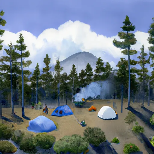
Volcano Adventure Youth Camp
One of the main attractions of the area is the Lassen Peak, which is an active volcano that towers over the landscape. Visitors can hike to the top of the peak for breathtaking views of the surrounding area. Other nearby points of interest include the Bumpass Hell, an area with boiling mud pots, steam vents, and hot springs, and the Sulphur Works, where visitors can see bubbling mud pools and steam vents.
The campground amenities include picnic tables, fire rings, and toilets, but there is no drinking water available, so visitors need to bring their own. The camping area is also accessible for RVs and trailers.
An interesting fact about the area is that it was created by the eruption of the Lassen Peak in 1915, which covered the landscape with ash and debris. Since then, the area has become a popular destination for outdoor enthusiasts and nature lovers.
The best time of year to visit the Volcano Adventure Youth Camp is from May to October, when the temperatures are pleasant and the weather is dry. The average temperature during this time is around 65 degrees Fahrenheit during the day and 40 degrees Fahrenheit at night. It is important to note that the park is closed during the winter months due to heavy snowfall.
Overall, the Volcano Adventure Youth Camp is a great destination for those who are looking for an adventure in the great outdoors and want to experience the beauty of a volcanic landscape.
What's on-site at Volcano Adventure Youth Camp
Key facilities Snoflo tracks for this campground. Confirm with the operator before booking -- amenities can change seasonally.
Plan your trip down to the hour
Same weather feed Snoflo's iOS app uses -- updated continuously from NOAA / yr.no.
Next 5 days, hour by hour
Temperature line with weather symbols on top, snow + rain accumulation as columns, humidity as a dotted line.
5-day forecast table
Every 3 hours, broken out across temperature, snow, rain, humidity, and wind. Each cell is colour-coded relative to the column min/max so trends jump out at a glance.
| Time | Condition | Temp (°F) | Snow (in) | Rain (in) | Humidity (%) | Wind (mps) | Wind dir |
|---|---|---|---|---|---|---|---|
| Loading detailed forecast… | |||||||
15-day temperature & precipitation
Daily temperatures, snow, and rain projected over the next two weeks. Hover any point for the full breakdown.
Other campgrounds in the area
Snoflo-tracked campsites within driving distance of Volcano Adventure Youth Camp, with reservations status.
| Campground | Reservations | Toilets | View |
|---|---|---|---|
| Crags - Lassen Volcanic National Park | ✓ | ✓ | → |
| Lost Creek Group Campground | ✗ | ✗ | → |
| Lost Creek Organization Campground | ✗ | ✗ | → |
| Manzanita Lake - Lassen Volcanic National Park | ✓ | ✓ | → |
| Manzanita Lake Campground | ✗ | ✗ | → |
Nearby streamflow
USGS streamgauges within reach of Volcano Adventure Youth Camp -- pulled live from the National Water Information System.
| Streamgauge | Discharge | View |
|---|---|---|
| Hat C Nr Hat Creek Ca | 128 cfs | → |
| Pit R Bl Pit No 1 Ph Nr Fall River Mills Ca | 959 cfs | → |
| Burney C A Burney Falls Nr Burney Ca | 168 cfs | → |
| Battle C Bl Coleman Fish Hatchery Nr Cottonwood Ca | 245 cfs | → |
| Cow C Nr Millville Ca | 31 cfs | → |
| Cottonwood C Nr Cottonwood Ca | 79 cfs | → |
Nearby snow depths
NRCS SNOTEL stations within reach of Volcano Adventure Youth Camp -- relevant when planning a shoulder-season or alpine trip.
| SNOTEL station | Snowpack | 24h Snowfall | View |
|---|---|---|---|
| Nohrsc Harkness Flat Near Chester 8nnw | 0.0 in | 0.0 in | → |
| Blacks Mountain #1 | 0.0 in | 0.0 in | → |
| Mission Ridge Snow Pillow | 0.0 in | 0.0 in | → |
| Susanville 3.2 Ssw | 0.0 in | 0.0 in | → |
| Stouts Meadow Goes | 67.0 in | 0.0 in | → |
Plan a longer trip
The closest parks, lakes, boat launches, and paddle runs so a camping night can grow into a full weekend.
Parks
- Wilderness Thousand Lakes
- Lassen Volcanic National Park
- Wilderness Lassen Volcanic
- Wilderness Caribou
- Chester Park
- Cinder Flats Wildlife Area
Boat launches
Fishing spots
Points of interest
Paddle runs
- Lassen Np Boundary To Just Below Highway 36 Crossing
- South Fork Battle Creek
- Just Below Highway 36 Crossing To One-Half Mile Downstream From Hole-In-The-Ground
- One-Half Mile Downstream From Hole-In-The-Ground To Sec Line Between 29/20 T28n, R3e, Below Big Bend
- Bear Creek
- North Fork From Nf Boundary At Section Line Between 17/18, T28n, R1e. To Mcclure Place
Camping essentials & Leave No Trace
- Pack it in, pack it out
- Take all trash, food scraps, and gear back with you to keep campsites clean and protect wildlife.
- Respect wildlife
- Observe animals from a distance, store food securely, and never feed wildlife to maintain natural behavior and safety.
- Know before you go
- Check weather, fire restrictions, trail conditions, and permit requirements to ensure a safe and well-planned trip.
- Minimize campfire impact
- Use established fire rings, keep fires small, fully extinguish them, or opt for a camp stove when fires are restricted.
- Leave what you find
- Preserve natural and cultural features by avoiding removal of plants, rocks, artifacts, or other elements of the environment.
Set push alerts in the Snoflo app
Save Volcano Adventure Youth Camp as a favorite, set a custom threshold (precipitation, snowpack, freezing temperatures), and the iOS app will push the moment conditions cross.
About Volcano Adventure Youth Camp
Can I make reservations at Volcano Adventure Youth Camp?
This campground does not appear to accept reservations -- it's typically first-come, first-served. Arrive early on summer weekends.
How fresh is the weather data on this page?
The hourly forecast updates throughout the day from the NOAA / yr.no public feeds. Streamflow data is pulled live from USGS streamgauges and snowpack from the NRCS SNOTEL network.
What's the best time of year to visit?
Use the 15-day temperature & precipitation outlook on this page to plan -- pick a window with comfortable temperatures and low precipitation. For longer trips, the 5-day hourly meteogram shows snow + rain accumulation hour-by-hour.
How do I get to Volcano Adventure Youth Camp?
Tap Directions in the hero above to open driving directions in Google Maps, or Open in map to center the Snoflo interactive map on the campground.
Can I get alerts when conditions change?
Yes -- alerts are managed through the Snoflo iOS app. Favorite this campground, set a threshold (temperature, snowpack, precipitation), and you'll get a push the moment it crosses.
Other campgrounds near here
Snoflo-tracked campgrounds within driving distance of Volcano Adventure Youth Camp.