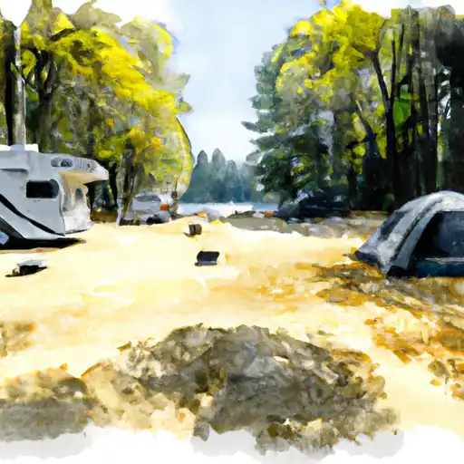
West Point Campground
Community Reviews
Been here? Share the conditions.
Reviews, ratings & photos are added in the free Snoflo iOS app — rate a spot, tag the conditions, and your visit is verified by location. Add or manage your reviews from the app.
West Point
Reservations are accepted at West Point camping area, allowing campers to secure a spot in advance. It is advisable to make reservations, especially during peak seasons, to ensure availability. The best time to visit this campground is during the summer months, from June to September, when the weather is pleasant and conducive to outdoor activities. It is essential to pack appropriate camping gear, including insect repellent and adequate clothing, as the area is known for its abundant wildlife and potential for mosquitoes.
In conclusion, West Point camping area in California offers a range of amenities such as picnic tables and fire rings, and reservations are accepted. The best time to visit is during the summer months, and campers should be prepared for wildlife and insects. With its serene surroundings and recreational opportunities, West Point camping area is an excellent choice for those seeking a memorable camping experience in California.
What's on-site at West Point
Key facilities Snoflo tracks for this campground. Confirm with the operator before booking -- amenities can change seasonally.
Plan your trip down to the hour
Same weather feed Snoflo's iOS app uses -- updated continuously from NOAA / yr.no.
Next 5 days, hour by hour
Temperature line with weather symbols on top, snow + rain accumulation as columns, humidity as a dotted line.
5-day forecast table
Every 3 hours, broken out across temperature, snow, rain, humidity, and wind. Each cell is colour-coded relative to the column min/max so trends jump out at a glance.
| Time | Condition | Temp (°F) | Snow (in) | Rain (in) | Humidity (%) | Wind (mps) | Wind dir |
|---|---|---|---|---|---|---|---|
| Loading detailed forecast… | |||||||
15-day temperature & precipitation
Daily temperatures, snow, and rain projected over the next two weeks. Hover any point for the full breakdown.
Other campgrounds in the area
Snoflo-tracked campsites within driving distance of West Point, with reservations status.
| Campground | Reservations | Toilets | View |
|---|---|---|---|
| Camino Cove Campground | ✓ | ✗ | → |
| Camino Cove | ✗ | ✓ | → |
| Sunset Campground | ✗ | ✗ | → |
| Wolf Creek Group Campground | ✗ | ✗ | → |
| Sunset | ✓ | ✓ | → |
Nearby streamflow
USGS streamgauges within reach of West Point -- pulled live from the National Water Information System.
| Streamgauge | Discharge | View |
|---|---|---|
| Pilot C Ab Stumpy Meadows Res Ca | 3 cfs | → |
| Pilot C Bl Mutton Canyon Nr Georgetown Ca | 2 cfs | → |
| General C Nr Meeks Bay Ca | 1 cfs | → |
| Blackwood C Nr Tahoe City Ca | 2 cfs | → |
| Upper Truckee R At Hwy 50 Above Meyers Ca | 9 cfs | → |
| Upper Truckee R At S Upper Truckee Rd Nr Meyers Ca | 4 cfs | → |
Nearby snow depths
NRCS SNOTEL stations within reach of West Point -- relevant when planning a shoulder-season or alpine trip.
| SNOTEL station | Snowpack | 24h Snowfall | View |
|---|---|---|---|
| Alpha | 0.0 in | 0.0 in | → |
| Nohrsc Forni Ridge | 1.1 in | 0.0 in | → |
| Nohrsc Rubicon #2 | 0.0 in | 0.0 in | → |
| Rubicon #2 | 0.0 in | 0.0 in | → |
| Nohrsc Echo Peak | 0.0 in | 0.0 in | → |
| Echo Peak | 0.0 in | 0.0 in | → |
Plan a longer trip
The closest parks, lakes, boat launches, and paddle runs so a camping night can grow into a full weekend.
Parks
- Granite Chief Wilderness
- Ed Z'Berg Sugar Pine Point State Park
- Dl Bliss State Park
- Wilderness Desolation
- Emerald Bay State Park
- Lumsden Park
Boat launches
- Union Valley Rervoir - West Point
- Junction Boat Ramp Road El Dorado County
- Union Valley Reservoir - Peninsula
- Ice House Reservoir
- Dry Lakes Trail El Dorado County
- Stumpy Meadows Reservoir
Fishing spots
Points of interest
- Big Hill
- Leoni House
- Nature Center And Observatory
- Vikingsholm Castle;Vikingsholm
- Fannette Island Tea House
- Balancing Rock
Paddle runs
- Ellicots Bridge To Big Grizzly Canyon
- Big Grizzly Canyon To Oxbow Reservoir
- Hell Hole Dam To Ellicotts Bridge
- Interbay To Oxbow (End Of The World)
- Confluence With Van Horn Creek To Cosumnes Mine Road
- Cosumnes Mine Road To Confluence With Steely Fork Cosumnes River
Camping essentials & Leave No Trace
- Pack it in, pack it out
- Take all trash, food scraps, and gear back with you to keep campsites clean and protect wildlife.
- Respect wildlife
- Observe animals from a distance, store food securely, and never feed wildlife to maintain natural behavior and safety.
- Know before you go
- Check weather, fire restrictions, trail conditions, and permit requirements to ensure a safe and well-planned trip.
- Minimize campfire impact
- Use established fire rings, keep fires small, fully extinguish them, or opt for a camp stove when fires are restricted.
- Leave what you find
- Preserve natural and cultural features by avoiding removal of plants, rocks, artifacts, or other elements of the environment.
Set push alerts in the Snoflo app
Save West Point as a favorite, set a custom threshold (precipitation, snowpack, freezing temperatures), and the iOS app will push the moment conditions cross.
About West Point
Can I make reservations at West Point?
This campground does not appear to accept reservations -- it's typically first-come, first-served. Arrive early on summer weekends.
How fresh is the weather data on this page?
The hourly forecast updates throughout the day from the NOAA / yr.no public feeds. Streamflow data is pulled live from USGS streamgauges and snowpack from the NRCS SNOTEL network.
What's the best time of year to visit?
Use the 15-day temperature & precipitation outlook on this page to plan -- pick a window with comfortable temperatures and low precipitation. For longer trips, the 5-day hourly meteogram shows snow + rain accumulation hour-by-hour.
How do I get to West Point?
Tap Directions in the hero above to open driving directions in Google Maps, or Open in map to center the Snoflo interactive map on the campground.
Can I get alerts when conditions change?
Yes -- alerts are managed through the Snoflo iOS app. Favorite this campground, set a threshold (temperature, snowpack, precipitation), and you'll get a push the moment it crosses.
Other campgrounds near here
Snoflo-tracked campgrounds within driving distance of West Point.