Catamount Bridge Campground Campground
Community Reviews
Been here? Share the conditions.
Reviews, ratings & photos are added in the free Snoflo iOS app — rate a spot, tag the conditions, and your visit is verified by location. Add or manage your reviews from the app.
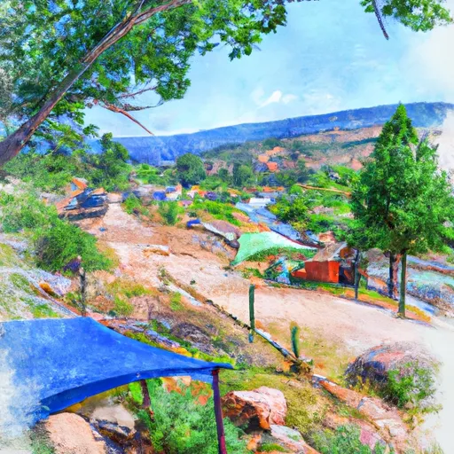
Catamount Bridge Campground
The campground amenities include 10 campsites equipped with fire rings and picnic tables, with access to drinking water and vault toilets. The area is also pet-friendly, with pets allowed on a leash.
Interesting facts about the area include its location within the Colorado River headwaters, which is the source of water for many western states. The nearby Williams Fork River is known for its excellent trout fishing, with rainbow and brown trout being the most common catch.
The best time to visit Catamount Bridge Campground is during the summer months, from June to August, when average temperatures range from 70-80 degrees Fahrenheit during the day, and 40-50 degrees Fahrenheit at night. It's important to note that the campground is at a high elevation, so visitors should be prepared for colder temperatures and potential snowfall during the shoulder seasons.
Sources:
- https://www.fs.usda.gov/recarea/arp/recarea/?recid=36973
- https://www.alltrails.com/parks/us/colorado/white-river-national-forest
- https://www.colorado.com/articles/colorado-river-headwaters-where-rivers-begin
- https://www.colorado.com/articles/trout-fishing-colorado
What's on-site at Catamount Bridge Campground
Key facilities Snoflo tracks for this campground. Confirm with the operator before booking -- amenities can change seasonally.
Plan your trip down to the hour
Same weather feed Snoflo's iOS app uses -- updated continuously from NOAA / yr.no.
Next 5 days, hour by hour
Temperature line with weather symbols on top, snow + rain accumulation as columns, humidity as a dotted line.
5-day forecast table
Every 3 hours, broken out across temperature, snow, rain, humidity, and wind. Each cell is colour-coded relative to the column min/max so trends jump out at a glance.
| Time | Condition | Temp (°F) | Snow (in) | Rain (in) | Humidity (%) | Wind (mps) | Wind dir |
|---|---|---|---|---|---|---|---|
| Loading detailed forecast… | |||||||
15-day temperature & precipitation
Daily temperatures, snow, and rain projected over the next two weeks. Hover any point for the full breakdown.
Other campgrounds in the area
Snoflo-tracked campsites within driving distance of Catamount Bridge Campground, with reservations status.
| Campground | Reservations | Toilets | View |
|---|---|---|---|
| Catamount | ✗ | ✓ | → |
| Colorado River Camp | ✗ | ✗ | → |
| Stifel Creek Camp | ✗ | ✗ | → |
| Pinball Point | ✗ | ✓ | → |
| Pinball Camping Area | ✗ | ✗ | → |
Nearby streamflow
USGS streamgauges within reach of Catamount Bridge Campground -- pulled live from the National Water Information System.
| Streamgauge | Discharge | View |
|---|---|---|
| Piney River Near State Bridge | 8 cfs | → |
| Eagle River Below Gypsum | 114 cfs | → |
| Lake Creek Near Edwards | 10 cfs | → |
| Colorado River Near Dotsero | 1,290 cfs | → |
| Colorado River Near Kremmling | 1,080 cfs | → |
| Eagle R Bl Wastewater Treatment Plant At Avon | 71 cfs | → |
Nearby snow depths
NRCS SNOTEL stations within reach of Catamount Bridge Campground -- relevant when planning a shoulder-season or alpine trip.
| SNOTEL station | Snowpack | 24h Snowfall | View |
|---|---|---|---|
| Yampa 5.1 S | 0.0 in | 0.0 in | → |
| Wolcott 2.3 N | 0.0 in | 0.0 in | → |
| Nohrsc Bear River | 0.0 in | 0.0 in | → |
| Bear River | 0.0 in | 0.0 in | → |
| Nohrsc Lynx Pass | 0.0 in | 0.0 in | → |
| Lynx Pass | 0.0 in | 0.0 in | → |
Plan a longer trip
The closest parks, lakes, boat launches, and paddle runs so a camping night can grow into a full weekend.
Parks
- Routt National Forest
- Wilderness Sarvis Creek
- Harry A. Nottingham
- Stagecoach State Park
- Ellefson Park
- Stephens Park
Boat launches
- Catamount Bridge Boat Ramp
- Two Bridges Boat Ramp
- Pinball Access Boat Ramp
- State Bridge Boat Ramp
- State Bridge River Access
- Wolcott Boat Ramp
Fishing spots
Camping essentials & Leave No Trace
- Pack it in, pack it out
- Take all trash, food scraps, and gear back with you to keep campsites clean and protect wildlife.
- Respect wildlife
- Observe animals from a distance, store food securely, and never feed wildlife to maintain natural behavior and safety.
- Know before you go
- Check weather, fire restrictions, trail conditions, and permit requirements to ensure a safe and well-planned trip.
- Minimize campfire impact
- Use established fire rings, keep fires small, fully extinguish them, or opt for a camp stove when fires are restricted.
- Leave what you find
- Preserve natural and cultural features by avoiding removal of plants, rocks, artifacts, or other elements of the environment.
Set push alerts in the Snoflo app
Save Catamount Bridge Campground as a favorite, set a custom threshold (precipitation, snowpack, freezing temperatures), and the iOS app will push the moment conditions cross.
About Catamount Bridge Campground
Can I make reservations at Catamount Bridge Campground?
This campground does not appear to accept reservations -- it's typically first-come, first-served. Arrive early on summer weekends.
How fresh is the weather data on this page?
The hourly forecast updates throughout the day from the NOAA / yr.no public feeds. Streamflow data is pulled live from USGS streamgauges and snowpack from the NRCS SNOTEL network.
What's the best time of year to visit?
Use the 15-day temperature & precipitation outlook on this page to plan -- pick a window with comfortable temperatures and low precipitation. For longer trips, the 5-day hourly meteogram shows snow + rain accumulation hour-by-hour.
How do I get to Catamount Bridge Campground?
Tap Directions in the hero above to open driving directions in Google Maps, or Open in map to center the Snoflo interactive map on the campground.
Can I get alerts when conditions change?
Yes -- alerts are managed through the Snoflo iOS app. Favorite this campground, set a threshold (temperature, snowpack, precipitation), and you'll get a push the moment it crosses.
Other campgrounds near here
Snoflo-tracked campgrounds within driving distance of Catamount Bridge Campground.