Lake Fork - Curecanti Area campground
Community Reviews
Been here? Share the conditions.
Reviews, ratings & photos are added in the free Snoflo iOS app — rate a spot, tag the conditions, and your visit is verified by location. Add or manage your reviews from the app.
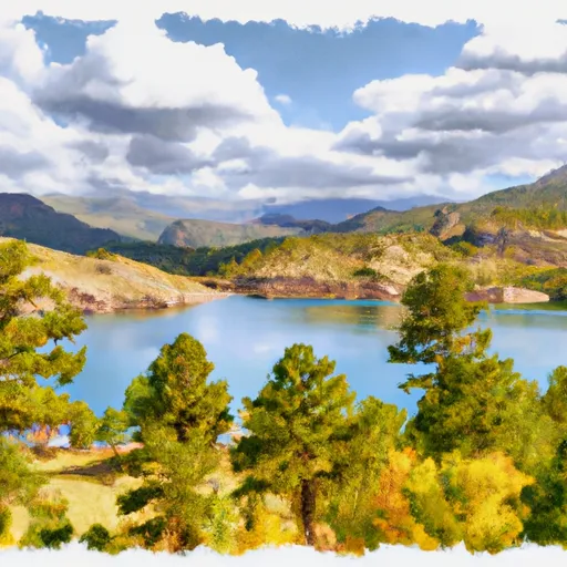
Lake Fork - Curecanti Area
Reservations are accepted at Lake Fork - Curecanti Area, allowing campers to secure their spot in advance. This is particularly beneficial during peak seasons when the campground tends to get crowded. To ensure availability, it is recommended to make a reservation ahead of time.
The best time to visit Lake Fork - Curecanti Area is during the summer months, from June to August, when the weather is warm and conducive to outdoor activities. Visitors can enjoy various recreational opportunities such as hiking, fishing, and boating in the nearby Lake Fork of the Gunnison River. Additionally, camping in the fall months offers stunning views of the changing foliage.
While exploring the camping area, it is essential to be cautious of wildlife encounters. Bears are known to inhabit the region; therefore, campers should properly store their food and dispose of waste in designated containers to prevent attracting wildlife. It is also recommended to bring bear-resistant containers to further ensure safety. As with any camping trip, it is crucial to respect the natural surroundings and leave no trace behind.
What's on-site at Lake Fork - Curecanti Area
Key facilities Snoflo tracks for this campground. Confirm with the operator before booking -- amenities can change seasonally.
Plan your trip down to the hour
Same weather feed Snoflo's iOS app uses -- updated continuously from NOAA / yr.no.
Next 5 days, hour by hour
Temperature line with weather symbols on top, snow + rain accumulation as columns, humidity as a dotted line.
5-day forecast table
Every 3 hours, broken out across temperature, snow, rain, humidity, and wind. Each cell is colour-coded relative to the column min/max so trends jump out at a glance.
| Time | Condition | Temp (°F) | Snow (in) | Rain (in) | Humidity (%) | Wind (mps) | Wind dir |
|---|---|---|---|---|---|---|---|
| Loading detailed forecast… | |||||||
15-day temperature & precipitation
Daily temperatures, snow, and rain projected over the next two weeks. Hover any point for the full breakdown.
Other campgrounds in the area
Snoflo-tracked campsites within driving distance of Lake Fork - Curecanti Area, with reservations status.
| Campground | Reservations | Toilets | View |
|---|---|---|---|
| Lake Fork Arm | ✗ | ✗ | → |
| Lake Fork Arm Boat-In Campsite | ✗ | ✗ | → |
| Narrows Boat-In Campsite | ✗ | ✗ | → |
| West Elk Boat-In Campsite | ✗ | ✗ | → |
| West Elk | ✗ | ✗ | → |
Nearby streamflow
USGS streamgauges within reach of Lake Fork - Curecanti Area -- pulled live from the National Water Information System.
| Streamgauge | Discharge | View |
|---|---|---|
| Lake Fork At Gateview | 59 cfs | → |
| Cimarron River Bl Squaw Creek | 13 cfs | → |
| Cimarron River Near Cimarron | 73 cfs | → |
| Gunnison River Below Gunnison Tunnel | 432 cfs | → |
| Gunnison River Near Gunnison | 290 cfs | → |
| Tomichi Creek At Gunnison | 11 cfs | → |
Nearby snow depths
NRCS SNOTEL stations within reach of Lake Fork - Curecanti Area -- relevant when planning a shoulder-season or alpine trip.
| SNOTEL station | Snowpack | 24h Snowfall | View |
|---|---|---|---|
| Gunnison 3wsw | 0.0 in | 0.0 in | → |
| Cimarron 8nw Ham | 0.0 in | 0.0 in | → |
| Gunnison Coop | 0.0 in | 0.0 in | → |
| Black Canyon Of The Gunnison | 0.0 in | 0.0 in | → |
| Montrose 7.3 Ene | 0.0 in | 0.0 in | → |
| Montrose 1.6 E | 0.0 in | 0.0 in | → |
Plan a longer trip
The closest parks, lakes, boat launches, and paddle runs so a camping night can grow into a full weekend.
Parks
- Wilderness West Elk
- Curecanti National Recreation Area
- Black Canyon Of The Gunnison National Park
- Wilderness Black Canyon Of The Gunnison
- Legion Jorgensen Park
- The Meadows City
Boat launches
- Us 50 Sapinero
- Dillon Pinnacles Trail Gunnison County
- Ponderosa Campground Gunnison County
- Us 50 Gunnison County
- Silver Thread Scenic Byway Gunnison County
Fishing spots
- Blue Mesa Reservoir
- Morrow Point Reservoir
- Crystal Reservoir
- Gould Reservoir
- Beaver Lake Day Use Area/ Fishing Site
- Tomichi Creek
Points of interest
- Morrow Point Boat Tour
- Dillon Pinnacles
- Middle Bridge
- Gateview Sign
- Elk Creek Visitor Center
- Gateview Rec. Site
Paddle runs
- Curecanti National Recreation Area Boundary To High Water Line Of Blue Mesa Reservoir
- Curecanti National Recreation Area Boundary To High Water Line Of Morrow Point Reservoir
- The Southern Boundary Of The Black Canyon Gunnison National Monument To The Painted Wall
Camping essentials & Leave No Trace
- Pack it in, pack it out
- Take all trash, food scraps, and gear back with you to keep campsites clean and protect wildlife.
- Respect wildlife
- Observe animals from a distance, store food securely, and never feed wildlife to maintain natural behavior and safety.
- Know before you go
- Check weather, fire restrictions, trail conditions, and permit requirements to ensure a safe and well-planned trip.
- Minimize campfire impact
- Use established fire rings, keep fires small, fully extinguish them, or opt for a camp stove when fires are restricted.
- Leave what you find
- Preserve natural and cultural features by avoiding removal of plants, rocks, artifacts, or other elements of the environment.
Set push alerts in the Snoflo app
Save Lake Fork - Curecanti Area as a favorite, set a custom threshold (precipitation, snowpack, freezing temperatures), and the iOS app will push the moment conditions cross.
About Lake Fork - Curecanti Area
Can I make reservations at Lake Fork - Curecanti Area?
Yes -- this campground accepts reservations. Snoflo recommends booking early for peak season; check the operator (Recreation.gov / state park system / private operator) for the booking window and cancellation policy.
How fresh is the weather data on this page?
The hourly forecast updates throughout the day from the NOAA / yr.no public feeds. Streamflow data is pulled live from USGS streamgauges and snowpack from the NRCS SNOTEL network.
What's the best time of year to visit?
Use the 15-day temperature & precipitation outlook on this page to plan -- pick a window with comfortable temperatures and low precipitation. For longer trips, the 5-day hourly meteogram shows snow + rain accumulation hour-by-hour.
How do I get to Lake Fork - Curecanti Area?
Tap Directions in the hero above to open driving directions in Google Maps, or Open in map to center the Snoflo interactive map on the campground.
Can I get alerts when conditions change?
Yes -- alerts are managed through the Snoflo iOS app. Favorite this campground, set a threshold (temperature, snowpack, precipitation), and you'll get a push the moment it crosses.
Other campgrounds near here
Snoflo-tracked campgrounds within driving distance of Lake Fork - Curecanti Area.