Mushroom Gulch Site 2 campground
Community Reviews
Been here? Share the conditions.
Reviews, ratings & photos are added in the free Snoflo iOS app — rate a spot, tag the conditions, and your visit is verified by location. Add or manage your reviews from the app.
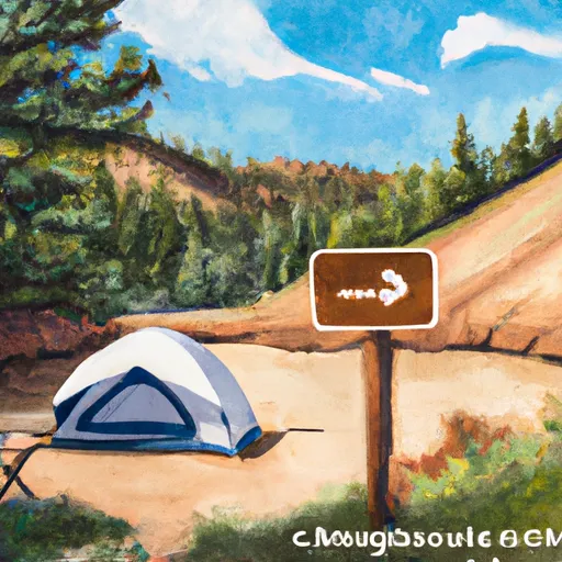
Mushroom Gulch Site 2
Reservations are not accepted at Mushroom Gulch Site 2, as it operates on a first-come, first-served basis. Therefore, it is recommended to arrive early, especially during peak seasons, to secure a camping spot. The best time of year to visit this camping area is during the summer months, from June to August, when the weather is mild and ideal for outdoor activities.
While in Mushroom Gulch Site 2, campers can explore the beautiful surroundings. The area is known for its scenic views, hiking trails, and opportunities for wildlife spotting. However, it is important to be cautious of potential hazards, such as rattlesnakes and uneven terrain, especially when hiking. Additionally, it is essential to follow all safety guidelines and regulations, including proper food storage to deter wildlife encounters.
In conclusion, Mushroom Gulch Site 2 offers a rustic camping experience with basic amenities. It is a popular destination for outdoor enthusiasts looking to enjoy the natural beauty of Colorado.
What's on-site at Mushroom Gulch Site 2
Key facilities Snoflo tracks for this campground. Confirm with the operator before booking -- amenities can change seasonally.
Plan your trip down to the hour
Same weather feed Snoflo's iOS app uses -- updated continuously from NOAA / yr.no.
Next 5 days, hour by hour
Temperature line with weather symbols on top, snow + rain accumulation as columns, humidity as a dotted line.
5-day forecast table
Every 3 hours, broken out across temperature, snow, rain, humidity, and wind. Each cell is colour-coded relative to the column min/max so trends jump out at a glance.
| Time | Condition | Temp (°F) | Snow (in) | Rain (in) | Humidity (%) | Wind (mps) | Wind dir |
|---|---|---|---|---|---|---|---|
| Loading detailed forecast… | |||||||
15-day temperature & precipitation
Daily temperatures, snow, and rain projected over the next two weeks. Hover any point for the full breakdown.
Other campgrounds in the area
Snoflo-tracked campsites within driving distance of Mushroom Gulch Site 2, with reservations status.
| Campground | Reservations | Toilets | View |
|---|---|---|---|
| Mushroom Gulch Site 3 | ✗ | ✗ | → |
| Mushroom Gulch Site 1 | ✗ | ✗ | → |
| Bv Overlook Camp & Lodging | ✗ | ✗ | → |
| Bassam Guardstation/Cabin | ✓ | ✗ | → |
| Ruby Mountain | ✗ | ✗ | → |
Nearby streamflow
USGS streamgauges within reach of Mushroom Gulch Site 2 -- pulled live from the National Water Information System.
| Streamgauge | Discharge | View |
|---|---|---|
| Arkansas River Near Nathrop | 191 cfs | → |
| Arkansas River Below Granite | 106 cfs | → |
| Clear Creek Above Clear Creek Reservoir | 24 cfs | → |
| Arkansas River At Granite | 62 cfs | → |
| Arkansas River At Salida | 196 cfs | → |
| S Platte R Ab 11-Mile Canyon Re | 96 cfs | → |
Nearby snow depths
NRCS SNOTEL stations within reach of Mushroom Gulch Site 2 -- relevant when planning a shoulder-season or alpine trip.
| SNOTEL station | Snowpack | 24h Snowfall | View |
|---|---|---|---|
| Buena Vista | 0.0 in | 0.0 in | → |
| South Platte River | 0.0 in | 0.0 in | → |
| Nathrop 1.9 Wsw | 0.0 in | 0.0 in | → |
| Nathrop 3.3 Wsw | 0.0 in | -0.5 in | → |
| Rough And Tumble | 0.0 in | 0.0 in | → |
| Nohrsc Rough And Tumble | 0.0 in | 0.0 in | → |
Plan a longer trip
The closest parks, lakes, boat launches, and paddle runs so a camping night can grow into a full weekend.
Parks
- Mcphelemy Park
- Wilderness Collegiate Peaks
- Spinney Mountain State Park
- Thonhoff Park
- Eleven Mile State Park
- Wilderness Leadville
Boat launches
- Buena Vista State Wildlife Area
- Ahra - Ruby Mountain Rec Sits
- Ahra - Fishermans Bridge Rec Site
- Cr 300 22504, Nathrop
- Ahra - Railroad Bridge Rec Site
- Ahra - Number 4 Rec Site
Fishing spots
- Antero Reservoir
- Chalk Lake Fishing Site
- Cottonwood Lake
- Cottonwood Lake (Buena Vista)
- Rich Creek
- Clear Creek Reservoir
Points of interest
Camping essentials & Leave No Trace
- Pack it in, pack it out
- Take all trash, food scraps, and gear back with you to keep campsites clean and protect wildlife.
- Respect wildlife
- Observe animals from a distance, store food securely, and never feed wildlife to maintain natural behavior and safety.
- Know before you go
- Check weather, fire restrictions, trail conditions, and permit requirements to ensure a safe and well-planned trip.
- Minimize campfire impact
- Use established fire rings, keep fires small, fully extinguish them, or opt for a camp stove when fires are restricted.
- Leave what you find
- Preserve natural and cultural features by avoiding removal of plants, rocks, artifacts, or other elements of the environment.
Set push alerts in the Snoflo app
Save Mushroom Gulch Site 2 as a favorite, set a custom threshold (precipitation, snowpack, freezing temperatures), and the iOS app will push the moment conditions cross.
About Mushroom Gulch Site 2
Can I make reservations at Mushroom Gulch Site 2?
This campground does not appear to accept reservations -- it's typically first-come, first-served. Arrive early on summer weekends.
How fresh is the weather data on this page?
The hourly forecast updates throughout the day from the NOAA / yr.no public feeds. Streamflow data is pulled live from USGS streamgauges and snowpack from the NRCS SNOTEL network.
What's the best time of year to visit?
Use the 15-day temperature & precipitation outlook on this page to plan -- pick a window with comfortable temperatures and low precipitation. For longer trips, the 5-day hourly meteogram shows snow + rain accumulation hour-by-hour.
How do I get to Mushroom Gulch Site 2?
Tap Directions in the hero above to open driving directions in Google Maps, or Open in map to center the Snoflo interactive map on the campground.
Can I get alerts when conditions change?
Yes -- alerts are managed through the Snoflo iOS app. Favorite this campground, set a threshold (temperature, snowpack, precipitation), and you'll get a push the moment it crosses.
Other campgrounds near here
Snoflo-tracked campgrounds within driving distance of Mushroom Gulch Site 2.