Upper Lagunitas campground
Community Reviews
Been here? Share the conditions.
Reviews, ratings & photos are added in the free Snoflo iOS app — rate a spot, tag the conditions, and your visit is verified by location. Add or manage your reviews from the app.
Upper Lagunitas
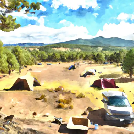
The campground offers amenities such as vault toilets, picnic tables, and fire rings, but does not have potable water or trash service. The campground also operates on a first-come, first-serve basis with a total of 10 campsites available. One interesting fact about the area is that it is home to the world's first designated wilderness area, the Gila Wilderness.
The best time to visit the Upper Lagunitas camping area is from May to October when temperatures range from 70-90 degrees Fahrenheit during the day and 40-60 degrees Fahrenheit at night. It is important to note that during the summer months, afternoon thunderstorms are common in the area, so visitors should be prepared for sudden weather changes. Overall, the Upper Lagunitas camping area is a great destination for those looking to immerse themselves in the natural beauty of New Mexico.
What's on-site at Upper Lagunitas
Key facilities Snoflo tracks for this campground. Confirm with the operator before booking -- amenities can change seasonally.
Plan your trip down to the hour
Same weather feed Snoflo's iOS app uses -- updated continuously from NOAA / yr.no.
Next 5 days, hour by hour
Temperature line with weather symbols on top, snow + rain accumulation as columns, humidity as a dotted line.
5-day forecast table
Every 3 hours, broken out across temperature, snow, rain, humidity, and wind. Each cell is colour-coded relative to the column min/max so trends jump out at a glance.
| Time | Condition | Temp (°F) | Snow (in) | Rain (in) | Humidity (%) | Wind (mps) | Wind dir |
|---|---|---|---|---|---|---|---|
| Loading detailed forecast… | |||||||
15-day temperature & precipitation
Daily temperatures, snow, and rain projected over the next two weeks. Hover any point for the full breakdown.
Other campgrounds in the area
Snoflo-tracked campsites within driving distance of Upper Lagunitas, with reservations status.
| Campground | Reservations | Toilets | View |
|---|---|---|---|
| Lagunitas | ✗ | ✗ | → |
| Upper Lagunitas / Lower Lagunitas Campgrounds | ✗ | ✗ | → |
| Lower Lagunitas | ✗ | ✓ | → |
| Cruces Basin Campground | ✗ | ✗ | → |
| Rio De Los Pinos Campground | ✗ | ✗ | → |
Nearby streamflow
USGS streamgauges within reach of Upper Lagunitas -- pulled live from the National Water Information System.
| Streamgauge | Discharge | View |
|---|---|---|
| Conejos River Near Mogote | 34 cfs | → |
| Rio Chama Near La Puente | 19 cfs | → |
| La Jara Creek At Gallegos Ranch | 2 cfs | → |
| Navajo R At Banded Peak Ranch | 24 cfs | → |
| Navajo River Bl Oso Diversion Dam Nr Chromo | 25 cfs | → |
| Rio Chama Below El Vado Dam | 105 cfs | → |
Nearby snow depths
NRCS SNOTEL stations within reach of Upper Lagunitas -- relevant when planning a shoulder-season or alpine trip.
| SNOTEL station | Snowpack | 24h Snowfall | View |
|---|---|---|---|
| San Antonio Sink Snotel | 0.0 in | 0.0 in | → |
| San Antonio Sink | 0.0 in | 0.0 in | → |
| Nohrsc Cumbres Trestle | 1.0 in | 0.0 in | → |
| Hopewell | 0.0 in | 0.0 in | → |
| Cumbres Trestle | 1.0 in | 0.0 in | → |
| Hopewell | 0.0 in | 0.0 in | → |
Plan a longer trip
The closest parks, lakes, boat launches, and paddle runs so a camping night can grow into a full weekend.
Parks
- Wilderness Cruces Basin
- Rio Grande National Forest
- Wilderness South San Juan
- Heron Lake State Park
- El Vado Lake State Park
- National Wild And Scenic River Rio Chama
Fishing spots
- Lagunitas Creek Fishing
- Trujillo Meadows Lake
- Trujillo Meadows Boating Site
- La Manga Creek (Beaver Ponds)
- Hidden Lakes Fishing
- Rio Nutritas Fishing
Camping essentials & Leave No Trace
- Pack it in, pack it out
- Take all trash, food scraps, and gear back with you to keep campsites clean and protect wildlife.
- Respect wildlife
- Observe animals from a distance, store food securely, and never feed wildlife to maintain natural behavior and safety.
- Know before you go
- Check weather, fire restrictions, trail conditions, and permit requirements to ensure a safe and well-planned trip.
- Minimize campfire impact
- Use established fire rings, keep fires small, fully extinguish them, or opt for a camp stove when fires are restricted.
- Leave what you find
- Preserve natural and cultural features by avoiding removal of plants, rocks, artifacts, or other elements of the environment.
Set push alerts in the Snoflo app
Save Upper Lagunitas as a favorite, set a custom threshold (precipitation, snowpack, freezing temperatures), and the iOS app will push the moment conditions cross.
About Upper Lagunitas
Can I make reservations at Upper Lagunitas?
This campground does not appear to accept reservations -- it's typically first-come, first-served. Arrive early on summer weekends.
How fresh is the weather data on this page?
The hourly forecast updates throughout the day from the NOAA / yr.no public feeds. Streamflow data is pulled live from USGS streamgauges and snowpack from the NRCS SNOTEL network.
What's the best time of year to visit?
Use the 15-day temperature & precipitation outlook on this page to plan -- pick a window with comfortable temperatures and low precipitation. For longer trips, the 5-day hourly meteogram shows snow + rain accumulation hour-by-hour.
How do I get to Upper Lagunitas?
Tap Directions in the hero above to open driving directions in Google Maps, or Open in map to center the Snoflo interactive map on the campground.
Can I get alerts when conditions change?
Yes -- alerts are managed through the Snoflo iOS app. Favorite this campground, set a threshold (temperature, snowpack, precipitation), and you'll get a push the moment it crosses.
Other campgrounds near here
Snoflo-tracked campgrounds within driving distance of Upper Lagunitas.