Upper Park Creek Campground
Community Reviews
Been here? Share the conditions.
Reviews, ratings & photos are added in the free Snoflo iOS app — rate a spot, tag the conditions, and your visit is verified by location. Add or manage your reviews from the app.
Upper Park Creek
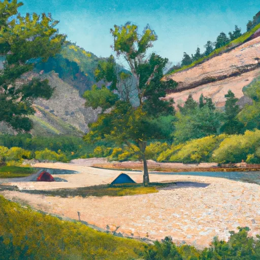
There are 14 campsites available on a first-come-first-serve basis, each equipped with a picnic table, fire ring, and access to potable water and vault toilets. The campground also features a day-use picnic area, a creek for fishing, and nearby hiking trails.
One of the main draws of Upper Park Creek is its proximity to the Continental Divide Trail, a 3,100-mile hiking trail that runs from Mexico to Canada. The trail passes through the nearby Elkhorn Mountains and offers stunning views of the surrounding landscape. Other nearby points of interest include the ghost town of Rimini, the Missouri River, and the state capital of Helena.
An interesting fact about the area is that it was once the site of a thriving mining community, with several ghost towns still visible in the surrounding mountains. Visitors can explore these abandoned towns and learn about the area’s rich mining history.
The best time of year to visit Upper Park Creek is from mid-June to early September when temperatures range from the mid-60s to mid-70s during the day and drop into the 40s at night. Visitors can expect beautiful wildflowers in the early summer and stunning fall foliage in September. Overall, Upper Park Creek Campground is an ideal destination for outdoor enthusiasts looking to escape the crowds and enjoy Montana’s natural beauty.
What's on-site at Upper Park Creek
Key facilities Snoflo tracks for this campground. Confirm with the operator before booking -- amenities can change seasonally.
Plan your trip down to the hour
Same weather feed Snoflo's iOS app uses -- updated continuously from NOAA / yr.no.
Next 5 days, hour by hour
Temperature line with weather symbols on top, snow + rain accumulation as columns, humidity as a dotted line.
5-day forecast table
Every 3 hours, broken out across temperature, snow, rain, humidity, and wind. Each cell is colour-coded relative to the column min/max so trends jump out at a glance.
| Time | Condition | Temp (°F) | Snow (in) | Rain (in) | Humidity (%) | Wind (mps) | Wind dir |
|---|---|---|---|---|---|---|---|
| Loading detailed forecast… | |||||||
15-day temperature & precipitation
Daily temperatures, snow, and rain projected over the next two weeks. Hover any point for the full breakdown.
Other campgrounds in the area
Snoflo-tracked campsites within driving distance of Upper Park Creek, with reservations status.
| Campground | Reservations | Toilets | View |
|---|---|---|---|
| Lake Isabel | ✗ | ✗ | → |
| Cobalt Lake | ✗ | ✗ | → |
| Upper Two Medicine Lake | ✗ | ✗ | → |
| Ole Lake | ✗ | ✗ | → |
| No Name Lake | ✗ | ✗ | → |
Nearby streamflow
USGS streamgauges within reach of Upper Park Creek -- pulled live from the National Water Information System.
| Streamgauge | Discharge | View |
|---|---|---|
| Two Medicine River Bl South Fork Nr Browning Mt | 196 cfs | → |
| Cut Bank Creek Near Browning Mt | 60 cfs | → |
| Middle Fork Flathead River Nr West Glacier Mt | 2,570 cfs | → |
| S F Flathead River Nr Columbia Falls Mt | 3,530 cfs | → |
| Swiftcurrent Creek At Many Glacier Mt | 167 cfs | → |
| Swiftcurrent Cr Ab Swiftcurrent Lk At Many Glacier | 113 cfs | → |
Nearby snow depths
NRCS SNOTEL stations within reach of Upper Park Creek -- relevant when planning a shoulder-season or alpine trip.
| SNOTEL station | Snowpack | 24h Snowfall | View |
|---|---|---|---|
| Pike Creek | 0.0 in | 0.0 in | → |
| Nohrsc Pike Creek | 0.0 in | 0.0 in | → |
| Bnsf Shed 4 | 21.8 in | 0.0 in | → |
| Usgs/Bnsf Shed 7 | 0.0 in | 0.0 in | → |
| Bnsf Shed 11 | 0.0 in | 0.0 in | → |
| Tunnel Ridge Snow | 2.1 in | 0.0 in | → |
Plan a longer trip
The closest parks, lakes, boat launches, and paddle runs so a camping night can grow into a full weekend.
Boat launches
- Two Medicine Lake
- Flathead County
- National Forest Development Road 38 Flathead County
- Rising Sun
- National Forest Development Road 5301 Flathead County
Fishing spots
Camping essentials & Leave No Trace
- Pack it in, pack it out
- Take all trash, food scraps, and gear back with you to keep campsites clean and protect wildlife.
- Respect wildlife
- Observe animals from a distance, store food securely, and never feed wildlife to maintain natural behavior and safety.
- Know before you go
- Check weather, fire restrictions, trail conditions, and permit requirements to ensure a safe and well-planned trip.
- Minimize campfire impact
- Use established fire rings, keep fires small, fully extinguish them, or opt for a camp stove when fires are restricted.
- Leave what you find
- Preserve natural and cultural features by avoiding removal of plants, rocks, artifacts, or other elements of the environment.
Set push alerts in the Snoflo app
Save Upper Park Creek as a favorite, set a custom threshold (precipitation, snowpack, freezing temperatures), and the iOS app will push the moment conditions cross.
About Upper Park Creek
Can I make reservations at Upper Park Creek?
This campground does not appear to accept reservations -- it's typically first-come, first-served. Arrive early on summer weekends.
How fresh is the weather data on this page?
The hourly forecast updates throughout the day from the NOAA / yr.no public feeds. Streamflow data is pulled live from USGS streamgauges and snowpack from the NRCS SNOTEL network.
What's the best time of year to visit?
Use the 15-day temperature & precipitation outlook on this page to plan -- pick a window with comfortable temperatures and low precipitation. For longer trips, the 5-day hourly meteogram shows snow + rain accumulation hour-by-hour.
How do I get to Upper Park Creek?
Tap Directions in the hero above to open driving directions in Google Maps, or Open in map to center the Snoflo interactive map on the campground.
Can I get alerts when conditions change?
Yes -- alerts are managed through the Snoflo iOS app. Favorite this campground, set a threshold (temperature, snowpack, precipitation), and you'll get a push the moment it crosses.
Other campgrounds near here
Snoflo-tracked campgrounds within driving distance of Upper Park Creek.