Swing Bridges South Parking Area Campground
Community Reviews
Been here? Share the conditions.
Reviews, ratings & photos are added in the free Snoflo iOS app — rate a spot, tag the conditions, and your visit is verified by location. Add or manage your reviews from the app.
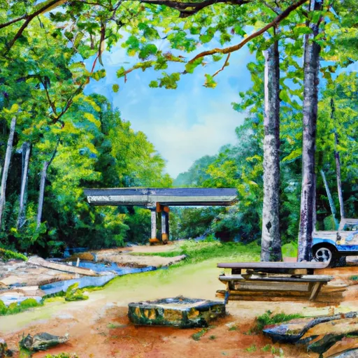
Swing Bridges South Parking Area
The campground offers amenities such as potable water, picnic tables, fire rings, and vault toilets. However, there are no RV hookups or showers available. It is recommended to bring your own water due to the campsite's limited supply.
Nearby points of interest include the Linville Gorge Wilderness Area, which offers hiking and rock climbing opportunities, and the Linville Falls Visitor Center, where visitors can learn about the local flora and fauna.
The Swing Bridges South Parking Area camping area is also located near several scenic drives, including the Blue Ridge Parkway and the Forest Heritage National Scenic Byway.
The best time to visit this campground is during the summer months when temperatures range from 70°F to 80°F. However, the area can get crowded during peak season, so it is recommended to make reservations in advance.
Interesting facts about the area include its history as a logging hub in the early 20th century and its designation as a national forest in 1916.
Overall, the Swing Bridges South Parking Area camping area is a great option for those looking to experience the natural beauty of the Blue Ridge Mountains and Pisgah National Forest.
What's on-site at Swing Bridges South Parking Area
Key facilities Snoflo tracks for this campground. Confirm with the operator before booking -- amenities can change seasonally.
Plan your trip down to the hour
Same weather feed Snoflo's iOS app uses -- updated continuously from NOAA / yr.no.
Next 5 days, hour by hour
Temperature line with weather symbols on top, snow + rain accumulation as columns, humidity as a dotted line.
5-day forecast table
Every 3 hours, broken out across temperature, snow, rain, humidity, and wind. Each cell is colour-coded relative to the column min/max so trends jump out at a glance.
| Time | Condition | Temp (°F) | Snow (in) | Rain (in) | Humidity (%) | Wind (mps) | Wind dir |
|---|---|---|---|---|---|---|---|
| Loading detailed forecast… | |||||||
15-day temperature & precipitation
Daily temperatures, snow, and rain projected over the next two weeks. Hover any point for the full breakdown.
Other campgrounds in the area
Snoflo-tracked campsites within driving distance of Swing Bridges South Parking Area, with reservations status.
| Campground | Reservations | Toilets | View |
|---|---|---|---|
| Pullout Parking At Mile Post 17.46 | ✗ | ✗ | → |
| Backcountry Parking #2 | ✗ | ✗ | → |
| #53 Poke Patch | ✗ | ✗ | → |
| 53 | ✗ | ✗ | → |
| #54 Nettle Creek | ✗ | ✗ | → |
Nearby streamflow
USGS streamgauges within reach of Swing Bridges South Parking Area -- pulled live from the National Water Information System.
| Streamgauge | Discharge | View |
|---|---|---|
| Oconaluftee River At Birdtown | 398 cfs | → |
| Tuckasegee River At Bryson City | 847 cfs | → |
| Tuckasegee River At Barker's Creek | 315 cfs | → |
| Little River Above Townsend | 239 cfs | → |
| Little Tennessee River At Needmore | 463 cfs | → |
| Cataloochee Creek Near Cataloochee | 79 cfs | → |
Nearby snow depths
NRCS SNOTEL stations within reach of Swing Bridges South Parking Area -- relevant when planning a shoulder-season or alpine trip.
| SNOTEL station | Snowpack | 24h Snowfall | View |
|---|---|---|---|
| New Found Gap | 16.7 in | 0.0 in | → |
| Gatlinburg | 0.0 in | 0.0 in | → |
| Bryson City 4 | 0.0 in | 0.0 in | → |
| Dillard 0.7 Nnw | 0.0 in | 0.0 in | → |
| Brevard | 0.0 in | 0.0 in | → |
| Germany Valley | 0.0 in | 0.0 in | → |
Plan a longer trip
The closest parks, lakes, boat launches, and paddle runs so a camping night can grow into a full weekend.
Parks
- Swain County Park
- Sevierville City Park
- Great Smoky Mountains National Park
- Needmore Game Land
- Kimberlin Heights Park
- Bower Field
Boat launches
- Church Street Jackson County
- Old 288
- Flat Branch
- Great Smoky Mountains Expressway 5453, Jackson County
- Tsali
- Lemmons Branch
Fishing spots
- Birchfield Branch
- Augerhole Branch
- Massey Branch Fishing Pier
- Santeetlah Lake
- Bear Creek Lake
- Allen Branch Pond
Points of interest
- Swinging Bridges Overlook
- Thomas Ridge Overlook
- Short Beech Ridge Overlook
- Webb Overlook
- Deep Creek Valley Overlook
- History Exhibit Overlook
Paddle runs
- Natahala Powerhouse To Lake Fontana (River Mile 4)
- Polecat Branch To Snowbird Picnic Area
- Headwaters In Standing Indian Basin To Slackwater Of Natahala Lake
- Owlcamp Branch To Polecat Branch
- Yellowstone Prong From Headwaters To Confluence With East Fork And Yellowstone Prong
- East Fork From Us Highway 276 To Confluence Of Dark Prong And Yellowstone Prong
Camping essentials & Leave No Trace
- Pack it in, pack it out
- Take all trash, food scraps, and gear back with you to keep campsites clean and protect wildlife.
- Respect wildlife
- Observe animals from a distance, store food securely, and never feed wildlife to maintain natural behavior and safety.
- Know before you go
- Check weather, fire restrictions, trail conditions, and permit requirements to ensure a safe and well-planned trip.
- Minimize campfire impact
- Use established fire rings, keep fires small, fully extinguish them, or opt for a camp stove when fires are restricted.
- Leave what you find
- Preserve natural and cultural features by avoiding removal of plants, rocks, artifacts, or other elements of the environment.
Set push alerts in the Snoflo app
Save Swing Bridges South Parking Area as a favorite, set a custom threshold (precipitation, snowpack, freezing temperatures), and the iOS app will push the moment conditions cross.
About Swing Bridges South Parking Area
Can I make reservations at Swing Bridges South Parking Area?
This campground does not appear to accept reservations -- it's typically first-come, first-served. Arrive early on summer weekends.
How fresh is the weather data on this page?
The hourly forecast updates throughout the day from the NOAA / yr.no public feeds. Streamflow data is pulled live from USGS streamgauges and snowpack from the NRCS SNOTEL network.
What's the best time of year to visit?
Use the 15-day temperature & precipitation outlook on this page to plan -- pick a window with comfortable temperatures and low precipitation. For longer trips, the 5-day hourly meteogram shows snow + rain accumulation hour-by-hour.
How do I get to Swing Bridges South Parking Area?
Tap Directions in the hero above to open driving directions in Google Maps, or Open in map to center the Snoflo interactive map on the campground.
Can I get alerts when conditions change?
Yes -- alerts are managed through the Snoflo iOS app. Favorite this campground, set a threshold (temperature, snowpack, precipitation), and you'll get a push the moment it crosses.
Other campgrounds near here
Snoflo-tracked campgrounds within driving distance of Swing Bridges South Parking Area.