East Shore 2 Campground
Community Reviews
Been here? Share the conditions.
Reviews, ratings & photos are added in the free Snoflo iOS app — rate a spot, tag the conditions, and your visit is verified by location. Add or manage your reviews from the app.
East Shore 2
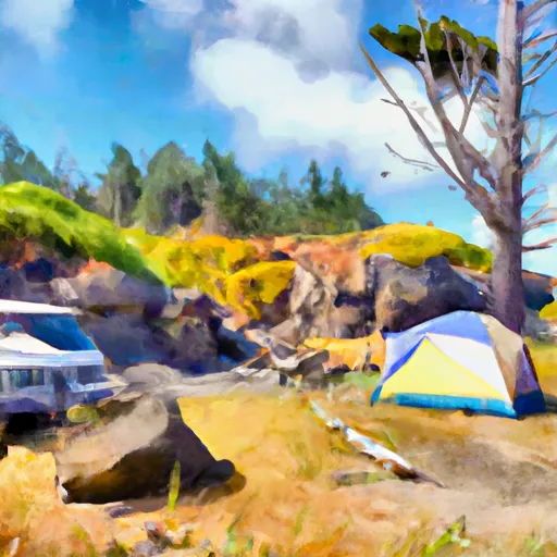
The East Shore 2 Campsite is a popular destination for fishing enthusiasts who come to the area to catch steelhead and salmon. Visitors can also enjoy hiking and exploring trails in the nearby Umpqua National Forest. Another nearby attraction is the Umpqua Hot Springs, which is just a short drive away from the campground. The hot springs offer visitors the opportunity to relax in naturally heated pools while enjoying breathtaking views of the surrounding forest.
The campground itself offers a range of amenities, including picnic tables, fire pits, and vault toilets for campers. The area is also pet-friendly, allowing visitors to bring their furry friends along on their camping trip.
Interesting facts about the area include the fact that the Umpqua River is one of the largest rivers in Oregon, stretching for over 100 miles. The river is also home to a diverse range of wildlife, including salmon, steelhead, and various bird species.
The best time of year to visit the East Shore 2 Campsite is during the summer months, from June to September. Average temperatures during this time range from 60°F to 80°F, making it a pleasant time to enjoy outdoor activities in the area. However, visitors are advised to come prepared for cooler temperatures during the night and to bring plenty of warm clothing.
Sources:
- https://www.fs.usda.gov/recarea/umpqua/recarea/?recid=63476
- https://www.outdoorproject.com/united-states/oregon/umpqua-hot-springs
- https://traveloregon.com/things-to-do/places-to-go/regions/roseburg-umpqua-river-valley/
What's on-site at East Shore 2
Key facilities Snoflo tracks for this campground. Confirm with the operator before booking -- amenities can change seasonally.
Plan your trip down to the hour
Same weather feed Snoflo's iOS app uses -- updated continuously from NOAA / yr.no.
Next 5 days, hour by hour
Temperature line with weather symbols on top, snow + rain accumulation as columns, humidity as a dotted line.
5-day forecast table
Every 3 hours, broken out across temperature, snow, rain, humidity, and wind. Each cell is colour-coded relative to the column min/max so trends jump out at a glance.
| Time | Condition | Temp (°F) | Snow (in) | Rain (in) | Humidity (%) | Wind (mps) | Wind dir |
|---|---|---|---|---|---|---|---|
| Loading detailed forecast… | |||||||
15-day temperature & precipitation
Daily temperatures, snow, and rain projected over the next two weeks. Hover any point for the full breakdown.
Other campgrounds in the area
Snoflo-tracked campsites within driving distance of East Shore 2, with reservations status.
| Campground | Reservations | Toilets | View |
|---|---|---|---|
| East Shore Campground | ✗ | ✗ | → |
| East Shore 1 | ✗ | ✗ | → |
| East Shore 3 | ✗ | ✗ | → |
| East Shore 5 | ✗ | ✗ | → |
| East Shore 4 | ✗ | ✗ | → |
Nearby streamflow
USGS streamgauges within reach of East Shore 2 -- pulled live from the National Water Information System.
| Streamgauge | Discharge | View |
|---|---|---|
| Umpqua River Near Elkton | 807 cfs | → |
| Little Wolf Creek Near Tyee | 0 cfs | → |
| North Umpqua River At Winchester | 744 cfs | → |
| Siuslaw River Near Mapleton | 120 cfs | → |
| Long Tom River Near Noti | 15 cfs | → |
| South Umpqua River Near Brockway | 60 cfs | → |
Nearby snow depths
NRCS SNOTEL stations within reach of East Shore 2 -- relevant when planning a shoulder-season or alpine trip.
| SNOTEL station | Snowpack | 24h Snowfall | View |
|---|---|---|---|
| Cottage Grove 2e | 0.0 in | 0.0 in | → |
| Eugene-Mahlon Sweet Field | 0.0 in | 0.0 in | → |
Plan a longer trip
The closest parks, lakes, boat launches, and paddle runs so a camping night can grow into a full weekend.
Parks
- Scottsburg Park
- Siuslaw National Forest
- Umpqua State Scenic Corridor
- Golden And Silver Falls State Natural Area
- Umpqua Myrtle State Natural Site
- Umpqua Myrtle State Park
Boat launches
- Loon Lake
- Loon Lake Day-Use Area
- Loon Lake Lodge Resorts
- Scottsburg Park
- Umpqua Wayside State Park
- Scott Creek
Points of interest
- Gardiner Historic District
- Trailhaed John Dellenback
- Umpqua River Light
- Oregon Coast Highway
- Sand Dunes Frontier
Paddle runs
- Eastern Siuslaw Nf Boundary To East Section Line Of Ne1/4se1/4 Of Sec 16, T21s, R10w
- East Section Line Of Ne1/4se1/4 Of Sec 16, T21s, R10w To Confluence With Smith River
- South Fork Coos River
- Confluence With Jump Creek To East Section Line Of Sec 36, T19s, R10w
- East Section Line Of Sec 36, T19s, R10w To South Section Line Of Sec 32, T19s, R10w
- Eastern Siuslaw Nf Boundary To Confluence With Jump Creek
Camping essentials & Leave No Trace
- Pack it in, pack it out
- Take all trash, food scraps, and gear back with you to keep campsites clean and protect wildlife.
- Respect wildlife
- Observe animals from a distance, store food securely, and never feed wildlife to maintain natural behavior and safety.
- Know before you go
- Check weather, fire restrictions, trail conditions, and permit requirements to ensure a safe and well-planned trip.
- Minimize campfire impact
- Use established fire rings, keep fires small, fully extinguish them, or opt for a camp stove when fires are restricted.
- Leave what you find
- Preserve natural and cultural features by avoiding removal of plants, rocks, artifacts, or other elements of the environment.
Set push alerts in the Snoflo app
Save East Shore 2 as a favorite, set a custom threshold (precipitation, snowpack, freezing temperatures), and the iOS app will push the moment conditions cross.
About East Shore 2
Can I make reservations at East Shore 2?
This campground does not appear to accept reservations -- it's typically first-come, first-served. Arrive early on summer weekends.
How fresh is the weather data on this page?
The hourly forecast updates throughout the day from the NOAA / yr.no public feeds. Streamflow data is pulled live from USGS streamgauges and snowpack from the NRCS SNOTEL network.
What's the best time of year to visit?
Use the 15-day temperature & precipitation outlook on this page to plan -- pick a window with comfortable temperatures and low precipitation. For longer trips, the 5-day hourly meteogram shows snow + rain accumulation hour-by-hour.
How do I get to East Shore 2?
Tap Directions in the hero above to open driving directions in Google Maps, or Open in map to center the Snoflo interactive map on the campground.
Can I get alerts when conditions change?
Yes -- alerts are managed through the Snoflo iOS app. Favorite this campground, set a threshold (temperature, snowpack, precipitation), and you'll get a push the moment it crosses.
Other campgrounds near here
Snoflo-tracked campgrounds within driving distance of East Shore 2.