Humbug Mountain State Park Campground
Community Reviews
Been here? Share the conditions.
Reviews, ratings & photos are added in the free Snoflo iOS app — rate a spot, tag the conditions, and your visit is verified by location. Add or manage your reviews from the app.
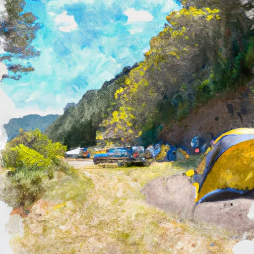
Humbug Mountain State Park
Reservations are accepted at Humbug Mountain State Park, allowing campers to secure their spot in advance. This is particularly recommended during peak season or weekends when the campground tends to fill up quickly. The best time to visit the park is during the summer months, from June to September, when the weather is generally warm and dry. However, it's worth noting that the campground can get quite busy during this time, so early reservation is advised.
Humbug Mountain State Park offers several attractions that campers can explore. The park features a stunning 6-mile long hiking trail that leads to the summit of Humbug Mountain, providing breathtaking views of the surrounding area. Nature enthusiasts will also appreciate the diverse flora and fauna found within the park. However, campers should be aware that the campground is located close to the Pacific Ocean, resulting in cool temperatures and foggy conditions, especially during the morning and evening hours. It's advised to bring appropriate clothing and be cautious of slippery trails in damp conditions.
What's on-site at Humbug Mountain State Park
Key facilities Snoflo tracks for this campground. Confirm with the operator before booking -- amenities can change seasonally.
Plan your trip down to the hour
Same weather feed Snoflo's iOS app uses -- updated continuously from NOAA / yr.no.
Next 5 days, hour by hour
Temperature line with weather symbols on top, snow + rain accumulation as columns, humidity as a dotted line.
5-day forecast table
Every 3 hours, broken out across temperature, snow, rain, humidity, and wind. Each cell is colour-coded relative to the column min/max so trends jump out at a glance.
| Time | Condition | Temp (°F) | Snow (in) | Rain (in) | Humidity (%) | Wind (mps) | Wind dir |
|---|---|---|---|---|---|---|---|
| Loading detailed forecast… | |||||||
15-day temperature & precipitation
Daily temperatures, snow, and rain projected over the next two weeks. Hover any point for the full breakdown.
Other campgrounds in the area
Snoflo-tracked campsites within driving distance of Humbug Mountain State Park, with reservations status.
| Campground | Reservations | Toilets | View |
|---|---|---|---|
| Hiker / Biker Campground | ✗ | ✗ | → |
| Biker/Hiker Campgrounds | ✗ | ✗ | → |
| Humbug Mtn | ✗ | ✗ | → |
| Evergreen Shores Rv | ✗ | ✗ | → |
| Sunshine Flat Campground | ✗ | ✗ | → |
Nearby streamflow
USGS streamgauges within reach of Humbug Mountain State Park -- pulled live from the National Water Information System.
| Streamgauge | Discharge | View |
|---|---|---|
| Rogue River At Hwy 101 Bridge | 3,580 cfs | → |
| Rogue River Near Agness | 1,460 cfs | → |
| South Fork Coquille River At Powers | 43 cfs | → |
| Chetco River Near Brookings | 80 cfs | → |
| West Fork Cow Creek Near Glendale | 5 cfs | → |
| Illinois River Near Kerby | 32 cfs | → |
Plan a longer trip
The closest parks, lakes, boat launches, and paddle runs so a camping night can grow into a full weekend.
Parks
- Humbug Mountain State Park
- Battle Rock Wayside
- Port Orford Heads State Park
- Buffington Memorial Park
- Tseriadun State Recreation Area
- Wilderness Grassy Knob
Boat launches
- California Street 1325, Port Orford
- Pinehurst
- Iron Head
- Edson Boat Ramp
- Edson Creek Recreation Site
- Sixes River Store
Points of interest
- Prehistoric Gardens
- Hughes House
- Jerry's Rogue Jets
- 5 Star Charters
- New River
- West Coast Game Park Safari
Paddle runs
- Sixes River
- Headwaters To Confluence With Johnson Creek
- Confluence With Sucker Creek To Confluence With South Fork Coquille River
- Coquille River Falls (Eastern Boundary) To Coquille River Falls (Western Boundary)
- South Fork Coquille River
- Coquille River Rna Boundary (Western) To Siskiyou Nf Boundary (North Section Line Sec 6, T32s, R11w
Camping essentials & Leave No Trace
- Pack it in, pack it out
- Take all trash, food scraps, and gear back with you to keep campsites clean and protect wildlife.
- Respect wildlife
- Observe animals from a distance, store food securely, and never feed wildlife to maintain natural behavior and safety.
- Know before you go
- Check weather, fire restrictions, trail conditions, and permit requirements to ensure a safe and well-planned trip.
- Minimize campfire impact
- Use established fire rings, keep fires small, fully extinguish them, or opt for a camp stove when fires are restricted.
- Leave what you find
- Preserve natural and cultural features by avoiding removal of plants, rocks, artifacts, or other elements of the environment.
Set push alerts in the Snoflo app
Save Humbug Mountain State Park as a favorite, set a custom threshold (precipitation, snowpack, freezing temperatures), and the iOS app will push the moment conditions cross.
About Humbug Mountain State Park
Can I make reservations at Humbug Mountain State Park?
Yes -- this campground accepts reservations. Snoflo recommends booking early for peak season; check the operator (Recreation.gov / state park system / private operator) for the booking window and cancellation policy.
How fresh is the weather data on this page?
The hourly forecast updates throughout the day from the NOAA / yr.no public feeds. Streamflow data is pulled live from USGS streamgauges and snowpack from the NRCS SNOTEL network.
What's the best time of year to visit?
Use the 15-day temperature & precipitation outlook on this page to plan -- pick a window with comfortable temperatures and low precipitation. For longer trips, the 5-day hourly meteogram shows snow + rain accumulation hour-by-hour.
How do I get to Humbug Mountain State Park?
Tap Directions in the hero above to open driving directions in Google Maps, or Open in map to center the Snoflo interactive map on the campground.
Can I get alerts when conditions change?
Yes -- alerts are managed through the Snoflo iOS app. Favorite this campground, set a threshold (temperature, snowpack, precipitation), and you'll get a push the moment it crosses.
Other campgrounds near here
Snoflo-tracked campgrounds within driving distance of Humbug Mountain State Park.