Tucker Flat Campground
Community Reviews
Been here? Share the conditions.
Reviews, ratings & photos are added in the free Snoflo iOS app — rate a spot, tag the conditions, and your visit is verified by location. Add or manage your reviews from the app.
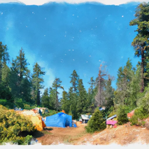
Tucker Flat
What's on-site at Tucker Flat
Key facilities Snoflo tracks for this campground. Confirm with the operator before booking -- amenities can change seasonally.
Plan your trip down to the hour
Same weather feed Snoflo's iOS app uses -- updated continuously from NOAA / yr.no.
Next 5 days, hour by hour
Temperature line with weather symbols on top, snow + rain accumulation as columns, humidity as a dotted line.
5-day forecast table
Every 3 hours, broken out across temperature, snow, rain, humidity, and wind. Each cell is colour-coded relative to the column min/max so trends jump out at a glance.
| Time | Condition | Temp (°F) | Snow (in) | Rain (in) | Humidity (%) | Wind (mps) | Wind dir |
|---|---|---|---|---|---|---|---|
| Loading detailed forecast… | |||||||
15-day temperature & precipitation
Daily temperatures, snow, and rain projected over the next two weeks. Hover any point for the full breakdown.
Other campgrounds in the area
Snoflo-tracked campsites within driving distance of Tucker Flat, with reservations status.
| Campground | Reservations | Toilets | View |
|---|---|---|---|
| Tucker Flat Campground | ✗ | ✗ | → |
| Rogue River Ranch | ✗ | ✗ | → |
| West Mule Creek (R19.96r) | ✗ | ✗ | → |
| West Rrr (R19.91r) | ✗ | ✗ | → |
| East Mule Creek (R19.95r) | ✗ | ✗ | → |
Nearby streamflow
USGS streamgauges within reach of Tucker Flat -- pulled live from the National Water Information System.
| Streamgauge | Discharge | View |
|---|---|---|
| Rogue River Near Agness | 1,410 cfs | → |
| West Fork Cow Creek Near Glendale | 5 cfs | → |
| South Fork Coquille River At Powers | 40 cfs | → |
| Cow Creek Near Riddle | 50 cfs | → |
| Rogue River At Hwy 101 Bridge | 3,580 cfs | → |
| Rogue River At Grants Pass | 1,230 cfs | → |
Nearby snow depths
NRCS SNOTEL stations within reach of Tucker Flat -- relevant when planning a shoulder-season or alpine trip.
| SNOTEL station | Snowpack | 24h Snowfall | View |
|---|---|---|---|
| Canyonville 2s | 0.0 in | 0.0 in | → |
| Nohrsc King Mountain | 0.0 in | 0.0 in | → |
| King Mountain | 0.0 in | 0.0 in | → |
Plan a longer trip
The closest parks, lakes, boat launches, and paddle runs so a camping night can grow into a full weekend.
Parks
- Wilderness Wild Rogue
- National Wild And Scenic River Elk, Oregon
- Wilderness Copper Salmon
- Coquille Myrtle Grove State Natural Site
- Albert H. Powers Memorial State Recreation Site
- Wilderness Grassy Knob
Boat launches
Points of interest
- Zane Grey Cabin Historic Site
- Brushy Bar Creek
- Mt Bolivar Trailhead
- Shasta Costa Overlook
- Bear Camp Viewpoint
- Big Tree Observation Site
Paddle runs
- Coquille River Falls (Eastern Boundary) To Coquille River Falls (Western Boundary)
- Confluence With Sucker Creek To Confluence With South Fork Coquille River
- Coquille River Rna Boundary (Western) To Siskiyou Nf Boundary (North Section Line Sec 6, T32s, R11w
- Landslide (Se1/4 Of Sec 33, T35s, R10w) To Confluence With West Indigo Creek
- South Fork Coquille River
- Headwaters To Confluence With Johnson Creek
Camping essentials & Leave No Trace
- Pack it in, pack it out
- Take all trash, food scraps, and gear back with you to keep campsites clean and protect wildlife.
- Respect wildlife
- Observe animals from a distance, store food securely, and never feed wildlife to maintain natural behavior and safety.
- Know before you go
- Check weather, fire restrictions, trail conditions, and permit requirements to ensure a safe and well-planned trip.
- Minimize campfire impact
- Use established fire rings, keep fires small, fully extinguish them, or opt for a camp stove when fires are restricted.
- Leave what you find
- Preserve natural and cultural features by avoiding removal of plants, rocks, artifacts, or other elements of the environment.
Set push alerts in the Snoflo app
Save Tucker Flat as a favorite, set a custom threshold (precipitation, snowpack, freezing temperatures), and the iOS app will push the moment conditions cross.
About Tucker Flat
Can I make reservations at Tucker Flat?
This campground does not appear to accept reservations -- it's typically first-come, first-served. Arrive early on summer weekends.
How fresh is the weather data on this page?
The hourly forecast updates throughout the day from the NOAA / yr.no public feeds. Streamflow data is pulled live from USGS streamgauges and snowpack from the NRCS SNOTEL network.
What's the best time of year to visit?
Use the 15-day temperature & precipitation outlook on this page to plan -- pick a window with comfortable temperatures and low precipitation. For longer trips, the 5-day hourly meteogram shows snow + rain accumulation hour-by-hour.
How do I get to Tucker Flat?
Tap Directions in the hero above to open driving directions in Google Maps, or Open in map to center the Snoflo interactive map on the campground.
Can I get alerts when conditions change?
Yes -- alerts are managed through the Snoflo iOS app. Favorite this campground, set a threshold (temperature, snowpack, precipitation), and you'll get a push the moment it crosses.
Other campgrounds near here
Snoflo-tracked campgrounds within driving distance of Tucker Flat.