

-
 Snoflo Premium
Get unlimited access to all our content
With no Ad interruptions! - Start Your Free Trial Login with existing account
Minden
Eden Index
Climate
8.5
•
Recreation
3.5
•
Community
1.9
•
Safeguard
5.1/10
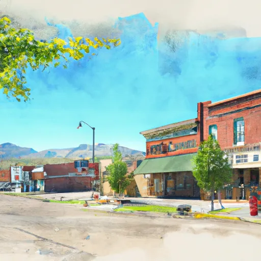
Minden, Nevada is a small town located in Douglas County, nestled in the scenic Carson Valley. The climate in Minden is classified as semi-arid, with hot summers and cool, dry winters. Summers are typically warm, with temperatures averaging around 90°F (32°C), and winters are mild with temperatures averaging around 45°F (7°C). The region experiences low precipitation throughout the year, with most rainfall occurring during the winter months.
The hydrology constituents in Minden are heavily influenced by the nearby Sierra Nevada Mountains. The town benefits from the melting snowpack, which feeds several rivers and streams, including the Carson River. These water sources provide important irrigation for agriculture in the area.
Outdoor enthusiasts visiting Minden have plenty of recreation opportunities to enjoy. The nearby Sierra Nevada Mountains offer a wide range of activities, including hiking, mountain biking, and rock climbing. The Carson Valley is also popular for fishing, with the Carson River being renowned for its trout. Additionally, the area offers opportunities for boating and kayaking in nearby lakes and reservoirs. Nature lovers can explore the diverse flora and fauna in the surrounding area, including the nearby Pine Nut Mountains. Overall, Minden, Nevada provides a picturesque setting for outdoor recreation enthusiasts to explore and enjoy the natural beauty of the region.
What is the Eden Index?
The Snoflo Eden Index serves as a comprehensive rating system for regions, evaluating their desirability through a holistic assessment of climate health, outdoor recreation opportunities, and natural disaster risk, acknowledging the profound impact of these factors on livability and well-being.
Climate Health Indicator (CHI): 8.5
Minden receives approximately
226mm of rain per year,
with humidity levels near 60%
and air temperatures averaging around
10°C.
Minden has a plant hardyness factor of
6, meaning
plants and agriculture in this region thrive during a short period during spring and early summer. Most
plants will die off during the colder winter months.
By considering the ideal temperature range, reliable water supplies, clean air, and stable seasonal rain or snowpacks, the Climate Health Indicator (CHI) underscores the significance of a healthy climate as the foundation for quality living.
A healthy climate is paramount for ensuring a high quality of life and livability in a region, fostering both physical well-being and environmental harmony. This can be characterized by ideal temperatures, reliable access to water supplies, clean air, and consistent seasonal rain or snowpacks.
Weather Forecast
Streamflow Conditions
Carson
Area Rivers
Carson
Snowpack Depths
Carson
Reservoir Storage Capacity
Carson
Groundwater Levels
Recreational Opportunity Index (ROI): 3.5
The Recreational Opportunity Index (ROI) recognizes the value of outdoor recreational options, such as parks, hiking trails, camping sites, and fishing spots, while acknowledging that climate plays a pivotal role in ensuring the comfort and consistency of these experiences.
Access to outdoor recreational opportunities, encompassing activities such as parks, hiking, camping, and fishing, is crucial for overall well-being, and the climate plays a pivotal role in enabling and enhancing these experiences, ensuring that individuals can engage in nature-based activities comfortably and consistently.
Camping Areas
| Campground | Campsites | Reservations | Toilets | Showers | Elevation |
|---|---|---|---|---|---|
| Nevada Beach | 54 | 6,213 ft | |||
| Markleeville | 10 | 5,557 ft | |||
| Crystal Springs | 25 | 6,065 ft | |||
| Kit Carson | 12 | 6,865 ft | |||
| Hope Valley | 24 | 7,155 ft | |||
| Grover Hot Springs State Park | 76 | 5,879 ft | |||
| Upper Blue Lake Dam | 25 | 8,162 ft | |||
| Centerville Flat | 20 | 5,852 ft | |||
| Turtle Rock Park | 28 | 6,057 ft | |||
| Middle Creek/Expansion | 35 | 8,106 ft |
Nearby Fishing
Nearby Ski Areas
Catastrophe Safeguard Index (CSI):
The Catastrophe Safeguard Index (CSI) recognizes that natural disaster risk, encompassing floods, fires, hurricanes, and tornadoes, can drastically affect safety and the overall appeal of an area.
The level of natural disaster risk in a region significantly affects safety and the overall livability, with climate change amplifying these risks by potentially increasing the frequency and intensity of events like floods, fires, hurricanes, and tornadoes, thereby posing substantial challenges to community resilience and well-being.
Community Resilience Indicator (CRI): 1.9
The Community Resilience Indicator (CRI) recognizes that education, healthcare, and socioeconomics are crucial to the well-being of a region. The CRI acknowledges the profound impact of these elements on residents' overall quality of life. By evaluating educational resources, healthcare accessibility, and economic inclusivity, the index captures the essential aspects that contribute to a thriving community, fostering resident satisfaction, equity, and social cohesion.