

-
 Snoflo Premium
Get unlimited access to all our content
With no Ad interruptions! - Start Your Free Trial Login with existing account
Vantage
Eden Index
Climate
7.0
•
Recreation
5.2
•
Community
•
Safeguard
4.6/10
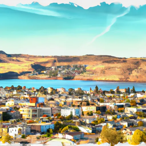
Vantage, Washington is a small town located in Kittitas County, in the central part of the state. With a population of around 90 people, it is a quiet and picturesque community. The climate in Vantage is semi-arid, characterized by hot and dry summers, and cold winters with limited snowfall. The average high temperature in summer is around 90°F (32°C), while winter temperatures can drop to around 30°F (-1°C).
Vantage is situated near the Columbia River, which plays a significant role in the area's hydrology. The river provides water for irrigation and supports diverse wildlife. Additionally, the region experiences occasional flooding due to its proximity to the river.
Outdoor recreation opportunities in Vantage are plentiful. The area is renowned for its stunning landscapes, including the nearby Ginkgo Petrified Forest State Park, where visitors can explore ancient petrified trees and unique geological formations. The Vantage area is also a popular destination for hiking, boating, fishing, and birdwatching. Moreover, rock climbers flock to the region for its iconic basalt cliffs, such as Frenchman Coulee, which offers challenging routes for climbers of all levels.
In conclusion, Vantage, Washington, offers a semi-arid climate, with hot summers and cold winters. The hydrology is influenced by the Columbia River, providing water for irrigation and occasional flooding. The town presents numerous opportunities for outdoor activities, including exploring petrified forests, hiking, boating, fishing, birdwatching, and rock climbing.
What is the Eden Index?
The Snoflo Eden Index serves as a comprehensive rating system for regions, evaluating their desirability through a holistic assessment of climate health, outdoor recreation opportunities, and natural disaster risk, acknowledging the profound impact of these factors on livability and well-being.
Climate Health Indicator (CHI): 7.0
Vantage receives approximately
191mm of rain per year,
with humidity levels near 86%
and air temperatures averaging around
12°C.
Vantage has a plant hardyness factor of
7, meaning
plants and agriculture in this region tend to thrive during the non-winter months.
By considering the ideal temperature range, reliable water supplies, clean air, and stable seasonal rain or snowpacks, the Climate Health Indicator (CHI) underscores the significance of a healthy climate as the foundation for quality living.
A healthy climate is paramount for ensuring a high quality of life and livability in a region, fostering both physical well-being and environmental harmony. This can be characterized by ideal temperatures, reliable access to water supplies, clean air, and consistent seasonal rain or snowpacks.
Weather Forecast
Streamflow Conditions
Upper Columbia
Area Rivers
Upper Columbia
Snowpack Depths
Upper Columbia
Reservoir Storage Capacity
Upper Columbia
Groundwater Levels
Recreational Opportunity Index (ROI): 5.2
The Recreational Opportunity Index (ROI) recognizes the value of outdoor recreational options, such as parks, hiking trails, camping sites, and fishing spots, while acknowledging that climate plays a pivotal role in ensuring the comfort and consistency of these experiences.
Access to outdoor recreational opportunities, encompassing activities such as parks, hiking, camping, and fishing, is crucial for overall well-being, and the climate plays a pivotal role in enabling and enhancing these experiences, ensuring that individuals can engage in nature-based activities comfortably and consistently.
Camping Areas
| Campground | Campsites | Reservations | Toilets | Showers | Elevation |
|---|---|---|---|---|---|
| Caliche Lake - WDFW | None | 1,196 ft | |||
| Burke Lake West - WDFW | None | 1,190 ft | |||
| Evergreen East - WDFW | None | 1,209 ft | |||
| Stan Coffin - WDFW | None | 1,176 ft | |||
| Quincey Lake - WDFW | None | 1,188 ft | |||
| Burke Lake Southwest - WDFW | None | 1,200 ft | |||
| Wanapum State Park/Ginkgo Petrified Forest | 50 | 708 ft |
Nearby Ski Areas
Catastrophe Safeguard Index (CSI):
The Catastrophe Safeguard Index (CSI) recognizes that natural disaster risk, encompassing floods, fires, hurricanes, and tornadoes, can drastically affect safety and the overall appeal of an area.
The level of natural disaster risk in a region significantly affects safety and the overall livability, with climate change amplifying these risks by potentially increasing the frequency and intensity of events like floods, fires, hurricanes, and tornadoes, thereby posing substantial challenges to community resilience and well-being.
Community Resilience Indicator (CRI):
The Community Resilience Indicator (CRI) recognizes that education, healthcare, and socioeconomics are crucial to the well-being of a region. The CRI acknowledges the profound impact of these elements on residents' overall quality of life. By evaluating educational resources, healthcare accessibility, and economic inclusivity, the index captures the essential aspects that contribute to a thriving community, fostering resident satisfaction, equity, and social cohesion.