Boles Creek Fishing
As of July 17, 2026, the nearest streamgauge to Boles Creek — Shasta R Nr Montague Ca — reports 59 cfs. Source: USGS gauge data, refreshed throughout the day.
Community Reviews
Been here? Share the conditions.
Reviews, ratings & photos are added in the free Snoflo iOS app — rate a spot, tag the conditions, and your visit is verified by location. Add or manage your reviews from the app.
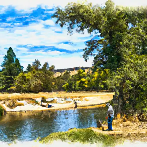
Boles Creek
What's biting at Boles Creek
Species commonly reported here -- tap any card for techniques, target seasons, and other waters where it's been caught.
Plan your trip down to the hour
Same weather feed Snoflo's iOS app uses -- updated continuously from NOAA / yr.no.
Next 5 days, hour by hour
Temperature line with weather symbols on top, snow + rain accumulation as columns, humidity as a dotted line.
5-day forecast table
Every 3 hours, broken out across temperature, snow, rain, humidity, and wind. Each cell is colour-coded relative to the column min/max so trends jump out at a glance.
| Time | Condition | Temp (°F) | Snow (in) | Rain (in) | Humidity (%) | Wind (mps) | Wind dir |
|---|---|---|---|---|---|---|---|
| Loading detailed forecast… | |||||||
15-day temperature & precipitation
Daily temperatures, snow, and rain projected over the next two weeks. Hover any point for the full breakdown.
Nearby streamflow
USGS streamgauges within reach of Boles Creek -- updated continuously from the National Water Information System.
| Streamgauge | Discharge | View |
|---|---|---|
| Shasta R Nr Montague Ca | 59 cfs | → |
| Trinity R Ab Coffee C Nr Trinity Ctr Ca | 28 cfs | → |
| Shasta R Nr Yreka Ca | 52 cfs | → |
| Scott R Nr Fort Jones Ca | 30 cfs | → |
| Klamath R Bl Iron Gate Dam Ca | 890 cfs | → |
| Sacramento R A Delta Ca | 251 cfs | → |
Plan a longer trip
The closest campgrounds, parks, boat launches, and reservoirs so a fishing run can grow into a weekend.
Campgrounds
- Trailer Lane Rv Park
- Deadfall Lake
- Mcbride Springs Campground
- Mcbride Springs
- Mt. Shasta City Koa
- Chilcoot Creek
Parks
- Mt Shasta City Park
- Shastice Park
- Cantara/Ney Springs Wildlife Area
- Mount Shasta Wilderness
- Dunsmuir City Park And Botanical Gardens
Reservoirs
Boat launches
- Siskiyou County
- Mountain Wood Drive 15182, Siskiyou County
- Lake Shastina Fishing Access/Boat)
- Driftwood Lane Siskiyou County
- Lake Siskiyou Trail - Delta Segment Siskiyou County
- National Forest Development Road 41n08 Siskiyou County
Points of interest
Paddle runs
- Shasta River
- Headwaters In Russian Wilderness To Wilderness Boundary
- Wilderness Boundary To Forest Road 40n54
- Iron Gate Dam To Happy Camp
- Scott District Boundary To Confluence With Sixmile Creek
- Headwaters In Marble Mountains Wilderness To Pre-1984 Wilderness Boundary
Angling safety & ethics
- Know the regulations
- Check local fishing rules, seasons, size limits, and license requirements to ensure legal and sustainable angling.
- Handle fish responsibly
- Use wet hands, minimize air exposure, and release fish gently to improve survival rates when practicing catch-and-release.
- Choose the right gear
- Match your rod, line, and tackle to the species and conditions to increase success and reduce unnecessary harm to fish.
- Respect the waterway
- Avoid disturbing habitat, prevent bank erosion, and keep a safe distance from spawning areas to protect ecosystems.
- Keep it clean
- Pack out all line, hooks, bait containers, and trash. Discarded gear can injure wildlife and degrade waterways.
Set push alerts in the Snoflo app
Save Boles Creek as a favorite, set a custom threshold (water temperature, streamflow, snowpack), and the iOS app will push the moment conditions cross.
About Boles Creek
What fish species are found at Boles Creek?
Snoflo tracks the species commonly reported at Boles Creek -- see the Fish Species panel above for the live list with images and links to per-species pages.
How fresh is the weather data on this page?
The hourly forecast updates throughout the day from the NOAA / yr.no public feeds. Streamflow data comes live from USGS streamgauges, also refreshed continuously.
Can I get alerts when conditions change?
Yes -- alerts are managed through the Snoflo iOS app. Favorite this area, set a threshold (water temperature, streamflow, snowpack), and you'll get a push the moment it crosses.
Do I need a fishing license?
Yes. Check your state agency's regulations for license requirements, seasons, size limits, and any waterbody-specific rules before fishing Boles Creek.
How do I get to Boles Creek?
Tap Open in map in the hero above to center the Snoflo interactive map on this area, or grab the coordinates from the location facts panel.
Other angling spots near here
Snoflo-tracked fishing areas within driving distance of Boles Creek.