Lower Otay Reservoir Fishing
As of August 3, 2026, the nearest streamgauge to Lower Otay Reservoir — Jamul C Nr Jamul Ca — reports 1 cfs. Source: USGS gauge data, refreshed throughout the day.
Community Reviews
Been here? Share the conditions.
Reviews, ratings & photos are added in the free Snoflo iOS app — rate a spot, tag the conditions, and your visit is verified by location. Add or manage your reviews from the app.
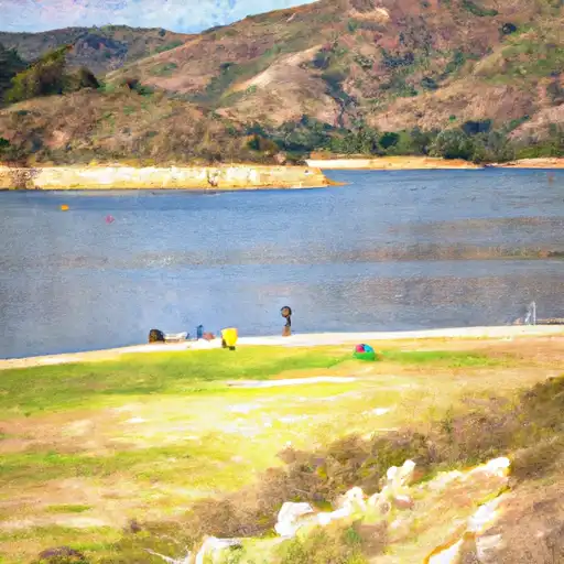
Lower Otay Reservoir
What's biting at Lower Otay Reservoir
Species commonly reported here -- tap any card for techniques, target seasons, and other waters where it's been caught.
Plan your trip down to the hour
Same weather feed Snoflo's iOS app uses -- updated continuously from NOAA / yr.no.
Next 5 days, hour by hour
Temperature line with weather symbols on top, snow + rain accumulation as columns, humidity as a dotted line.
5-day forecast table
Every 3 hours, broken out across temperature, snow, rain, humidity, and wind. Each cell is colour-coded relative to the column min/max so trends jump out at a glance.
| Time | Condition | Temp (°F) | Snow (in) | Rain (in) | Humidity (%) | Wind (mps) | Wind dir |
|---|---|---|---|---|---|---|---|
| Loading detailed forecast… | |||||||
15-day temperature & precipitation
Daily temperatures, snow, and rain projected over the next two weeks. Hover any point for the full breakdown.
Nearby streamflow
USGS streamgauges within reach of Lower Otay Reservoir -- updated continuously from the National Water Information System.
| Streamgauge | Discharge | View |
|---|---|---|
| Jamul C Nr Jamul Ca | 1 cfs | → |
| Sweetwater R A Dehesa Ca | · | → |
| Los Coches C Nr Lakeside Ca | 0 cfs | → |
| San Diego R A Mast Rd Nr Santee Ca | 1 cfs | → |
| San Diego R A Fashion Valley At San Diego Ca | 1 cfs | → |
| Sweetwater R Nr Descanso Ca | · | → |
Plan a longer trip
The closest campgrounds, parks, boat launches, and reservoirs so a fishing run can grow into a weekend.
Campgrounds
- Tt Pio Pico Rv Resort
- Sweetwater Summit
- Indian Hills Camp
- Carson Trailer
- Silver Strand State Beach Dispersed
- Kumeyaay Lake Campground - Mission Trails Park
Parks
- Mountain Hawk Community Park
- Eastlake Iii Park
- Salt Creek Community Park
- Otay County Open Space Preserve
- Dolphin Beach Club
- Winding Walk Park
Reservoirs
Boat launches
- Lower Otay Lake
- Bayfront Park - Chula Vista
- Marine Group Boat Works
- National City (Pepper Park)
- Murray Reservoir
- Glorietta Bay
Points of interest
- Abby's Garden
- Sesame Street Party Parade
- Storytime
- Sesame Street Neighborhood
- Dance Party
- Games Of Skill
Paddle runs
- Cañon La Presa (Valle Las Palma To Presa Rodriguez)
- Crouch Ranch To Morena Reservoir
- Forest Boundary, Above Zoo Creek Below Spillway (S1/2, Sec 3, T11s, R2e) To La Jolla Indian Reservation Boundary (N1/2, Sec 31, T10s, R2e)
- Confluence Of Fry And Iron Spring Creeks (E1/2, Sec 3, T10s,R1e To Se1/4 Sec 16, T10s, R2e
Angling safety & ethics
- Know the regulations
- Check local fishing rules, seasons, size limits, and license requirements to ensure legal and sustainable angling.
- Handle fish responsibly
- Use wet hands, minimize air exposure, and release fish gently to improve survival rates when practicing catch-and-release.
- Choose the right gear
- Match your rod, line, and tackle to the species and conditions to increase success and reduce unnecessary harm to fish.
- Respect the waterway
- Avoid disturbing habitat, prevent bank erosion, and keep a safe distance from spawning areas to protect ecosystems.
- Keep it clean
- Pack out all line, hooks, bait containers, and trash. Discarded gear can injure wildlife and degrade waterways.
Set push alerts in the Snoflo app
Save Lower Otay Reservoir as a favorite, set a custom threshold (water temperature, streamflow, snowpack), and the iOS app will push the moment conditions cross.
About Lower Otay Reservoir
What fish species are found at Lower Otay Reservoir?
Snoflo tracks the species commonly reported at Lower Otay Reservoir -- see the Fish Species panel above for the live list with images and links to per-species pages.
How fresh is the weather data on this page?
The hourly forecast updates throughout the day from the NOAA / yr.no public feeds. Streamflow data comes live from USGS streamgauges, also refreshed continuously.
Can I get alerts when conditions change?
Yes -- alerts are managed through the Snoflo iOS app. Favorite this area, set a threshold (water temperature, streamflow, snowpack), and you'll get a push the moment it crosses.
Do I need a fishing license?
Yes. Check your state agency's regulations for license requirements, seasons, size limits, and any waterbody-specific rules before fishing Lower Otay Reservoir.
How do I get to Lower Otay Reservoir?
Tap Open in map in the hero above to center the Snoflo interactive map on this area, or grab the coordinates from the location facts panel.
Other angling spots near here
Snoflo-tracked fishing areas within driving distance of Lower Otay Reservoir.