Camp Wishon To Confluence With Middle Fork Tule River river run
Community Reviews
Been here? Share the conditions.
Reviews, ratings & photos are added in the free Snoflo iOS app — rate a spot, tag the conditions, and your visit is verified by location. Add or manage your reviews from the app.
Camp Wishon To Confluence With Middle Fork Tule River
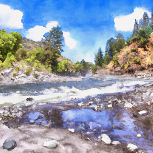
The segment mileage for the Whitewater River Run from Camp Wishon to Confluence with Middle Fork Tule River is approximately 14 miles. The run features several exciting rapids and obstacles, including Lions Den, which is a Class IV rapid that requires precise navigation. Other notable rapids include Shotgun, Upper and Lower Hoedown, and The Potholes.
To ensure safety and preserve the natural environment, there are specific regulations in place for this area. All boaters must obtain a permit from the Forest Service before embarking on this run. Additionally, boaters must follow Leave No Trace principles and pack out all trash. Camping is only allowed in designated areas, and fires are prohibited.
In conclusion, the Whitewater River Run from Camp Wishon to Confluence with Middle Fork Tule River is a thrilling adventure for experienced paddlers. The ideal streamflow range, class rating, and challenging rapids make this run a must-do for anyone seeking an adrenaline rush on the water. However, it is essential to follow regulations and be respectful of the natural environment to ensure the sustainability of this beautiful area for future generations.
Plan your run down to the hour
Same weather feed Snoflo's iOS app uses -- updated continuously from NOAA / yr.no. Watch the precipitation column on the meteogram; rain ahead of a run typically lifts flows 12-48 hours later depending on the basin.
Next 5 days, hour by hour
Temperature line with weather symbols on top, snow + rain accumulation as columns, humidity as a dotted line.
5-day forecast table
Every 3 hours, broken out across temperature, snow, rain, humidity, and wind. Each cell is colour-coded relative to the column min/max.
| Time | Condition | Temp (°F) | Snow (in) | Rain (in) | Humidity (%) | Wind (mps) | Wind dir |
|---|---|---|---|---|---|---|---|
| Loading detailed forecast… | |||||||
15-day temperature & precipitation
Daily temperatures, snow, and rain projected over the next two weeks -- the upstream story that drives next week's flows.
Regional streamflow levels
USGS streamgauges around Camp Wishon To Confluence With Middle Fork Tule River -- useful for spotting upstream pulses and gauging which tributary is contributing what.
| Streamgauge | Discharge | View |
|---|---|---|
| Sf Tule R Nr Cholollo Campground Nr Porterville Ca | 9 cfs | → |
| Sf Tule R Nr Reservation Bndry Nr Porterville Ca | 11 cfs | → |
| Deer C Nr Fountain Springs Ca | 7 cfs | → |
| Marble Fork Kaweah R Ab Horse C Nr Lodgepole Ca | 3 cfs | → |
| Sf Kern R Nr Onyx Ca | 23 cfs | → |
| San Joaquin R Bl Friant Ca | 314 cfs | → |
Plan a longer trip
The closest boat launches, other paddle runs, and campgrounds so a day on the water can grow into a full weekend.
Other river runs
- Nf Boundary To Camp Wishon
- Nf Boundary With Sequoia Np To Nf Boundary
- Nf Boundary To Table Meadows Creek
- Outlet Of Green Meadows North Of The Windy Gap And Windy Ridges (Boundary Extend 0.25 Mile On Each Side Of River) To Bridge Above South Fork Campground
- Table Meadow Creek To Kern River
Campgrounds
Fishing spots
- Tule River
- Balch Park Lakes, Western Lake
- Balch Park Lakes, Eastern Lake
- Success Lake
- Lake Success
- Bone Creek
Whitewater safety
- Check the flow before you run
- Use the linked-gauge card and Regional Flow panel above. Class ratings change with flow -- a Class III at low water can become Class IV+ at high water.
- Know your skill ceiling
- Pick runs comfortably below your ceiling. Cold-water and big-water runs raise the consequences of any mistake.
- Wear the right gear
- Helmet, PFD, drysuit / wetsuit when water is below 60°F. Throw bag, knife, and whistle on your person, not in the boat.
- Scout, set safety, and run with a team
- Scout new rapids on foot, set safety with throw bags above the consequence pool, and run with at least one other competent paddler.
- Respect the river
- Strainers, undercuts, low-head dams, and wood can kill at any class rating. When in doubt, portage.
Set push alerts in the Snoflo app
Save Camp Wishon To Confluence With Middle Fork Tule River as a favorite, set a discharge threshold (e.g. "alert me when flow hits 600 cfs"), and the iOS app pushes the moment the linked gauge crosses.
About Camp Wishon To Confluence With Middle Fork Tule River
What's the optimal flow for Camp Wishon To Confluence With Middle Fork Tule River?
The optimal flow depends on the section and the craft. Check the Run Details panel for the linked gauge and current status.
How fresh is the cfs reading on this page?
The linked USGS streamgauge reports continuously (every 15 minutes); Snoflo refreshes throughout the day. Hover the streamflow sparkline to read individual datapoints.
What's the whitewater class?
See the Run Details panel for the class rating Snoflo tracks for this run. Class ratings change with flow -- a Class III at low water can become Class IV in high water.
Where do I put in / take out?
Tap Directions in the hero above to open driving directions to the put-in. For shuttle planning, check the Nearby Boat Launches panel and the river run operator's site.
Can I get alerts when flows hit the optimal range?
Yes -- alerts are managed in the Snoflo iOS app. Favorite this run, set a discharge threshold, and you'll get a push the moment the gauge crosses.
Other runs near here
Snoflo-tracked paddle runs within driving distance of Camp Wishon To Confluence With Middle Fork Tule River.