Headwaters To Walker Lake River Run
Community Reviews
Been here? Share the conditions.
Reviews, ratings & photos are added in the free Snoflo iOS app — rate a spot, tag the conditions, and your visit is verified by location. Add or manage your reviews from the app.
Headwaters To Walker Lake
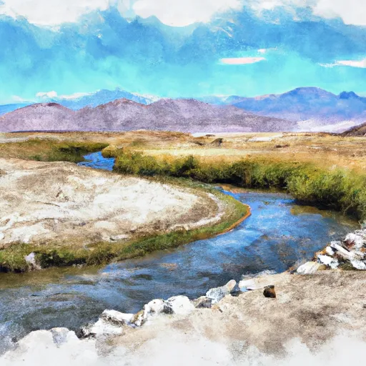
The segment mileage for this run is approximately 8 miles, starting at the headwaters and ending at Walker Lake. Along the way, paddlers will encounter a variety of rapids and obstacles, including the infamous "Lucifer's Falls" which is a 20-foot waterfall drop. Other notable rapids include "Pinball", "Toilet Bowl", and "Golf Course".
There are specific regulations in place for this area, including a permit requirement from the Bureau of Land Management (BLM). Paddlers must also follow Leave No Trace principles, pack out all trash and human waste, and avoid damaging vegetation and wildlife habitats.
Overall, the Headwaters to Walker Lake section of the Whitewater River offers a thrilling and rewarding experience for experienced paddlers seeking a challenge in a beautiful and remote natural setting. However, it is important to always prioritize safety and follow all regulations to minimize environmental impact and preserve the area for future generations.
Plan your run down to the hour
Same weather feed Snoflo's iOS app uses -- updated continuously from NOAA / yr.no. Watch the precipitation column on the meteogram; rain ahead of a run typically lifts flows 12-48 hours later depending on the basin.
Next 5 days, hour by hour
Temperature line with weather symbols on top, snow + rain accumulation as columns, humidity as a dotted line.
5-day forecast table
Every 3 hours, broken out across temperature, snow, rain, humidity, and wind. Each cell is colour-coded relative to the column min/max.
| Time | Condition | Temp (°F) | Snow (in) | Rain (in) | Humidity (%) | Wind (mps) | Wind dir |
|---|---|---|---|---|---|---|---|
| Loading detailed forecast… | |||||||
15-day temperature & precipitation
Daily temperatures, snow, and rain projected over the next two weeks -- the upstream story that drives next week's flows.
Regional streamflow levels
USGS streamgauges around Headwaters To Walker Lake -- useful for spotting upstream pulses and gauging which tributary is contributing what.
| Streamgauge | Discharge | View |
|---|---|---|
| Deadman C A Big Springs Nr Crestview Ca | 20 cfs | → |
| Mf San Joaquin R Nr Mammoth Lakes Ca | 67 cfs | → |
| Green Creek Near Bridgeport | 22 cfs | → |
| Robinson C At Twin Lks Outlet Nr Bridgeport | 100 cfs | → |
| Merced R A Happy Isles Bridge Nr Yosemite Ca | 91 cfs | → |
| Hot C A Flume Nr Mammoth Lakes Ca | 42 cfs | → |
Plan a longer trip
The closest boat launches, other paddle runs, and campgrounds so a day on the water can grow into a full weekend.
Boat launches
- Grant Lake Marina
- Silver Lake Resort
- Big Rock Resort And Marina
- Gull Meadows Car Top Boat Launch
- Gull Lake Marina
- Lee Vining Creek
Other river runs
- Headwaters To Wilderness Boundary
- Sce Powerhouse To La Dept. Of Water And Power Diversion
- Saddlebag Lake Rna Boundary To State Highway 120
- Headwaters Tributaries To Research Natural Area Boundary
Campgrounds
- Grant Lake Campground
- Lower Lee Vining
- Boulder
- Lower Lee Vining Campground
- Cattleguard
- Aerie Crag Picnic Area
Fishing spots
Parks
Whitewater safety
- Check the flow before you run
- Use the linked-gauge card and Regional Flow panel above. Class ratings change with flow -- a Class III at low water can become Class IV+ at high water.
- Know your skill ceiling
- Pick runs comfortably below your ceiling. Cold-water and big-water runs raise the consequences of any mistake.
- Wear the right gear
- Helmet, PFD, drysuit / wetsuit when water is below 60°F. Throw bag, knife, and whistle on your person, not in the boat.
- Scout, set safety, and run with a team
- Scout new rapids on foot, set safety with throw bags above the consequence pool, and run with at least one other competent paddler.
- Respect the river
- Strainers, undercuts, low-head dams, and wood can kill at any class rating. When in doubt, portage.
Set push alerts in the Snoflo app
Save Headwaters To Walker Lake as a favorite, set a discharge threshold (e.g. "alert me when flow hits 600 cfs"), and the iOS app pushes the moment the linked gauge crosses.
About Headwaters To Walker Lake
What's the optimal flow for Headwaters To Walker Lake?
The optimal flow depends on the section and the craft. Check the Run Details panel for the linked gauge and current status.
How fresh is the cfs reading on this page?
The linked USGS streamgauge reports continuously (every 15 minutes); Snoflo refreshes throughout the day. Hover the streamflow sparkline to read individual datapoints.
What's the whitewater class?
See the Run Details panel for the class rating Snoflo tracks for this run. Class ratings change with flow -- a Class III at low water can become Class IV in high water.
Where do I put in / take out?
Tap Directions in the hero above to open driving directions to the put-in. For shuttle planning, check the Nearby Boat Launches panel and the river run operator's site.
Can I get alerts when flows hit the optimal range?
Yes -- alerts are managed in the Snoflo iOS app. Favorite this run, set a discharge threshold, and you'll get a push the moment the gauge crosses.
Other runs near here
Snoflo-tracked paddle runs within driving distance of Headwaters To Walker Lake.