One-Quarter Mile Upstream Of Forest Road 5no2 Bridge Crossing To One-Quarter Mile Downstream Of Forest Road 5n75 Bridge Crossing River Run
Community Reviews
Been here? Share the conditions.
Reviews, ratings & photos are added in the free Snoflo iOS app — rate a spot, tag the conditions, and your visit is verified by location. Add or manage your reviews from the app.
One-Quarter Mile Upstream Of Forest Road 5no2 Bridge Crossing To One-Quarter Mile Downstream Of Forest Road 5n75 Bridge Crossing
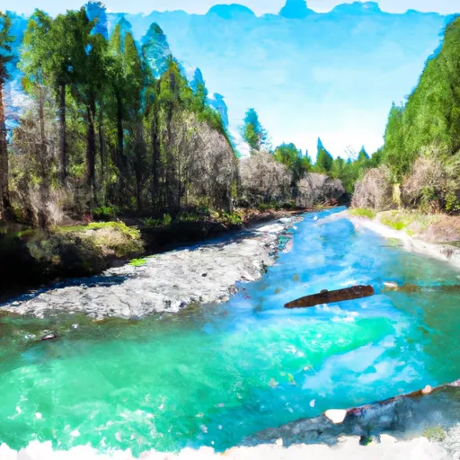
This section of the river is rated as Class III-IV, and spans a distance of approximately 6 miles. The rapids and obstacles present on the river include "S-turn" (Class III), "Island Rapid" (Class III), "Double Drop" (Class IV), and "Devil's Toenail" (Class IV). Paddlers should be prepared for technical maneuvers through tight channels, large drops, and boulder-strewn segments.
It is important for paddlers to be aware of the regulations and restrictions surrounding this section of the river. Permits are required to enter the area, and there are specific guidelines in place to protect the river's flora and fauna. It is also important for paddlers to practice Leave No Trace principles and respect private property boundaries.
Plan your run down to the hour
Same weather feed Snoflo's iOS app uses -- updated continuously from NOAA / yr.no. Watch the precipitation column on the meteogram; rain ahead of a run typically lifts flows 12-48 hours later depending on the basin.
Next 5 days, hour by hour
Temperature line with weather symbols on top, snow + rain accumulation as columns, humidity as a dotted line.
5-day forecast table
Every 3 hours, broken out across temperature, snow, rain, humidity, and wind. Each cell is colour-coded relative to the column min/max.
| Time | Condition | Temp (°F) | Snow (in) | Rain (in) | Humidity (%) | Wind (mps) | Wind dir |
|---|---|---|---|---|---|---|---|
| Loading detailed forecast… | |||||||
15-day temperature & precipitation
Daily temperatures, snow, and rain projected over the next two weeks -- the upstream story that drives next week's flows.
Regional streamflow levels
USGS streamgauges around One-Quarter Mile Upstream Of Forest Road 5no2 Bridge Crossing To One-Quarter Mile Downstream Of Forest Road 5n75 Bridge Crossing -- useful for spotting upstream pulses and gauging which tributary is contributing what.
| Streamgauge | Discharge | View |
|---|---|---|
| Cherry C Bl Valley Dam Nr Hetch Hetchy Ca | 12 cfs | → |
| Lk Eleanor Div To Cherry Lake Nr Hetch Hetchy Ca | 1 cfs | → |
| Eleanor C Nr Hetch Hetchy Ca | 22 cfs | → |
| Black C Nr Copperopolis Ca | · | → |
| Cherry C Nr Early Intake Ca | 39 cfs | → |
| Big C Ab Whites Gulch Nr Groveland Ca | · | → |
Plan a longer trip
The closest boat launches, other paddle runs, and campgrounds so a day on the water can grow into a full weekend.
Boat launches
Other river runs
- Confluence With Highland Creek To One-Quarter Mile Upstream Forest Road 5no2 Bridge Crossing
- One-Quarter Mile Downstream Of Forest Road 5n75 Bridge Crossing To Calaveras Big Trees State Park Boundary In Sec 24, T5n, R15e
- Calaveras Big Trees State Park Boundary In Sec 24, T5n, R15e To One Mile Downstream Of State Park Boundary In Sec 24, T5n, R15e
- One Mile Downstream Of State Park Boundary In Sec 24, T5n, R15e To Mckay's Reservoir
- Below Mckay's Reservoir To Confluence With Middle Fork Stanislaus River
Campgrounds
- Boards Crossing
- Wakalu Hep Yo (Wild River) Campground
- Wa Ka Luu Hep Yoo (Wild River) Campground
- Wa Ka Luu Hep Yoo
- Lone Snag
- Stanislaus View
Fishing spots
- Highland Creek
- Salt Springs Reservoir
- Hobart Creek
- Pinecrest Lake
- Lower Bear River Reservoir
- Bear River Reservoir
Parks
Whitewater safety
- Check the flow before you run
- Use the linked-gauge card and Regional Flow panel above. Class ratings change with flow -- a Class III at low water can become Class IV+ at high water.
- Know your skill ceiling
- Pick runs comfortably below your ceiling. Cold-water and big-water runs raise the consequences of any mistake.
- Wear the right gear
- Helmet, PFD, drysuit / wetsuit when water is below 60°F. Throw bag, knife, and whistle on your person, not in the boat.
- Scout, set safety, and run with a team
- Scout new rapids on foot, set safety with throw bags above the consequence pool, and run with at least one other competent paddler.
- Respect the river
- Strainers, undercuts, low-head dams, and wood can kill at any class rating. When in doubt, portage.
Set push alerts in the Snoflo app
Save One-Quarter Mile Upstream Of Forest Road 5no2 Bridge Crossing To One-Quarter Mile Downstream Of Forest Road 5n75 Bridge Crossing as a favorite, set a discharge threshold (e.g. "alert me when flow hits 600 cfs"), and the iOS app pushes the moment the linked gauge crosses.
About One-Quarter Mile Upstream Of Forest Road 5no2 Bridge Crossing To One-Quarter Mile Downstream Of Forest Road 5n75 Bridge Crossing
What's the optimal flow for One-Quarter Mile Upstream Of Forest Road 5no2 Bridge Crossing To One-Quarter Mile Downstream Of Forest Road 5n75 Bridge Crossing?
The optimal flow depends on the section and the craft. Check the Run Details panel for the linked gauge and current status.
How fresh is the cfs reading on this page?
The linked USGS streamgauge reports continuously (every 15 minutes); Snoflo refreshes throughout the day. Hover the streamflow sparkline to read individual datapoints.
What's the whitewater class?
See the Run Details panel for the class rating Snoflo tracks for this run. Class ratings change with flow -- a Class III at low water can become Class IV in high water.
Where do I put in / take out?
Tap Directions in the hero above to open driving directions to the put-in. For shuttle planning, check the Nearby Boat Launches panel and the river run operator's site.
Can I get alerts when flows hit the optimal range?
Yes -- alerts are managed in the Snoflo iOS app. Favorite this run, set a discharge threshold, and you'll get a push the moment the gauge crosses.
Other runs near here
Snoflo-tracked paddle runs within driving distance of One-Quarter Mile Upstream Of Forest Road 5no2 Bridge Crossing To One-Quarter Mile Downstream Of Forest Road 5n75 Bridge Crossing.