Arkansas River Segment 2 river run
Community Reviews
Been here? Share the conditions.
Reviews, ratings & photos are added in the free Snoflo iOS app — rate a spot, tag the conditions, and your visit is verified by location. Add or manage your reviews from the app.
Arkansas River Segment 2
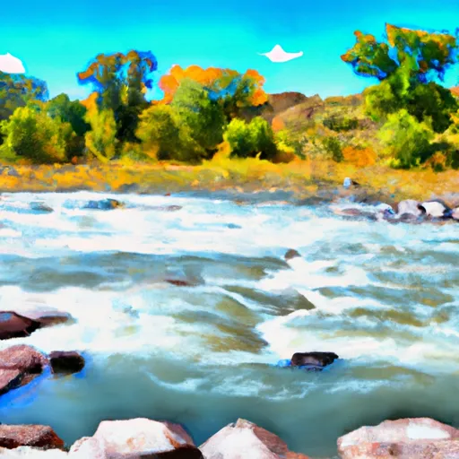
The Whitewater River Run Arkansas River Segment 2 is a popular destination for whitewater enthusiasts in Colorado. The ideal streamflow range for this segment is between 800 - 2,000 cfs. The segment is rated as Class III-IV rapids, making it suitable for intermediate to advanced paddlers.
This segment covers 13 miles of the Arkansas River, starting at the Railroad Bridge in Howard and ending at the Texas Creek Bridge. There are several notable rapids and obstacles along the way, including the Pine Creek Rapids, which is a long and technical section of Class IV rapids. Other notable obstacles include the Three Sisters, a series of three large boulders in the middle of the river, and the Spike Buck Rapid, which features a large wave followed by a rocky drop.
There are specific regulations to be aware of when paddling this segment of the Arkansas River. The Bighorn Sheep Canyon section, which includes Segment 2, is designated as a "Wildlife Protection Area" by the Colorado Parks and Wildlife Commission. As a result, paddlers are not allowed to stop on the shoreline or disturb wildlife in the area.
Overall, the Whitewater River Run Arkansas River Segment 2 is a challenging and exciting whitewater destination in Colorado. Paddlers should be experienced and familiar with Class III-IV rapids, and should be aware of specific regulations in the area.
Plan your run down to the hour
Same weather feed Snoflo's iOS app uses -- updated continuously from NOAA / yr.no. Watch the precipitation column on the meteogram; rain ahead of a run typically lifts flows 12-48 hours later depending on the basin.
Next 5 days, hour by hour
Temperature line with weather symbols on top, snow + rain accumulation as columns, humidity as a dotted line.
5-day forecast table
Every 3 hours, broken out across temperature, snow, rain, humidity, and wind. Each cell is colour-coded relative to the column min/max.
| Time | Condition | Temp (°F) | Snow (in) | Rain (in) | Humidity (%) | Wind (mps) | Wind dir |
|---|---|---|---|---|---|---|---|
| Loading detailed forecast… | |||||||
15-day temperature & precipitation
Daily temperatures, snow, and rain projected over the next two weeks -- the upstream story that drives next week's flows.
Regional streamflow levels
USGS streamgauges around Arkansas River Segment 2 -- useful for spotting upstream pulses and gauging which tributary is contributing what.
| Streamgauge | Discharge | View |
|---|---|---|
| Arkansas River Below Granite | 121 cfs | → |
| Arkansas River Near Nathrop | 191 cfs | → |
| Clear Creek Above Clear Creek Reservoir | 26 cfs | → |
| Arkansas River At Granite | 80 cfs | → |
| Arkansas River At Salida | 196 cfs | → |
| Lake Creek Above Twin Lakes Reservoir | 30 cfs | → |
Plan a longer trip
The closest boat launches, other paddle runs, and campgrounds so a day on the water can grow into a full weekend.
Boat launches
- Buena Vista State Wildlife Area
- Ahra - Fishermans Bridge Rec Site
- Ahra - Railroad Bridge Rec Site
- Ahra - Ruby Mountain Rec Sits
- Cr 300 22504, Nathrop
- Ahra - Number 4 Rec Site
Other river runs
- Buena Vista Whitewater Park
- Milk Run
- Browns Canyon (Fisherman's Bridge To Stone Bridge)
- Fractions
- Numbers
Campgrounds
- Bv Overlook Camp & Lodging
- Valley Mobile Rv Park
- Railroad Bridge - Arkansas Headwaters State Rec Area
- Camp Site, Free, Without Facilities
- Mushroom Gulch Site 1
- Ruby Mountain - Arkansas Headwaters State Rec Area
Whitewater safety
- Check the flow before you run
- Use the linked-gauge card and Regional Flow panel above. Class ratings change with flow -- a Class III at low water can become Class IV+ at high water.
- Know your skill ceiling
- Pick runs comfortably below your ceiling. Cold-water and big-water runs raise the consequences of any mistake.
- Wear the right gear
- Helmet, PFD, drysuit / wetsuit when water is below 60°F. Throw bag, knife, and whistle on your person, not in the boat.
- Scout, set safety, and run with a team
- Scout new rapids on foot, set safety with throw bags above the consequence pool, and run with at least one other competent paddler.
- Respect the river
- Strainers, undercuts, low-head dams, and wood can kill at any class rating. When in doubt, portage.
Set push alerts in the Snoflo app
Save Arkansas River Segment 2 as a favorite, set a discharge threshold (e.g. "alert me when flow hits 600 cfs"), and the iOS app pushes the moment the linked gauge crosses.
About Arkansas River Segment 2
What's the optimal flow for Arkansas River Segment 2?
The optimal flow depends on the section and the craft. Check the Run Details panel for the linked gauge and current status.
How fresh is the cfs reading on this page?
The linked USGS streamgauge reports continuously (every 15 minutes); Snoflo refreshes throughout the day. Hover the streamflow sparkline to read individual datapoints.
What's the whitewater class?
See the Run Details panel for the class rating Snoflo tracks for this run. Class ratings change with flow -- a Class III at low water can become Class IV in high water.
Where do I put in / take out?
Tap Directions in the hero above to open driving directions to the put-in. For shuttle planning, check the Nearby Boat Launches panel and the river run operator's site.
Can I get alerts when flows hit the optimal range?
Yes -- alerts are managed in the Snoflo iOS app. Favorite this run, set a discharge threshold, and you'll get a push the moment the gauge crosses.
Other runs near here
Snoflo-tracked paddle runs within driving distance of Arkansas River Segment 2.