Middle Santiam Wilderness Boundary To Willamette Nf Boundary river run
Community Reviews
Been here? Share the conditions.
Reviews, ratings & photos are added in the free Snoflo iOS app — rate a spot, tag the conditions, and your visit is verified by location. Add or manage your reviews from the app.
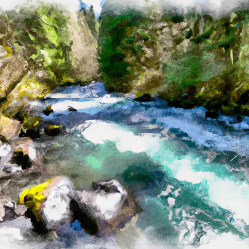
Middle Santiam Wilderness Boundary To Willamette Nf Boundary
There are several notable rapids and obstacles on this river, including Green Wall, Gut Buster, and Boxcar. Green Wall is a challenging rapid that requires precise navigation through a tight channel with a steep drop and strong currents. Gut Buster is another difficult rapid that requires paddlers to navigate through a narrow chute with large waves and technical maneuvers. Boxcar is a technical rapid that requires precise navigation through a series of boulder fields and drops.
In terms of regulations, all boaters are required to obtain a permit from the Willamette National Forest before embarking on this river run. Additionally, there are restrictions on camping and campfires along the river, and all boaters are required to follow Leave No Trace principles to minimize their impact on the environment. Overall, the Middle Santiam River offers a thrilling whitewater experience for experienced paddlers seeking a challenge.
Plan your run down to the hour
Same weather feed Snoflo's iOS app uses -- updated continuously from NOAA / yr.no. Watch the precipitation column on the meteogram; rain ahead of a run typically lifts flows 12-48 hours later depending on the basin.
Next 5 days, hour by hour
Temperature line with weather symbols on top, snow + rain accumulation as columns, humidity as a dotted line.
5-day forecast table
Every 3 hours, broken out across temperature, snow, rain, humidity, and wind. Each cell is colour-coded relative to the column min/max.
| Time | Condition | Temp (°F) | Snow (in) | Rain (in) | Humidity (%) | Wind (mps) | Wind dir |
|---|---|---|---|---|---|---|---|
| Loading detailed forecast… | |||||||
15-day temperature & precipitation
Daily temperatures, snow, and rain projected over the next two weeks -- the upstream story that drives next week's flows.
Regional streamflow levels
USGS streamgauges around Middle Santiam Wilderness Boundary To Willamette Nf Boundary -- useful for spotting upstream pulses and gauging which tributary is contributing what.
| Streamgauge | Discharge | View |
|---|---|---|
| Quartzville Creek Near Cascadia | 33 cfs | → |
| Blowout Creek Near Detroit | 9 cfs | → |
| Schafer Creek Near Lacomb | 0 cfs | → |
| South Santiam River Below Cascadia | 84 cfs | → |
| No Santiam R Blw Boulder Crk | 425 cfs | → |
| Smith R Ab Smith R Res Nr Belknap Sprgs | 6 cfs | → |
Plan a longer trip
The closest boat launches, other paddle runs, and campgrounds so a day on the water can grow into a full weekend.
Boat launches
- Whitcomb Creek
- Thistle Creek
- South Shore - Detroit Lake
- Mongold State Park
- Billings Park
- Cove Creek Campground
Other river runs
- Middle Santiam River
- West Section Line Of Sec 31, T12s, R6e To Middle Santiam Wilderness Boundary
- Confluence With Unnamed Creek West Of Bruler To Willamette Nf Boundary
- Headwaters To Confluence With Unnamed Creek West Of Bruler Creek
- Headwaters Of Sevenmile Creek To Confluence With Latiwi Creek
Campgrounds
- South Pyramid Horse Camp
- Old Miners Meadow Group Use Area
- Yellowbottom Recreation Site
- Yellowbottom
- Fernview
- Fernview Group Camp
Whitewater safety
- Check the flow before you run
- Use the linked-gauge card and Regional Flow panel above. Class ratings change with flow -- a Class III at low water can become Class IV+ at high water.
- Know your skill ceiling
- Pick runs comfortably below your ceiling. Cold-water and big-water runs raise the consequences of any mistake.
- Wear the right gear
- Helmet, PFD, drysuit / wetsuit when water is below 60°F. Throw bag, knife, and whistle on your person, not in the boat.
- Scout, set safety, and run with a team
- Scout new rapids on foot, set safety with throw bags above the consequence pool, and run with at least one other competent paddler.
- Respect the river
- Strainers, undercuts, low-head dams, and wood can kill at any class rating. When in doubt, portage.
Set push alerts in the Snoflo app
Save Middle Santiam Wilderness Boundary To Willamette Nf Boundary as a favorite, set a discharge threshold (e.g. "alert me when flow hits 600 cfs"), and the iOS app pushes the moment the linked gauge crosses.
About Middle Santiam Wilderness Boundary To Willamette Nf Boundary
What's the optimal flow for Middle Santiam Wilderness Boundary To Willamette Nf Boundary?
The optimal flow depends on the section and the craft. Check the Run Details panel for the linked gauge and current status.
How fresh is the cfs reading on this page?
The linked USGS streamgauge reports continuously (every 15 minutes); Snoflo refreshes throughout the day. Hover the streamflow sparkline to read individual datapoints.
What's the whitewater class?
See the Run Details panel for the class rating Snoflo tracks for this run. Class ratings change with flow -- a Class III at low water can become Class IV in high water.
Where do I put in / take out?
Tap Directions in the hero above to open driving directions to the put-in. For shuttle planning, check the Nearby Boat Launches panel and the river run operator's site.
Can I get alerts when flows hit the optimal range?
Yes -- alerts are managed in the Snoflo iOS app. Favorite this run, set a discharge threshold, and you'll get a push the moment the gauge crosses.
Other runs near here
Snoflo-tracked paddle runs within driving distance of Middle Santiam Wilderness Boundary To Willamette Nf Boundary.