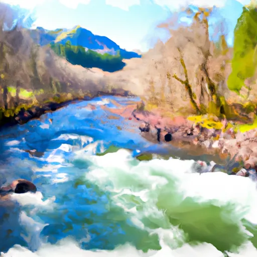
Little Silver Lake To Confluence With Silver Creek River Run
Community Reviews
Been here? Share the conditions.
Reviews, ratings & photos are added in the free Snoflo iOS app — rate a spot, tag the conditions, and your visit is verified by location. Add or manage your reviews from the app.
Little Silver Lake To Confluence With Silver Creek
The segment mileage for this run is approximately 13 miles. Along the way, paddlers will encounter several Class III rapids, including "The Narrows" and "The Chute." Additionally, there are several obstacles such as downed trees and sweepers that require careful navigation.
Specific regulations to the area include the need for a permit to access the Little Silver Lake area. Additionally, due to the sensitive habitat of some of the surrounding flora and fauna, paddlers are advised to take care not to disturb the environment.
Overall, the Whitewater River run from Little Silver Lake to Confluence with Silver Creek is a thrilling adventure for intermediate paddlers looking for a challenge. With proper preparation and attention to regulations, it can be a rewarding experience for those seeking a unique whitewater experience in Oregon.
Plan your run down to the hour
Same weather feed Snoflo's iOS app uses -- updated continuously from NOAA / yr.no. Watch the precipitation column on the meteogram; rain ahead of a run typically lifts flows 12-48 hours later depending on the basin.
Next 5 days, hour by hour
Temperature line with weather symbols on top, snow + rain accumulation as columns, humidity as a dotted line.
5-day forecast table
Every 3 hours, broken out across temperature, snow, rain, humidity, and wind. Each cell is colour-coded relative to the column min/max.
| Time | Condition | Temp (°F) | Snow (in) | Rain (in) | Humidity (%) | Wind (mps) | Wind dir |
|---|---|---|---|---|---|---|---|
| Loading detailed forecast… | |||||||
15-day temperature & precipitation
Daily temperatures, snow, and rain projected over the next two weeks -- the upstream story that drives next week's flows.
Regional streamflow levels
USGS streamgauges around Little Silver Lake To Confluence With Silver Creek -- useful for spotting upstream pulses and gauging which tributary is contributing what.
| Streamgauge | Discharge | View |
|---|---|---|
| Rogue River Near Agness | 1,430 cfs | → |
| Illinois River Near Kerby | 33 cfs | → |
| Applegate River Near Wilderville | 76 cfs | → |
| Rogue River At Grants Pass | 1,210 cfs | → |
| West Fork Cow Creek Near Glendale | 5 cfs | → |
| Sucker Cr Bl Lt Grayback Cr Nr Holland | 23 cfs | → |
Plan a longer trip
The closest boat launches, other paddle runs, and campgrounds so a day on the water can grow into a full weekend.
Boat launches
- Miami Bar Boating Site
- Miami Bar
- Cougar Lane Store &Amp; Lodge
- Galice Boat Landing
- Ennis Riffle
- Foster Bar
Other river runs
- Falls (Sw1/4 Of Sec 24, T35s, R10w) To Confluence With Silver Creek
- Confluence With Breezy Creek To Confluence With West Fork Indigo Creek
- West Indigo Lake (Sw1/4 Of Sec 26, T34s, R7w) To Confluence With East Fork Indigo
- Falls (Nw1/4 Of Sec 15, T36s, R9w) To Confluence With Silver Creek
- Confluence With Chief Creek To Confluence With Breezy Creek
Campgrounds
- Briggs Creek Campground
- Grassy Flats
- Grassy Flats Dispersed Campsites
- Cedar Camp
- Sam Brown Campground
- Sam Brown
Whitewater safety
- Check the flow before you run
- Use the linked-gauge card and Regional Flow panel above. Class ratings change with flow -- a Class III at low water can become Class IV+ at high water.
- Know your skill ceiling
- Pick runs comfortably below your ceiling. Cold-water and big-water runs raise the consequences of any mistake.
- Wear the right gear
- Helmet, PFD, drysuit / wetsuit when water is below 60°F. Throw bag, knife, and whistle on your person, not in the boat.
- Scout, set safety, and run with a team
- Scout new rapids on foot, set safety with throw bags above the consequence pool, and run with at least one other competent paddler.
- Respect the river
- Strainers, undercuts, low-head dams, and wood can kill at any class rating. When in doubt, portage.
Set push alerts in the Snoflo app
Save Little Silver Lake To Confluence With Silver Creek as a favorite, set a discharge threshold (e.g. "alert me when flow hits 600 cfs"), and the iOS app pushes the moment the linked gauge crosses.
About Little Silver Lake To Confluence With Silver Creek
What's the optimal flow for Little Silver Lake To Confluence With Silver Creek?
The optimal flow depends on the section and the craft. Check the Run Details panel for the linked gauge and current status.
How fresh is the cfs reading on this page?
The linked USGS streamgauge reports continuously (every 15 minutes); Snoflo refreshes throughout the day. Hover the streamflow sparkline to read individual datapoints.
What's the whitewater class?
See the Run Details panel for the class rating Snoflo tracks for this run. Class ratings change with flow -- a Class III at low water can become Class IV in high water.
Where do I put in / take out?
Tap Directions in the hero above to open driving directions to the put-in. For shuttle planning, check the Nearby Boat Launches panel and the river run operator's site.
Can I get alerts when flows hit the optimal range?
Yes -- alerts are managed in the Snoflo iOS app. Favorite this run, set a discharge threshold, and you'll get a push the moment the gauge crosses.
Other runs near here
Snoflo-tracked paddle runs within driving distance of Little Silver Lake To Confluence With Silver Creek.