Source To Murray City Diversion River Run
Community Reviews
Been here? Share the conditions.
Reviews, ratings & photos are added in the free Snoflo iOS app — rate a spot, tag the conditions, and your visit is verified by location. Add or manage your reviews from the app.
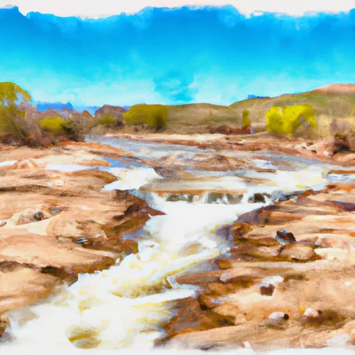
Source To Murray City Diversion
In terms of regulations, all boaters are required to wear life jackets and carry a whistle, and there are restrictions on the use of motorized watercraft. Users are expected to pack out all trash and follow Leave No Trace principles to preserve the natural environment. Additionally, the use of alcohol and other controlled substances is prohibited on the river.
According to the Utah Rivers Council, the Source to Murray City Diversion section of the river offers "a thrilling yet manageable whitewater experience for intermediate kayakers and rafters." However, it's important for boaters to be aware of changing river conditions and to exercise caution at all times. Overall, this river run is a popular destination for outdoor enthusiasts seeking a fun and challenging adventure in the beautiful Utah wilderness.
Plan your run down to the hour
Same weather feed Snoflo's iOS app uses -- updated continuously from NOAA / yr.no. Watch the precipitation column on the meteogram; rain ahead of a run typically lifts flows 12-48 hours later depending on the basin.
Next 5 days, hour by hour
Temperature line with weather symbols on top, snow + rain accumulation as columns, humidity as a dotted line.
5-day forecast table
Every 3 hours, broken out across temperature, snow, rain, humidity, and wind. Each cell is colour-coded relative to the column min/max.
| Time | Condition | Temp (°F) | Snow (in) | Rain (in) | Humidity (%) | Wind (mps) | Wind dir |
|---|---|---|---|---|---|---|---|
| Loading detailed forecast… | |||||||
15-day temperature & precipitation
Daily temperatures, snow, and rain projected over the next two weeks -- the upstream story that drives next week's flows.
Regional streamflow levels
USGS streamgauges around Source To Murray City Diversion -- useful for spotting upstream pulses and gauging which tributary is contributing what.
| Streamgauge | Discharge | View |
|---|---|---|
| American Fk Ab Upper Powerplant Nr American Fk | 18 cfs | → |
| Little Cottonwood Creek @ Jordan River Nr Slc | 5 cfs | → |
| Mcleod Creek Near Park City | 8 cfs | → |
| Surplus Canal @ Salt Lake City | 223 cfs | → |
| Jordan River @ 1700 South @ Salt Lake City | 173 cfs | → |
| Red Butte Creek At Fort Douglas | 1 cfs | → |
Plan a longer trip
The closest boat launches, other paddle runs, and campgrounds so a day on the water can grow into a full weekend.
Boat launches
- Oquirrh Lake Boat Ramp
- Deer Creek State Park- Charleston Day Use Area
- American Fork Boat Harbor
- State Route 314 Wasatch County
- Deer Creek Island
- Lindon Boat Harbor
Other river runs
- Park And Ride To Old Mill Catch Pond
- Skeletor's Gorge
- Tibble Res Down
- Eastern Boundary Of National Monument To Western Boundary Of National Monument
- Mt Timpanogos Wilderenss Boundary To Scout Falls
Campgrounds
- Tanners Flat Campground
- Tanners Flat
- Albion Basin Campground
- Albion Basin
- Jordan Pines Group Campground
- Granite Flat
Fishing spots
Whitewater safety
- Check the flow before you run
- Use the linked-gauge card and Regional Flow panel above. Class ratings change with flow -- a Class III at low water can become Class IV+ at high water.
- Know your skill ceiling
- Pick runs comfortably below your ceiling. Cold-water and big-water runs raise the consequences of any mistake.
- Wear the right gear
- Helmet, PFD, drysuit / wetsuit when water is below 60°F. Throw bag, knife, and whistle on your person, not in the boat.
- Scout, set safety, and run with a team
- Scout new rapids on foot, set safety with throw bags above the consequence pool, and run with at least one other competent paddler.
- Respect the river
- Strainers, undercuts, low-head dams, and wood can kill at any class rating. When in doubt, portage.
Set push alerts in the Snoflo app
Save Source To Murray City Diversion as a favorite, set a discharge threshold (e.g. "alert me when flow hits 600 cfs"), and the iOS app pushes the moment the linked gauge crosses.
About Source To Murray City Diversion
What's the optimal flow for Source To Murray City Diversion?
The optimal flow depends on the section and the craft. Check the Run Details panel for the linked gauge and current status.
How fresh is the cfs reading on this page?
The linked USGS streamgauge reports continuously (every 15 minutes); Snoflo refreshes throughout the day. Hover the streamflow sparkline to read individual datapoints.
What's the whitewater class?
See the Run Details panel for the class rating Snoflo tracks for this run. Class ratings change with flow -- a Class III at low water can become Class IV in high water.
Where do I put in / take out?
Tap Directions in the hero above to open driving directions to the put-in. For shuttle planning, check the Nearby Boat Launches panel and the river run operator's site.
Can I get alerts when flows hit the optimal range?
Yes -- alerts are managed in the Snoflo iOS app. Favorite this run, set a discharge threshold, and you'll get a push the moment the gauge crosses.
Other runs near here
Snoflo-tracked paddle runs within driving distance of Source To Murray City Diversion.