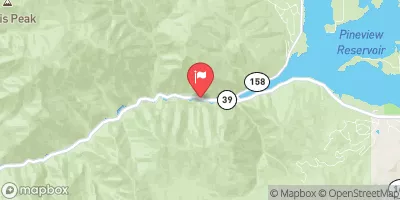
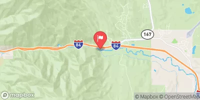
Ogden Narrows
For those boaters that live in Ogden this is a great intermediate to advanced run when the water is flowing. Since this river is dam controlled, good flows can be sporadic but can also possibly last well into the late season (on good water years).
Suggested river levels for paddling this section of the Ogden River are between a bare minimum of 200cfs and a high of 800cfs.
River conditions sourced from USGS 10137500, the South Fork Ogden River Near Huntsville
Remember only watercraft are permitted
at Ogden Narrows.
Run Stats
Status | Too Low |
Class Level | III+ to IV |
Elevation | 5,219 ft |
Run Length | 2.0 Mi |
Gradient | 133 FPM |
Streamflow Discharge | 48.5 cfs |
Gage Height | 1.5 ft |
Air Temperature | 46° |
River | Ogden River |
Reporting Streamgage |
South Fork Ogden River Near Huntsville
USGS 10137500 |
Gauge | Streamflow | Stage |
---|---|---|
Mcleod Creek Near Park City
USGS 10133600 |
12 cfs | 6.3 ft |
Silver Creek Near Silver Creek Junction
USGS 10129900 |
7 cfs | 4.2 ft |
Jordan River @ 1700 South @ Salt Lake City
USGS 10171000 |
109 cfs | 1.8 ft |
Provo River At River Road Bridge
USGS 10155200 |
121 cfs | 0.8 ft |
East Canyon Creek Bl I-80 Rest Stop Nr Park City
USGS 10133650 |
17 cfs | 5.5 ft |
Little Bear River At Paradise
USGS 10105900 |
43 cfs | 5.6 ft |
Red Butte Creek At Fort Douglas
USGS 10172200 |
2 cfs | 0.4 ft |
East Canyon Creek Near Jeremy Ranch
USGS 10133800 |
35 cfs | 5.0 ft |
Ogden River Bl Pineview Res Near Huntsville
USGS 10140100 |
18 cfs | 1.6 ft |
Ogden River Nr Gibson Avenue At Ogden
USGS 10140700 |
24 cfs | 4.8 ft |
Snotel Site | Snowpack | 24hr Change |
---|---|---|
Vernon Creek
SNOTEL 844 |
9" | -1" |
Horse Ridge
SNOTEL 533 |
24" | -1" |
alta - guard house
SNOTEL AGD |
56" | -2" |
Thaynes Canyon
SNOTEL 814 |
43" | -2" |
Payson R.S.
SNOTEL 686 |
12" | -3" |
Hobble Creek
SNOTEL 1223 |
6" | -1" |
Slug Creek Divide
SNOTEL 761 |
21" | -2" |
Dry Bread Pond
SNOTEL 455 |
25" | -2" |
Emigrant Summit
SNOTEL 471 |
38" | -2" |
Hardscrabble
SNOTEL 896 |
27" | -1" |
Kilfoil Creek
SNOTEL 1145 |
16" | -3" |
Parrish Creek
SNOTEL 971 |
36" | -1" |
Klondike Narrows
SNOTEL 1115 |
24" | -3" |
Farmington Lower
SNOTEL 1054 |
23" | -2" |
Temple Fork
SNOTEL 1013 |
22" | -2" |
Franklin Basin
SNOTEL 484 |
38" | -2" |
Tony Grove Lake
SNOTEL 823 |
49" | -2" |
Brighton
SNOTEL 366 |
30" | -2" |
Lightning Ridge
SNOTEL 1056 |
23" | -3" |
Parley'S Summit
SNOTEL 684 |
25" | -3" |
Cascade Mountain
SNOTEL 1039 |
24" | -2" |
atwater study plot
SNOTEL ATH20_MADIS |
61" | -2" |
Rocky Basin-Settleme
SNOTEL 723 |
34" | -1" |
Usu Doc Daniel
SNOTEL 1098 |
56" | 0" |
Ben Lomond Peak
SNOTEL 332 |
44" | 0" |
Snowbird
SNOTEL 766 |
64" | -1" |
alta
SNOTEL ATAU1 |
60" | -2" |
Clear Creek #1
SNOTEL 399 |
20" | -154" |
Garden City Summit
SNOTEL 1114 |
26" | -1" |
Mill-D North
SNOTEL 628 |
43" | -2" |
Louis Meadow
SNOTEL 972 |
19" | -3" |
Ben Lomond Trail
SNOTEL 333 |
12" | -2" |
Dry Fork
SNOTEL 906 |
24" | -2" |
Sedgwick Peak
SNOTEL 741 |
37" | -2" |
Farmington
SNOTEL 474 |
60" | -2" |
Oxford Spring
SNOTEL 677 |
1" | 0" |
Bug Lake
SNOTEL 374 |
30" | -2" |
Monte Cristo
SNOTEL 634 |
41" | -2" |
Lookout Peak
SNOTEL 596 |
56" | -1" |
Campground | Campsites | Reservations | Toilets | Showers | Elevation |
---|
Ski Area | Snowpack | Air Temperature | 5 Day Forecast |
---|---|---|---|
Solitude Mountain Resort | 43" | 36° | 9.78" |
Brighton Ski Resort | 43" | 35° | 9.07" |
Powder Mountain | 0" | 46° | 9.87" |
Canyons | 43" | 35° | 9.07" |
Cherry Peak | 49" | 38° | 8.5" |
Alta Ski Area | 64" | 39° | 7.94" |
Snowbird Ski and Summer Resort | 64" | 39° | 7.94" |
Snowbasin | 12" | 48° | 9.71" |
River Run | Streamflow | Length | Class |
---|---|---|---|
Ogden Play Park | 77.9cfs | 0.06 Mi | III- |
3rd Dam to 2nd Dam | 111.0cfs | None Mi | II+ to III |
Park and Ride to Old Mill Catch Pond | 25.2cfs | 1.25 Mi | IV to V |
Mouth of Weber Canyon to Riverdale | 0.79cfs | 10.0 Mi | III |
Logan Town Run | 111.0cfs | None Mi | II+ to III- |
Scrambled Eggs Bend | 71.2cfs | 4.0 Mi | IV |
Ogden Narrows | 48.5cfs | 2.0 Mi | III+ to IV |
Below Ogden Play Park | 77.9cfs | 3.0 Mi | II |
Staircase Section - 2nd Dam to 1st Dam | 111.0cfs | None Mi | IV+ to V- |
Round Valley | 0.79cfs | 5.5 Mi | II |
Ricks Spring to Wood Camp Campground | 111.0cfs | None Mi | III+ to IV |
Lower Ogden | 48.5cfs | 2.5 Mi | III+ |
Riverdale Wave | 0.79cfs | 0.18 Mi | III- |
Morgan Waterfall | 0.79cfs | 0.1 Mi | III+ |
Rainbow Gardens | 48.5cfs | 3.0 Mi | III to IV- |