Engineer Lake Dam

Engineer Lake
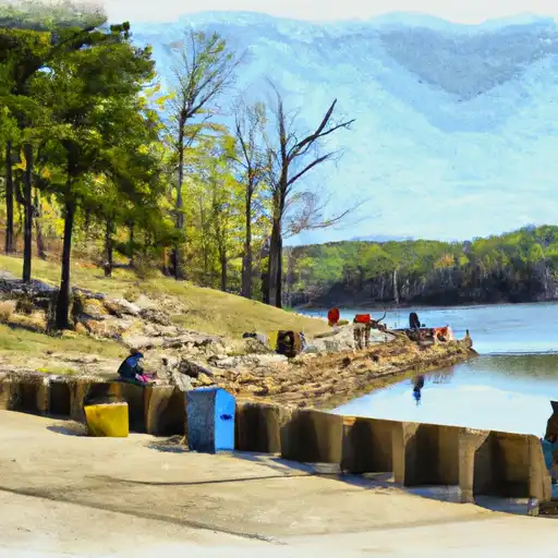
Engineer Lake, located in Sebastian County, Arkansas, is a federally owned water resource managed by the US Army. Constructed in 1945, this Earth dam stands at 25 feet high and spans 360 feet in length, with a storage capacity of 544 acre-feet. The primary purpose of Engineer Lake is for recreation, offering a surface area of 23 acres for water enthusiasts to enjoy.
The lake is situated on Tr Big Creek and is overseen by the US Army for operations, design, construction, and regulatory purposes. Despite being categorized as low hazard potential, the risk assessment for Engineer Lake is moderate. Although the last inspection was conducted in 1981, with an inspection frequency of 4 years, the condition assessment is currently not available. With a spillway width of 30 feet and a maximum discharge of 1100 cubic feet per second, Engineer Lake provides both a safe and enjoyable environment for visitors.
Overall, Engineer Lake offers a picturesque setting for outdoor activities in the Bloomer area, with its recreational facilities and tranquil waters attracting both locals and tourists alike. As a key water resource managed by the US Army, the lake serves as a vital hub for leisure and enjoyment while also ensuring the safety and well-being of its visitors through regular hazard assessments and risk management measures.
Plan around the weather
Same NOAA / yr.no feed Snoflo's iOS app uses. Watch the precipitation column on the meteogram -- rain on the basin upstream typically lifts inflow 24-72 hours later.
Next 5 days, hour by hour
Temperature line with weather symbols on top, snow + rain accumulation as columns, humidity as a dotted line.
5-day forecast table
Every 3 hours, broken out across temperature, snow, rain, humidity, and wind. Each cell is colour-coded relative to the column min/max.
| Time | Condition | Temp (°F) | Snow (in) | Rain (in) | Humidity (%) | Wind (mps) | Wind dir |
|---|---|---|---|---|---|---|---|
| Loading detailed forecast… | |||||||
15-day temperature & precipitation
Daily temperatures, snow, and rain projected over the next two weeks.
Nearby streamflow gauges
USGS streamgauges around Engineer Lake -- inflows here typically show up in storage 24-72 hours later.
| Streamgauge | Discharge | View |
|---|---|---|
| Petit Jean River Near Booneville | 2 cfs | → |
| James Fork Near Hackett | 5 cfs | → |
| Arkansas River At Ft. Smith | 24,100 cfs | → |
| Mulberry River Near Mulberry. Ar | 182 cfs | → |
| Lee Creek Near Short | 140 cfs | → |
| Poteau River At Cauthron | 6 cfs | → |


About Engineer Lake
Where does the data for Engineer Lake come from?
Structural and regulatory data come from the U.S. Army Corps of Engineers' National Inventory of Dams (NID). Weather forecast comes from NOAA / yr.no -- the same feed Snoflo's iOS app uses.
How often is the report updated?
NID structural data refreshes annually as the Corps publishes updated assessments. The weather forecast refreshes throughout the day.
What does the Low hazard rating mean?
The Corps of Engineers' hazard potential classification grades probable consequences if the dam fails: High = probable loss of human life; Significant = no probable loss of human life but possible economic loss / environmental damage; Low = no probable loss of human life, only minor economic / environmental losses. See the Dam Data Reference card below for the full definitions.
What's "% of normal"?
The current storage value compared to the historical average storage on this calendar day. 100% = right on average; values above 100% mean above-normal storage (wet year); values below mean below-normal (dry year or drought).
Can I get alerts when storage crosses a threshold?
Yes -- alerts are managed in the Snoflo iOS app. Favorite this dam, set a threshold, and you'll get a push the moment conditions cross.
Dam data reference
Condition Assessment
- Satisfactory
- No existing or potential dam safety deficiencies are recognized. Acceptable performance is expected under all loading conditions (static, hydrologic, seismic) in accordance with the minimum applicable state or federal regulatory criteria or tolerable risk guidelines.
- Fair
- No existing dam safety deficiencies are recognized for normal operating conditions. Rare or extreme hydrologic and/or seismic events may result in a dam safety deficiency. Risk may be in the range to take further action.
- Poor
- A dam safety deficiency is recognized for normal operating conditions which may realistically occur. Remedial action is necessary. POOR may also be used when uncertainties exist as to critical analysis parameters which identify a potential dam safety deficiency.
- Unsatisfactory
- A dam safety deficiency is recognized that requires immediate or emergency remedial action for problem resolution.
- Not Rated
- The dam has not been inspected, is not under state or federal jurisdiction, or has been inspected but, for whatever reason, has not been rated.
Hazard Potential Classification
- High
- Dams assigned the high hazard potential classification are those where failure or mis-operation will probably cause loss of human life.
- Significant
- Dams assigned the significant hazard potential classification are those dams where failure or mis-operation results in no probable loss of human life but can cause economic loss, environmental damage, disruption of lifeline facilities, or impact other concerns. Significant hazard potential classification dams are often located in predominantly rural or agricultural areas but could be in areas with population and significant infrastructure.
- Low
- Dams assigned the low hazard potential classification are those where failure or mis-operation results in no probable loss of human life and low economic and/or environmental losses. Losses are principally limited to the owner's property.
- Undetermined
- Dams for which a downstream hazard potential has not been designated or is not provided.