Surge Pond - Dike 3 Dam

Surge Pond - Dike 3
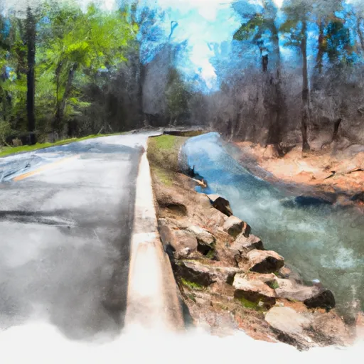
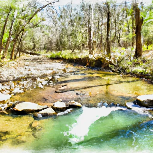
Surge Pond - Dike 3 is a fascinating water resource structure located in Jefferson County, Arkansas. This earth dam, completed in 1979, stands at a height of 45 feet and spans a length of 2800 feet. With a maximum storage capacity of 940 acre-feet and a normal storage capacity of 2083 acre-feet, Surge Pond - Dike 3 plays a crucial role in managing water resources in the region. Situated on Love Creek, this dam is regulated by the Arkansas Natural Resources Commission and undergoes regular inspections to ensure its safety and functionality.
Despite its low hazard potential, Surge Pond - Dike 3 is a significant piece of infrastructure that serves various purposes beyond flood control. Owned by a public utility, this dam contributes to water supply, irrigation, and recreational activities in the area. The structure's condition is currently rated as "Not Rated," indicating a need for further assessment to determine its long-term viability. With a strategic location and a history of effective operation, Surge Pond - Dike 3 stands as a testament to the importance of sustainable water management practices in the face of changing climate patterns and increasing demands on water resources.
As water resource and climate enthusiasts, the Surge Pond - Dike 3 presents an intriguing case study of how man-made structures can positively impact the environment while also facing challenges in maintaining their integrity over time. With its impressive dimensions and critical role in water management, this dam serves as a reminder of the interconnectedness between human activities and natural ecosystems. By monitoring and maintaining structures like Surge Pond - Dike 3, we can ensure the resilience of water resources in the face of climate change and evolving regulatory frameworks.
Plan around the weather
Same NOAA / yr.no feed Snoflo's iOS app uses. Watch the precipitation column on the meteogram -- rain on the basin upstream typically lifts inflow 24-72 hours later.
Next 5 days, hour by hour
Temperature line with weather symbols on top, snow + rain accumulation as columns, humidity as a dotted line.
5-day forecast table
Every 3 hours, broken out across temperature, snow, rain, humidity, and wind. Each cell is colour-coded relative to the column min/max.
| Time | Condition | Temp (°F) | Snow (in) | Rain (in) | Humidity (%) | Wind (mps) | Wind dir |
|---|---|---|---|---|---|---|---|
| Loading detailed forecast… | |||||||
15-day temperature & precipitation
Daily temperatures, snow, and rain projected over the next two weeks.
Nearby streamflow gauges
USGS streamgauges around Surge Pond - Dike 3 -- inflows here typically show up in storage 24-72 hours later.
| Streamgauge | Discharge | View |
|---|---|---|
| Hurricane Creek Near Sheridan | 14 cfs | → |
| Rock Creek At 36th Street At Little Rock | 1 cfs | → |
| Saline River Near Sheridan | 80 cfs | → |
| Bayou Meto Near Lonoke | 0 cfs | → |
| Saline River At Benton | 5 cfs | → |
| Maumelle River At Maumelle Dam At Natural Steps | · | → |


About Surge Pond - Dike 3
Where does the data for Surge Pond - Dike 3 come from?
Structural and regulatory data come from the U.S. Army Corps of Engineers' National Inventory of Dams (NID). Weather forecast comes from NOAA / yr.no -- the same feed Snoflo's iOS app uses.
How often is the report updated?
NID structural data refreshes annually as the Corps publishes updated assessments. The weather forecast refreshes throughout the day.
What does the Low hazard rating mean?
The Corps of Engineers' hazard potential classification grades probable consequences if the dam fails: High = probable loss of human life; Significant = no probable loss of human life but possible economic loss / environmental damage; Low = no probable loss of human life, only minor economic / environmental losses. See the Dam Data Reference card below for the full definitions.
What's "% of normal"?
The current storage value compared to the historical average storage on this calendar day. 100% = right on average; values above 100% mean above-normal storage (wet year); values below mean below-normal (dry year or drought).
Can I get alerts when storage crosses a threshold?
Yes -- alerts are managed in the Snoflo iOS app. Favorite this dam, set a threshold, and you'll get a push the moment conditions cross.
Dam data reference
Condition Assessment
- Satisfactory
- No existing or potential dam safety deficiencies are recognized. Acceptable performance is expected under all loading conditions (static, hydrologic, seismic) in accordance with the minimum applicable state or federal regulatory criteria or tolerable risk guidelines.
- Fair
- No existing dam safety deficiencies are recognized for normal operating conditions. Rare or extreme hydrologic and/or seismic events may result in a dam safety deficiency. Risk may be in the range to take further action.
- Poor
- A dam safety deficiency is recognized for normal operating conditions which may realistically occur. Remedial action is necessary. POOR may also be used when uncertainties exist as to critical analysis parameters which identify a potential dam safety deficiency.
- Unsatisfactory
- A dam safety deficiency is recognized that requires immediate or emergency remedial action for problem resolution.
- Not Rated
- The dam has not been inspected, is not under state or federal jurisdiction, or has been inspected but, for whatever reason, has not been rated.
Hazard Potential Classification
- High
- Dams assigned the high hazard potential classification are those where failure or mis-operation will probably cause loss of human life.
- Significant
- Dams assigned the significant hazard potential classification are those dams where failure or mis-operation results in no probable loss of human life but can cause economic loss, environmental damage, disruption of lifeline facilities, or impact other concerns. Significant hazard potential classification dams are often located in predominantly rural or agricultural areas but could be in areas with population and significant infrastructure.
- Low
- Dams assigned the low hazard potential classification are those where failure or mis-operation results in no probable loss of human life and low economic and/or environmental losses. Losses are principally limited to the owner's property.
- Undetermined
- Dams for which a downstream hazard potential has not been designated or is not provided.