Pit No. 1 Forebay Dam

Pit No. 1 Forebay
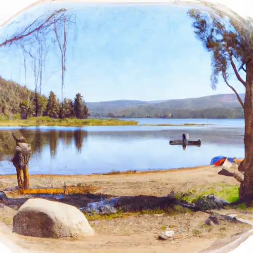
Pit No. 1 Forebay, located in Fall River Mills, California, is a privately owned hydroelectric dam completed in 1947 with a primary purpose of generating hydroelectric power. The dam stands at 46.5 feet in height with a hydraulic height of 35 feet and a structural height of 44 feet. It has a capacity of storing 3,212 acre-feet of water, with a normal storage level of 614 acre-feet and a maximum discharge of 13,000 cubic feet per second.
The dam spans 586 feet in length and has a surface area of 222 acres, serving a drainage area of 725 acres. It features a controlled spillway with a width of 45 feet and is equipped with two Tainter (radial) outlet gates. The dam's hazard potential is classified as high, and it has a very high risk assessment rating. While the condition assessment of the dam is not available, it is regulated, permitted, inspected, and enforced by various state and federal agencies, including the Federal Energy Regulatory Commission.
Despite its age, Pit No. 1 Forebay remains a crucial component of California's water resource infrastructure, contributing to the generation of clean energy and water management in the region. Its strategic location on the Fall River underscores its importance in the local ecosystem and highlights the need for ongoing monitoring and maintenance to ensure its continued safe operation and resilience in the face of changing climate conditions.
Plan around the weather
Same NOAA / yr.no feed Snoflo's iOS app uses. Watch the precipitation column on the meteogram -- rain on the basin upstream typically lifts inflow 24-72 hours later.
Next 5 days, hour by hour
Temperature line with weather symbols on top, snow + rain accumulation as columns, humidity as a dotted line.
5-day forecast table
Every 3 hours, broken out across temperature, snow, rain, humidity, and wind. Each cell is colour-coded relative to the column min/max.
| Time | Condition | Temp (°F) | Snow (in) | Rain (in) | Humidity (%) | Wind (mps) | Wind dir |
|---|---|---|---|---|---|---|---|
| Loading detailed forecast… | |||||||
15-day temperature & precipitation
Daily temperatures, snow, and rain projected over the next two weeks.
Nearby streamflow gauges
USGS streamgauges around Pit No. 1 Forebay -- inflows here typically show up in storage 24-72 hours later.
| Streamgauge | Discharge | View |
|---|---|---|
| Pit R Bl Pit No 1 Ph Nr Fall River Mills Ca | 1,080 cfs | → |
| Burney C A Burney Falls Nr Burney Ca | 168 cfs | → |
| Hat C Nr Hat Creek Ca | 130 cfs | → |
| Pit R Nr Canby Ca | 1 cfs | → |
| Sacramento R A Delta Ca | 255 cfs | → |
| Cow C Nr Millville Ca | 31 cfs | → |
Make a day of it
Boat launches, lakeside camping, fishing access, and other reservoirs near Pit No. 1 Forebay .
Boat launches
See all →


Campgrounds
See all →


Fishing spots
See all →


River runs
See all →


About Pit No. 1 Forebay
Where does the data for Pit No. 1 Forebay come from?
Structural and regulatory data come from the U.S. Army Corps of Engineers' National Inventory of Dams (NID). Weather forecast comes from NOAA / yr.no -- the same feed Snoflo's iOS app uses.
How often is the report updated?
NID structural data refreshes annually as the Corps publishes updated assessments. The weather forecast refreshes throughout the day.
What does the High hazard rating mean?
The Corps of Engineers' hazard potential classification grades probable consequences if the dam fails: High = probable loss of human life; Significant = no probable loss of human life but possible economic loss / environmental damage; Low = no probable loss of human life, only minor economic / environmental losses. See the Dam Data Reference card below for the full definitions.
What's "% of normal"?
The current storage value compared to the historical average storage on this calendar day. 100% = right on average; values above 100% mean above-normal storage (wet year); values below mean below-normal (dry year or drought).
Can I get alerts when storage crosses a threshold?
Yes -- alerts are managed in the Snoflo iOS app. Favorite this dam, set a threshold, and you'll get a push the moment conditions cross.
Dam data reference
Condition Assessment
- Satisfactory
- No existing or potential dam safety deficiencies are recognized. Acceptable performance is expected under all loading conditions (static, hydrologic, seismic) in accordance with the minimum applicable state or federal regulatory criteria or tolerable risk guidelines.
- Fair
- No existing dam safety deficiencies are recognized for normal operating conditions. Rare or extreme hydrologic and/or seismic events may result in a dam safety deficiency. Risk may be in the range to take further action.
- Poor
- A dam safety deficiency is recognized for normal operating conditions which may realistically occur. Remedial action is necessary. POOR may also be used when uncertainties exist as to critical analysis parameters which identify a potential dam safety deficiency.
- Unsatisfactory
- A dam safety deficiency is recognized that requires immediate or emergency remedial action for problem resolution.
- Not Rated
- The dam has not been inspected, is not under state or federal jurisdiction, or has been inspected but, for whatever reason, has not been rated.
Hazard Potential Classification
- High
- Dams assigned the high hazard potential classification are those where failure or mis-operation will probably cause loss of human life.
- Significant
- Dams assigned the significant hazard potential classification are those dams where failure or mis-operation results in no probable loss of human life but can cause economic loss, environmental damage, disruption of lifeline facilities, or impact other concerns. Significant hazard potential classification dams are often located in predominantly rural or agricultural areas but could be in areas with population and significant infrastructure.
- Low
- Dams assigned the low hazard potential classification are those where failure or mis-operation results in no probable loss of human life and low economic and/or environmental losses. Losses are principally limited to the owner's property.
- Undetermined
- Dams for which a downstream hazard potential has not been designated or is not provided.