Redbank dam

Redbank
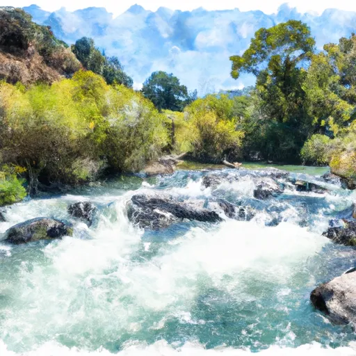
Redbank, located in Fresno, California, is a significant Earth-type dam built in 1962 for flood risk reduction along the Redbank Creek. With a height of 33 feet and a storage capacity of 1,100 acre-feet, this dam plays a crucial role in protecting the surrounding area from potential flooding events. The dam is under state jurisdiction and is regulated, permitted, inspected, and enforced by the California Department of Water Resources, Safety of Dams division, ensuring its structural integrity and safety.
This high-hazard dam has a satisfactory condition assessment as of September 2017 and is subject to regular inspections, with the last one conducted in February 2021. Redbank's hazard potential is classified as high, highlighting the importance of its maintenance and monitoring. Despite not having associated structures, Redbank serves a vital purpose in flood risk reduction within the region, covering a drainage area of 15.56 square miles and providing a surface area of 195 acres for water storage. Enthusiasts interested in water resources and climate will find Redbank to be an essential infrastructure contributing to the protection and management of water resources in Fresno.
Redbank's location along the Redbank Creek and its proximity to Fresno make it a crucial asset in water management and flood control efforts in California. With its significant storage capacity and role in reducing flood risks, Redbank stands as a testament to the state's commitment to water resource management and infrastructure development. Climate and water resource enthusiasts can appreciate the engineering feat of this dam, which continues to play a vital role in safeguarding the local community against potential flooding events, demonstrating the importance of sustainable water management practices in the face of a changing climate.
Plan around the weather
Same NOAA / yr.no feed Snoflo's iOS app uses. Watch the precipitation column on the meteogram -- rain on the basin upstream typically lifts inflow 24-72 hours later.
Next 5 days, hour by hour
Temperature line with weather symbols on top, snow + rain accumulation as columns, humidity as a dotted line.
5-day forecast table
Every 3 hours, broken out across temperature, snow, rain, humidity, and wind. Each cell is colour-coded relative to the column min/max.
| Time | Condition | Temp (°F) | Snow (in) | Rain (in) | Humidity (%) | Wind (mps) | Wind dir |
|---|---|---|---|---|---|---|---|
| Loading detailed forecast… | |||||||
15-day temperature & precipitation
Daily temperatures, snow, and rain projected over the next two weeks.
Nearby streamflow gauges
USGS streamgauges around Redbank -- inflows here typically show up in storage 24-72 hours later.
| Streamgauge | Discharge | View |
|---|---|---|
| San Joaquin R Bl Friant Ca | 314 cfs | → |
| Nf Willow C Nr Sugar Pine Ca | 416 cfs | → |
| San Joaquin R Nr Mendota Ca | 149 cfs | → |
| Big C Div Nr Fish Camp Ca | 0 cfs | → |
| Marble Fork Kaweah R Ab Horse C Nr Lodgepole Ca | 2 cfs | → |
| Cantua C Nr Cantua Creek Ca | · | → |
Make a day of it
Boat launches, lakeside camping, fishing access, and other reservoirs near Redbank.
Boat launches
See all →


Campgrounds
See all →


Fishing spots
See all →


River runs
See all →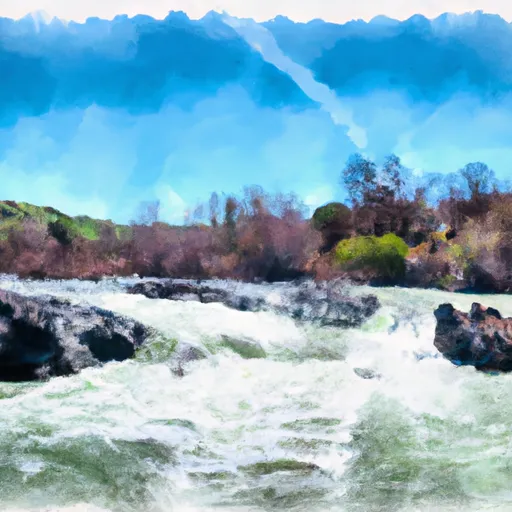


About Redbank
Where does the data for Redbank come from?
Structural and regulatory data come from the U.S. Army Corps of Engineers' National Inventory of Dams (NID). Weather forecast comes from NOAA / yr.no -- the same feed Snoflo's iOS app uses.
How often is the report updated?
NID structural data refreshes annually as the Corps publishes updated assessments. The weather forecast refreshes throughout the day.
What does the High hazard rating mean?
The Corps of Engineers' hazard potential classification grades probable consequences if the dam fails: High = probable loss of human life; Significant = no probable loss of human life but possible economic loss / environmental damage; Low = no probable loss of human life, only minor economic / environmental losses. See the Dam Data Reference card below for the full definitions.
What's "% of normal"?
The current storage value compared to the historical average storage on this calendar day. 100% = right on average; values above 100% mean above-normal storage (wet year); values below mean below-normal (dry year or drought).
Can I get alerts when storage crosses a threshold?
Yes -- alerts are managed in the Snoflo iOS app. Favorite this dam, set a threshold, and you'll get a push the moment conditions cross.
Dam data reference
Condition Assessment
- Satisfactory
- No existing or potential dam safety deficiencies are recognized. Acceptable performance is expected under all loading conditions (static, hydrologic, seismic) in accordance with the minimum applicable state or federal regulatory criteria or tolerable risk guidelines.
- Fair
- No existing dam safety deficiencies are recognized for normal operating conditions. Rare or extreme hydrologic and/or seismic events may result in a dam safety deficiency. Risk may be in the range to take further action.
- Poor
- A dam safety deficiency is recognized for normal operating conditions which may realistically occur. Remedial action is necessary. POOR may also be used when uncertainties exist as to critical analysis parameters which identify a potential dam safety deficiency.
- Unsatisfactory
- A dam safety deficiency is recognized that requires immediate or emergency remedial action for problem resolution.
- Not Rated
- The dam has not been inspected, is not under state or federal jurisdiction, or has been inspected but, for whatever reason, has not been rated.
Hazard Potential Classification
- High
- Dams assigned the high hazard potential classification are those where failure or mis-operation will probably cause loss of human life.
- Significant
- Dams assigned the significant hazard potential classification are those dams where failure or mis-operation results in no probable loss of human life but can cause economic loss, environmental damage, disruption of lifeline facilities, or impact other concerns. Significant hazard potential classification dams are often located in predominantly rural or agricultural areas but could be in areas with population and significant infrastructure.
- Low
- Dams assigned the low hazard potential classification are those where failure or mis-operation results in no probable loss of human life and low economic and/or environmental losses. Losses are principally limited to the owner's property.
- Undetermined
- Dams for which a downstream hazard potential has not been designated or is not provided.